Driving path planning method for vehicle navigation

A technology of driving route and vehicle navigation, which is applied in the field of driving route planning of vehicle navigation, and can solve the problems that the navigation information does not contain real-time traffic condition information, vehicles cannot obtain road condition information in a timely and effective manner, and cannot adjust the driving route in a timely and effective manner. Save time and improve efficiency

Active Publication Date: 2017-05-17
ORDOS CITY PUDU TECH CO LTD
View PDF6 Cites 66 Cited by
  • Summary
  • Abstract
  • Description
  • Claims
  • Application Information

AI Technical Summary

Problems solved by technology

Although the existing vehicle navigation software can provide basic navigation information, such navigation information does not contain real-time traffic information, and the vehicle cannot obtain the road conditi

Method used


Image

  • Driving path planning method for vehicle navigation
  • Driving path planning method for vehicle navigation
  • Driving path planning method for vehicle navigation

Examples


Embodiment Construction

[0036] The following will clearly and completely describe the technical solutions in the embodiments of the present invention with reference to the accompanying drawings in the embodiments of the present invention. Obviously, the described embodiments are only some of the embodiments of the present invention, not all of them. Based on the embodiments of the present invention, all other embodiments obtained by persons of ordinary skill in the art without making creative efforts belong to the protection scope of the present invention.

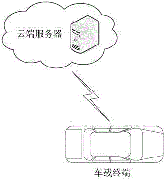
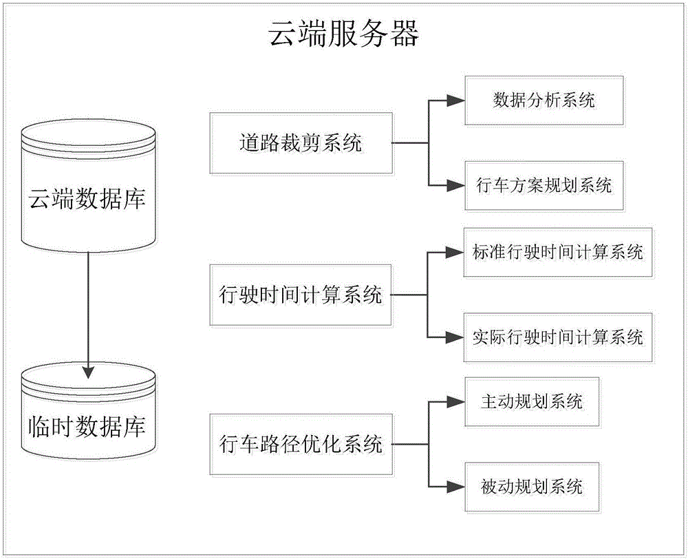
[0037] see Figure 1-6, the present invention provides a technical solution: a driving route planning method for vehicle navigation, including a road cutting system, a driving time calculation system and a driving route optimization system, characterized in that the road cutting system includes a data analysis system and a driving plan The planning system and the data analysis system obtain the location information of the vehicle and the location...


PUM


Abstract

The invention discloses a driving path planning method for vehicle navigation. The method comprises a road cutting system, a driving time computing system and a driving path optimization system. The method is characterized in that the road cutting system comprises a data analysis system and a driving scheme planning system, and cutting the driving path into traffic lights, crossroads and road sections which are formed by using places where the speed limit, driveway number and road name change as the nodes; the vehicle driving path is composed of the road sections, and the road sections in the driving path are numbered; when traffic jams, traffic accidents, road blocks and other conditions appear in the driving path, the real-time traffic conditions change, and the original planned path is possibly not the fastest path; and the path is replanned to select the fastest path as the optimal driving path, thereby enhancing the navigation efficiency and saving the time.

Description

technical field [0001] The invention relates to the technical field of road traffic navigation, in particular to a driving path planning method for vehicle navigation. Background technique [0002] With the continuous development of communication technology and GPS system, more and more car navigation systems have emerged as the times require, which brings great convenience for people to accurately reach their destinations by planning driving routes in complex road environments. However, with the development of cities and the increasing number of vehicles, traffic congestion has become a very serious problem. Human factors have the most direct and obvious impact on traffic to some extent. Although the existing vehicle navigation software can provide basic navigation information, such navigation information does not contain real-time traffic information, and the vehicle cannot obtain the road condition information of the planned route in a timely and effective manner. When th...

Claims


Application Information

Patent Timeline
IPC IPC(8): G01C21/34
CPCG01C21/3492
Inventor 付云飞胡倩李伊宁
Owner ORDOS CITY PUDU TECH CO LTD
Why Eureka
Try Eureka