Encoded tag, navigation method and map

A coding and labeling technology, which is applied in the field of coding labels, navigation methods and maps, can solve the problems of inaccurate navigation and inaccurate positioning, etc.

Pending Publication Date: 2017-06-06
上海迈景信息技术有限公司
View PDF4 Cites 11 Cited by
  • Summary
  • Abstract
  • Description
  • Claims
  • Application Information

AI Technical Summary

Problems solved by technology

[0010] The technical problem to be solved by the present invention is to provide a coded label, a navigation method and a map, which are suitable for outdoor and indoor navigation, and avoid inaccurate positioning due to weak or no signal required for positioning, or inaccurate positioning due to positioning accuracy problems navigation

Method used


Image

  • Encoded tag, navigation method and map
  • Encoded tag, navigation method and map
  • Encoded tag, navigation method and map

Examples


Embodiment Construction

[0049] The present invention will be further described below in conjunction with the accompanying drawings and embodiments.

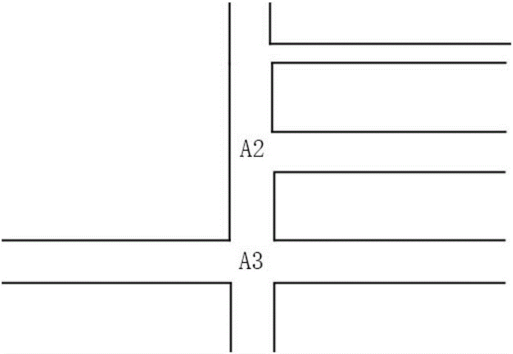
[0050] " / " in the present invention means "and / or". figure 1 It is a schematic diagram of encoding tag deployment of the present invention.

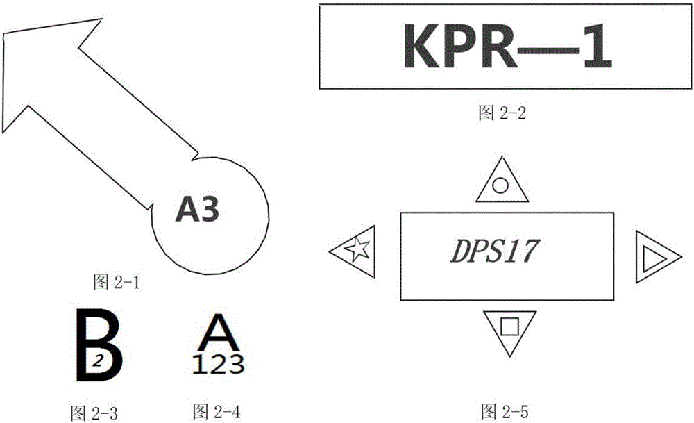
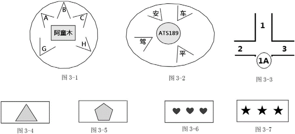
[0051] See figure 1 , a coded label provided by the present invention, the coded label contains an identifiable code. Coded tags can contain multiple codes with different meanings and different parts. The encoding uses a combination of uppercase and lowercase letters, numbers, colors, numbers and digital symbols, symbols, characters and characters of any language system, flat images, curved surface images, and stereoscopic images, or a combination of the above.

[0052] Example: Mixing example of color and image: There are two forms, one is the image area contains the color represented by the code, such as blue triangle, purple pentagon; one is the image as a separate code, and the color outside the image area ...


PUM


Abstract

The invention discloses an encoded tag, a navigation method and a map. The encoded tag contains an identifiable code; the encoded tag is an encoded locating tag or an encoded navigation tag; the code uses one or more than one of capital and small letters, numbers, colors, symbols, languages and characters, flat images, curved surface images and stereo images; the encoded tag is deployed at an actual physical location, and a location on the map is correspondingly marked. According to the encoded tag, the navigation method and the map that are provided by the invention, a real object with the encoded tag in a real scene is used for guiding advance, therefore, the possibility that an advancer lowers a head to watch a screen of navigation equipment is reduced, or visual dead zones in advancing are reduced. Meanwhile, the invention also provides an optimal deployment method of the encoded tag in the real scene, so that the advancing of a partial section even a whole course is completed based on the deployment method without a support of navigation software / the map between specific roads / road sections in an advancing process under the condition that a locating signal is weak or no locating signal exists.

Description

technical field [0001] The invention relates to a positioning and navigation device and method, in particular to a coding label, a navigation method and a map. Background technique [0002] With the development of people's travel needs and transportation networks, people's daily travel needs for navigation are increasing. The application of outdoor navigation, especially driving a car using a navigation system for navigation has become known. Outdoor navigation systems, such as GPS system, Galileo system, Beidou navigation system, GLONASS system, etc., but when people use navigation equipment to navigate, they are often afraid of missing intersections and look at the navigation equipment for matching from time to time, resulting in short-term visual Blind spots have brought many hidden dangers to traffic safety. In reality, accidents caused by looking down and looking at the navigation while driving, appear in media reports from time to time. [0003] Especially at night,...

Claims


Application Information

Patent Timeline
IPC IPC(8): G01C21/34G06K19/06
CPCG01C21/3446G06K19/0614G06K19/0615G06K19/06159G06K2019/06225G06K2019/06271
Inventor 邢霞
Owner 上海迈景信息技术有限公司
Why Eureka
Try Eureka