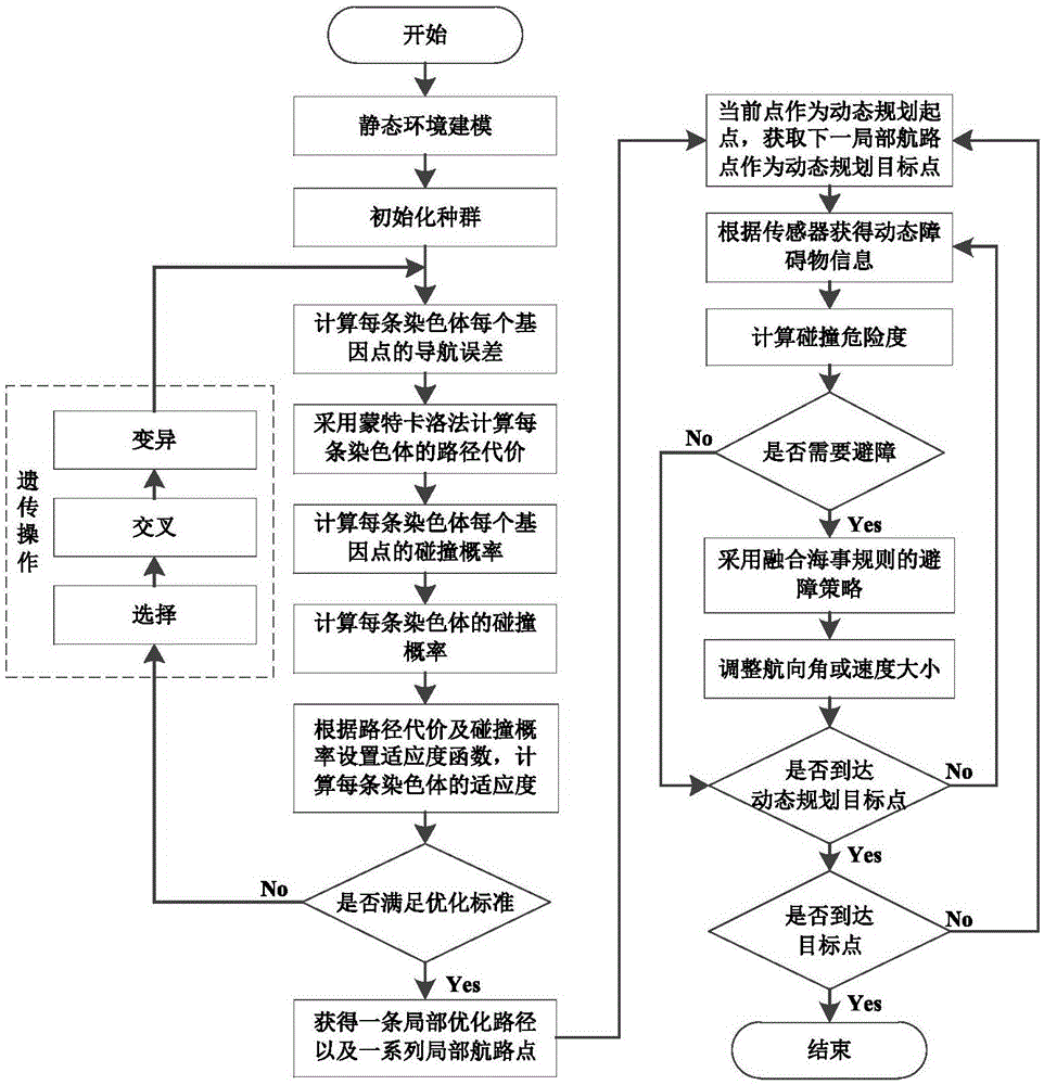
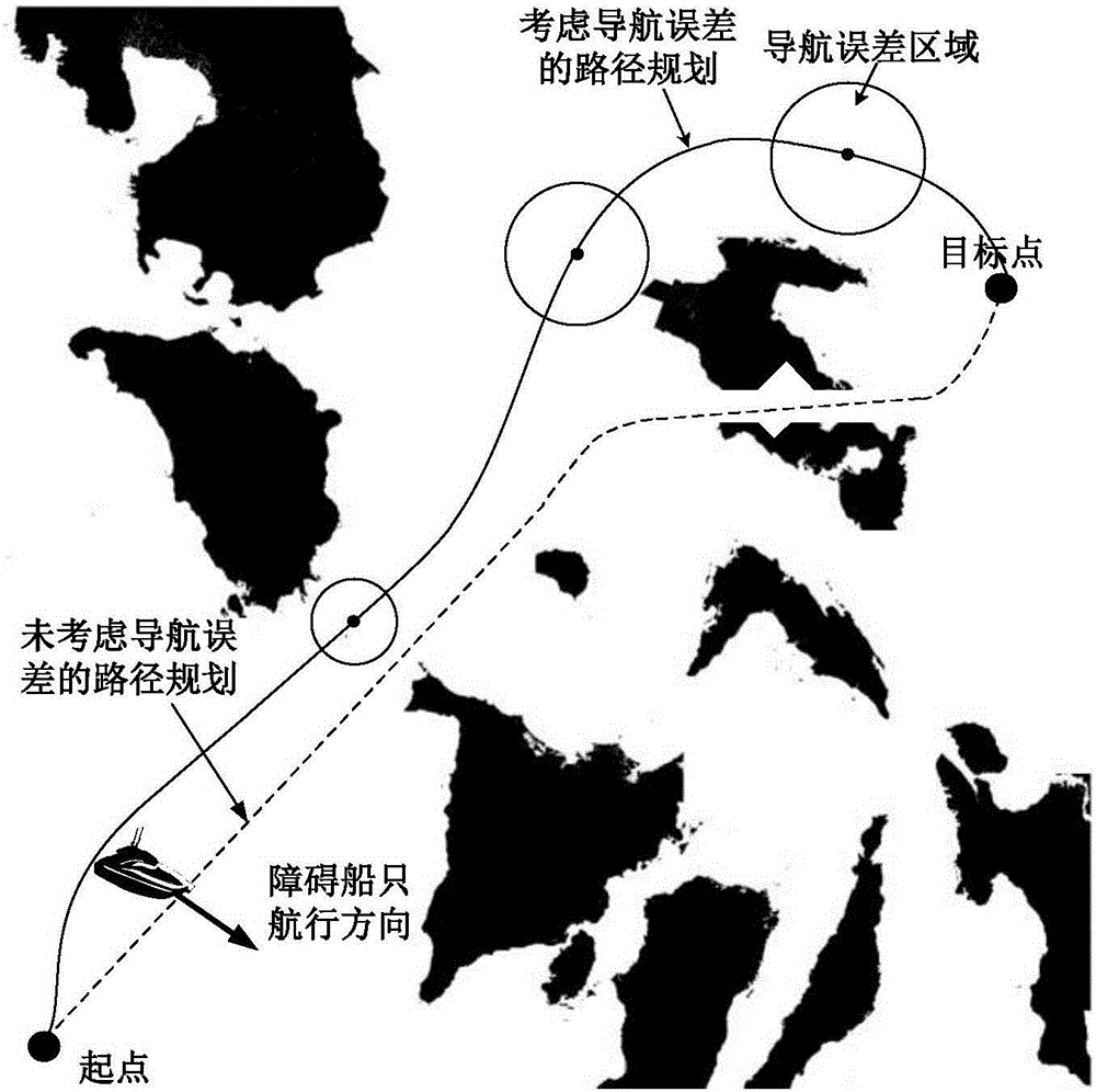
Water unmanned ship local hierarchical path planning method based on navigation error constraint
A path planning and error constraint technology, applied in the direction of genetic model, genetic law, data processing application, etc., can solve the problem of not considering the influence of navigation error path planning, not incorporating genetic algorithm, etc.
- Summary
- Abstract
- Description
- Claims
- Application Information
AI Technical Summary
Problems solved by technology
Method used
Image
Examples
Embodiment Construction
[0072] The present invention will be further described below in conjunction with embodiment and accompanying drawing.
[0073] The local hierarchical path planning method of the surface unmanned boat based on navigation error constraints of the present invention comprises the following steps:
[0074] Step 1) Discretize the environment into two-dimensional basic unit grids by using the Cartesian coordinate system and the grid method according to the static obstacle information obtained by the task, the electronic chart and the sensor, and carry out the environmental analysis by marking these grids. Modeling, initialize the starting point position Start and the target point position Goal; the area with obstacles is marked as 1, which means the obstacle grid, and the area without obstacles is marked as 0, which means the free grid; the Cartesian coordinate system is based on the starting point is the origin, and x, y, and z point to the east, north, and sky of the starting point, ...
PUM
 Abstract
Description
Claims
Application Information
 - R&D
- Intellectual Property
- Life Sciences
- Materials
- Tech Scout
- Unparalleled Data Quality
- Higher Quality Content
- 60% Fewer Hallucinations
Browse by: Latest US Patents, China's latest patents, Technical Efficacy Thesaurus, Application Domain, Technology Topic, Popular Technical Reports.
© 2025 PatSnap. All rights reserved.Legal|Privacy policy|Modern Slavery Act Transparency Statement|Sitemap|About US| Contact US: help@patsnap.com


