

Airport bird information obtaining method based on panoramic and precise image tracking system
An image tracking and panoramic image technology, applied in the field of ornithology and information, can solve the problem of difficulty in obtaining detailed information of birds
- Summary
- Abstract
- Description
- Claims
- Application Information
AI Technical Summary
Problems solved by technology
Method used
Image

Examples
Embodiment Construction
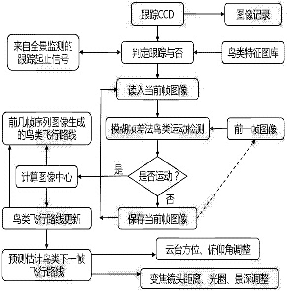
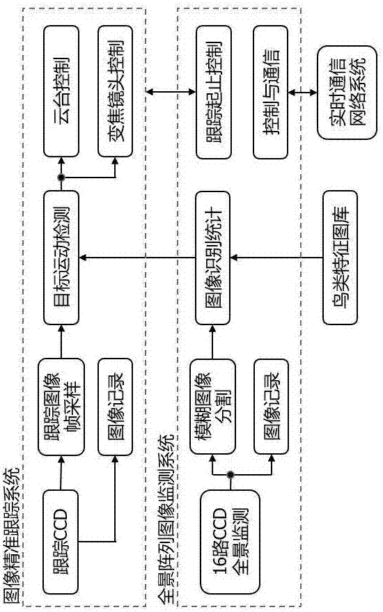
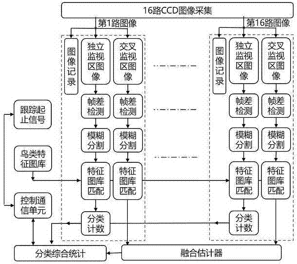
[0027] Refer to attached figure 1 , attached figure 2 , attached image 3 .
[0028] Step 1: The activity time, range and other habits of birds are unpredictable. Only panoramic monitoring can capture the activities of birds. Due to the limited resolution of a single CCD and the limited field of view of the lens, it is difficult to complete panoramic monitoring. Array methods, Panoramic monitoring can be realized with 16 CCD arrays, covering the entire monitoring range;
[0029] (1) In terms of image acquisition of the bird panoramic array image monitoring system, 16 visible and infrared CCD camera arrays are densely arranged on the hemispheric polyhedron to cover the ground panorama, and 16 CCDs collect image signals synchronously. Records can be compressed independently;
[0030] (2) Fix the focal length of each CCD so that the field of view is known. When the distance is given, the independent monitoring area of a certain CCD and the area jointly monitored by the CCD...
PUM
 Abstract
Description
Claims
Application Information