A 2D Terrain Forward Modeling and Correction Method
A terrain and forward modeling technology, applied in geophysical surveying, instruments, measuring devices, etc., can solve problems that are not terrain correction, cannot be qualitative, semi-quantitative, quantitative judgment and interpretation, and cannot solve problems fundamentally, so as to avoid The effect of chance error
- Summary
- Abstract
- Description
- Claims
- Application Information
AI Technical Summary
Problems solved by technology
Method used
Image
Examples
Embodiment Construction
[0030] The technical solution of the present invention is further described below, but the scope of protection is not limited to the description.
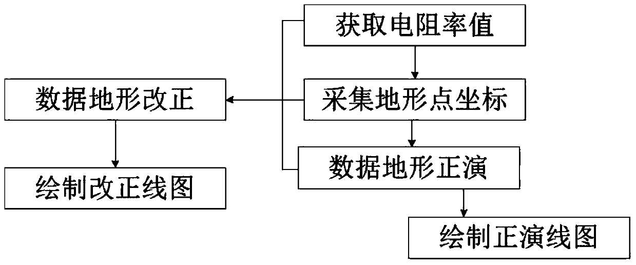
[0031] Such as figure 1 As shown, a two-dimensional terrain forward modeling and correction method, in drawing the apparent resistivity contour map, collects the coordinate point data of the terrain of the homogeneous medium and the terrain of the inhomogeneous medium and obtains its resistivity value, through positive Develop and correct to draw the apparent resistivity contour map of the pure terrain profile.
[0032] Based on a two-dimensional terrain forward modeling and correction method, it includes the following steps:
[0033] ① Obtain the resistivity value: take the average value of the apparent resistivity of the cross-section measured by the direct current method of any symmetrical quadrupole device and the same device by the high-density electric method as the apparent resistivity value of the topographical section of ...
PUM
 Abstract
Description
Claims
Application Information
 - R&D
- Intellectual Property
- Life Sciences
- Materials
- Tech Scout
- Unparalleled Data Quality
- Higher Quality Content
- 60% Fewer Hallucinations
Browse by: Latest US Patents, China's latest patents, Technical Efficacy Thesaurus, Application Domain, Technology Topic, Popular Technical Reports.
© 2025 PatSnap. All rights reserved.Legal|Privacy policy|Modern Slavery Act Transparency Statement|Sitemap|About US| Contact US: help@patsnap.com


