

An integrated monitoring method of land subsidence based on fusion of multi-source monitoring technology
A ground subsidence, technical technology, applied in the direction of measuring devices, surveying and navigation, height/horizontal measurement, etc., to achieve the effect of eliminating atmospheric delay
- Summary
- Abstract
- Description
- Claims
- Application Information
AI Technical Summary
Problems solved by technology
Method used
Image

Examples
Embodiment Construction
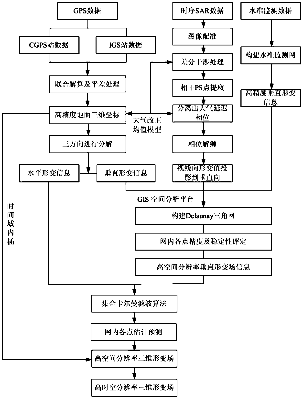
[0050] The specific steps of the invention of the land subsidence integrated monitoring method are described in detail in conjunction with the accompanying drawings.
[0051] Refer to attached figure 1 As shown, the ground subsidence integrated monitoring method of the present invention comprises the following steps:
[0052] 1) Lay out benchmarking points, GPS points and artificial corner reflector (CR)-GPS-leveling integrated points
[0053] Firstly, precision leveling points and GPS monitoring points are arranged in the key monitoring areas of land subsidence for ground subsidence monitoring; CR-GPS-leveling integrated points are arranged in areas with relatively stable ground surface, which can be used as reference points for subsidence monitoring and air-ground monitoring points. Integral connection reference point. And the CR-GPS-leveling integrated point can unify the subsequent GPS measurement data and InSAR data into the same reference coordinate system, and the GPS...
PUM
 Abstract
Description
Claims
Application Information