Line frequency calculation method for TDI camera vertical orbit rotating whiskbroom imaging
A calculation method and vertical rail technology, which is applied in the line frequency calculation field of TDI camera vertical track rotation and sweep imaging, can solve problems such as the difficulty of line frequency calculation, and achieve the effect of expanding the calculation method, expanding the application field, and expanding the scope
- Summary
- Abstract
- Description
- Claims
- Application Information
AI Technical Summary
Problems solved by technology
Method used
Image
Examples
specific Embodiment approach 1
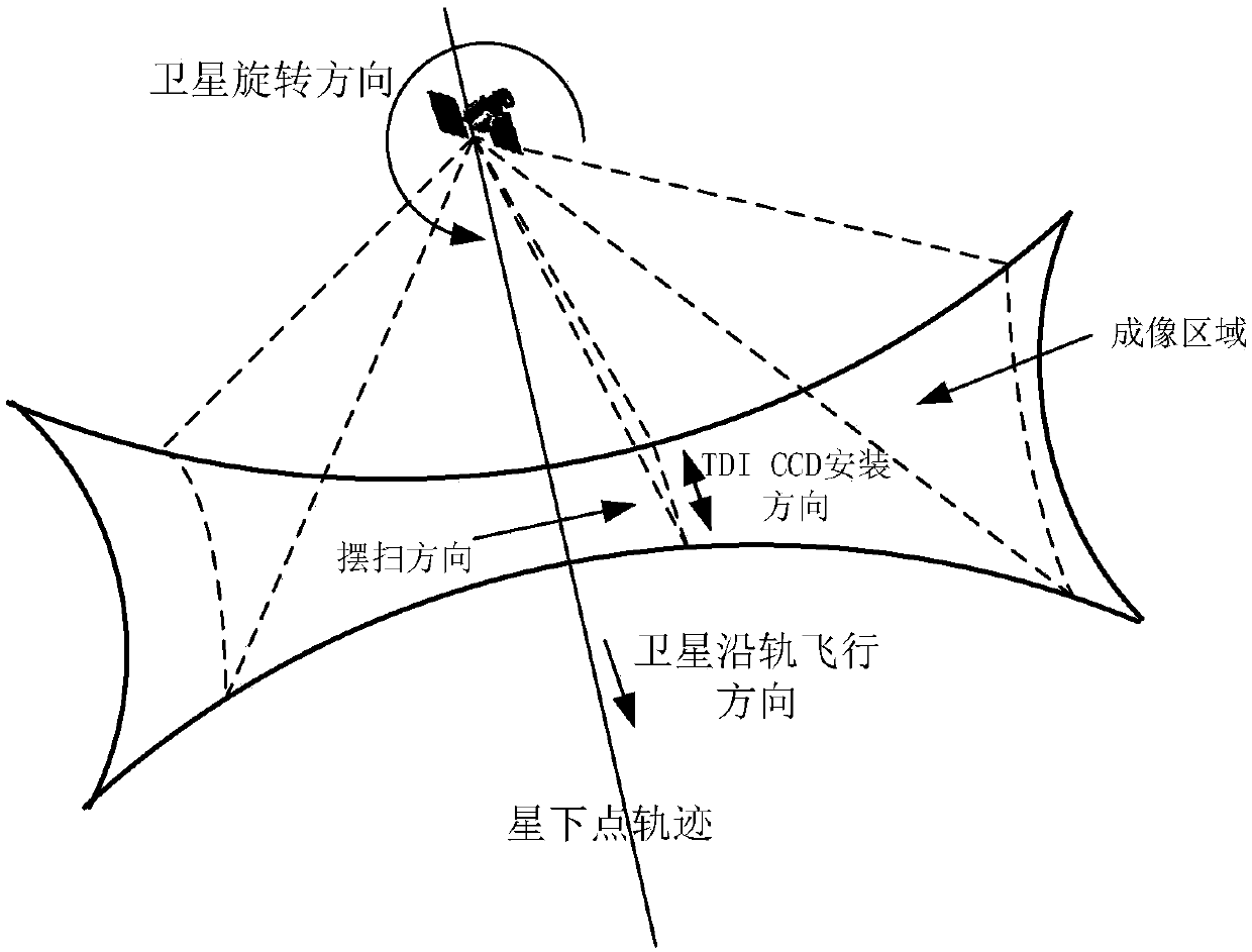
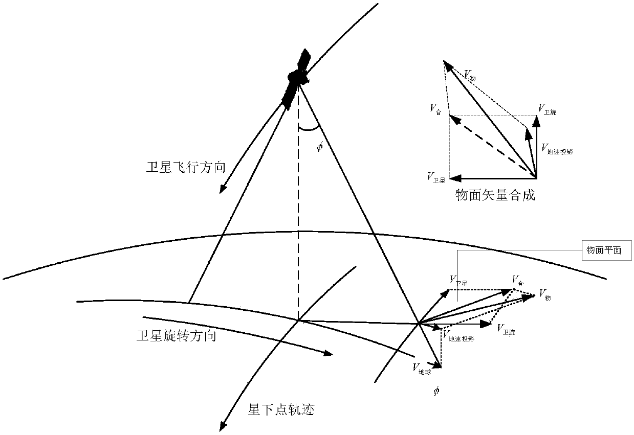
[0033] Specific implementation mode 1. Combination Figure 1 to Figure 4 Description of this embodiment, the line frequency calculation method of the TDI camera vertical orbit rotation swing imaging line frequency is determined by the combined speed of the target scene on the image plane and the size of the CCD pixel. , there are three velocity vectors: the earth's rotation velocity, the satellite's precession velocity and the satellite's rotational angular velocity. Because the three velocity vectors are not on the same plane;
[0034] Firstly, each velocity vector should be calculated separately and projected onto the object surface for synthesis.
[0035] V 地 = ω 地 × R 地 ;
[0036]
[0037] V 卫旋 = ω 卫 × L 侧 ;
[0038]
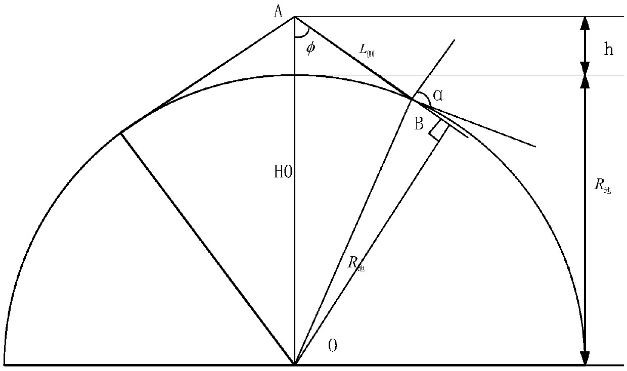
[0039] Among them, ω 地 =7.2921×10 -5 rad / s; R 地 =6371.004km; ω 卫 =10° / s; μ=3.986×10 14 ;H 0 =h+R 地 ;φ is the angular position corresponding to the rotation;
[0040] V 地速投影 =V 地 ×cosφ
[0041] Then the satellite speed and the camera...
specific Embodiment approach 2
[0053] Specific Embodiment 2. This embodiment is an embodiment of the method for calculating the line frequency of a TDI camera vertical orbit rotation and sweep imaging described in Embodiment 1: calculate the detector according to the orbital height, geographic latitude and sweep angle position The vertical rail swings to sweep the line frequency.
[0054] (1) Assuming that the satellite orbit height is h=500km, the earth’s radius R=6371km, and the latitude is 0°, when the vertical orbit swing imaging reaches a side swing of 45°, there are three velocity vectors as follows: Figure 4 As shown, they are:
[0055] Earth's rotation speed V 地 = ω 地 × R 地 =464.58m / s
[0056]satellite precession speed
[0057] Satellite rotation sweep speed V 旋 = ω 卫 × L 侧 =123385.68m / s
[0058] (2) Calculation of combined velocity vector on object surface
[0059] i 0 =97.4°
[0060] α=atan(V 旋 / V 卫星 )+i 0
[0061]
[0062] (3) Calculation of the uplink frequency on the image...
PUM
 Abstract
Description
Claims
Application Information
 - R&D
- Intellectual Property
- Life Sciences
- Materials
- Tech Scout
- Unparalleled Data Quality
- Higher Quality Content
- 60% Fewer Hallucinations
Browse by: Latest US Patents, China's latest patents, Technical Efficacy Thesaurus, Application Domain, Technology Topic, Popular Technical Reports.
© 2025 PatSnap. All rights reserved.Legal|Privacy policy|Modern Slavery Act Transparency Statement|Sitemap|About US| Contact US: help@patsnap.com


