Cross-media electronic document technology platform supporting spatial data

A technology of spatial data and technology platform, applied in electronic digital data processing, structured data retrieval, geographic information database, etc., can solve the problems of no spatial data stored in documents, no GIS-related functions, etc., and achieve easy-to-use solutions. sexual effect

Inactive Publication Date: 2018-06-22
霍亮
View PDF11 Cites 6 Cited by
  • Summary
  • Abstract
  • Description
  • Claims
  • Application Information

AI Technical Summary

Problems solved by technology

Online electronic documents carry maps that embed electronic maps in web pages, such as online map applications such as Google Map, Baidu Map, and Tiandi map; offline electronic documents such as PDF, DOC, TEXT, etc. a

Method used


Image

  • Cross-media electronic document technology platform supporting spatial data
  • Cross-media electronic document technology platform supporting spatial data
  • Cross-media electronic document technology platform supporting spatial data

Examples


Embodiment Construction

[0024] The present invention will be further described in detail below in conjunction with the accompanying drawings, so that those skilled in the art can implement it with reference to the description.

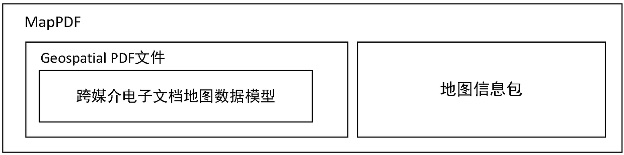
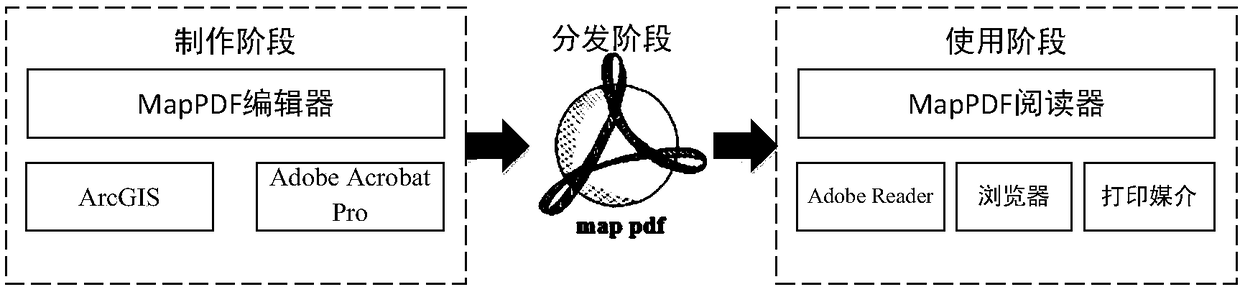
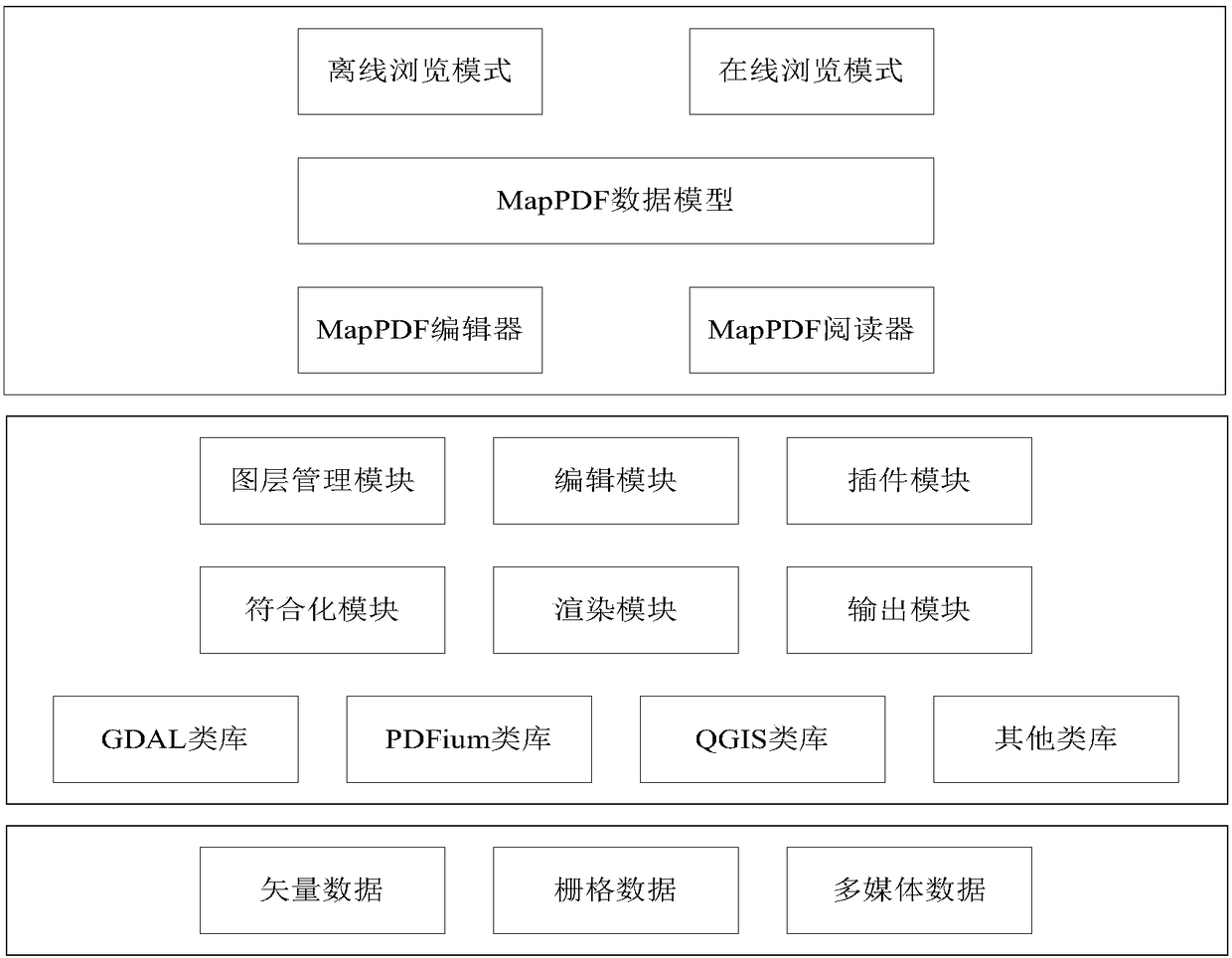
[0025] Such as figure 1 As shown, the present invention provides a cross-media electronic document technology platform supporting spatial data, including: a MapPDF editor, which is used to embed the MXD derived from ArcGIS into a PDF file and make it into a Map PDF map file; A MapPDF reader, which is used to browse the Map PDF map file; wherein, the technical platform establishes a data model with the GeospatialPDF specification, and adopts the GeoPackage standard to establish a map information package, and the map information package is used to store multi-scale heterogeneous spatial data.

[0026] Geospatial PDF is a geographic spatial extension of the PDF1.7 specification. It is a new type of map data storage method. It is based on PDF files and additionally stores map-re...


PUM


Abstract

The invention discloses a cross-media electronic document technology platform supporting spatial data. The cross-media electronic document technology platform comprises a MapPDF editor and a MapPDF reader and is characterized in that the MapPDF editor is used for embedding MXD maps exported from ArcGIS into a PDF file to generate a Map PDF map file; the MapPDF reader is used for browsing the Map PDF file; the technology platform uses the Geospatial PDF standards to build data models and uses the GeoPackage standards to build map information packets, and the map information packets are used forstoring multi-dimensional heterogeneous spatial data. The cross-media electronic document technology platform has the advantages that the Geospatial PDF standards and the GeoPackage standards are adopted, the cross-media feature of PDF is utilized, the spatial data, application logic, mapping information and printing and publication information are integrated, and the limitation of a traditionalelectronic map on usability, portability and readability is well solved.

Description

technical field [0001] The invention relates to a map visualization tool. More specifically, the invention relates to a cross-media electronic document technology platform supporting spatial data. Background technique [0002] With the rapid development of visualization technology and network technology, map visualization has greatly expanded both in the medium it uses and in the field of application. New forms of maps have emerged one after another, and the functions of maps have also been greatly expanded. At the same time, the visualization technology of digital maps has also promoted the deepening of map representation methods, and has made major breakthroughs in describing geographical environments and explaining objective laws compared with traditional maps. [0003] Different forms of maps rely on different media. Generally speaking, the media for map dissemination can be divided into three categories: printed media (mainly refers to flat paper), electronic media (m...

Claims


Application Information

Patent Timeline
IPC IPC(8): G06F17/30
CPCG06F16/29
Inventor 霍亮
Owner 霍亮
Why Eureka
Try Eureka