Method and device for rapidly establishing national coordinate framework reference

A frame and coordinate technology, applied in the field of surveying and mapping, can solve the problems of long establishment period and high cost of coordinate frame establishment

Inactive Publication Date: 2018-06-26
QIANXUN SPATIAL INTELLIGENCE INC
View PDF4 Cites 3 Cited by
  • Summary
  • Abstract
  • Description
  • Claims
  • Application Information

AI Technical Summary

Problems solved by technology

[0013] (1) It is necessary to apply for coordinate results;
[0014] (2) The establishment period is long, usually about 10-15 days (including the time for coordinate achievement application);
[0015] (3) The cost of establishing the coordinate frame is relatively high (need to increase the observation personnel and equipment of national high-level control points, etc.)

Method used


Image

  • Method and device for rapidly establishing national coordinate framework reference
  • Method and device for rapidly establishing national coordinate framework reference
  • Method and device for rapidly establishing national coordinate framework reference

Examples


Embodiment Construction

[0039] In the following description, many technical details are proposed in order to enable readers to better understand the application. However, those skilled in the art can understand that without these technical details and various changes and modifications based on the following implementation modes, the technical solution claimed in each claim of the present application can be realized.

[0040] In order to make the purpose, technical solution and advantages of the present invention clearer, the following will further describe the implementation of the present invention in detail in conjunction with the accompanying drawings.

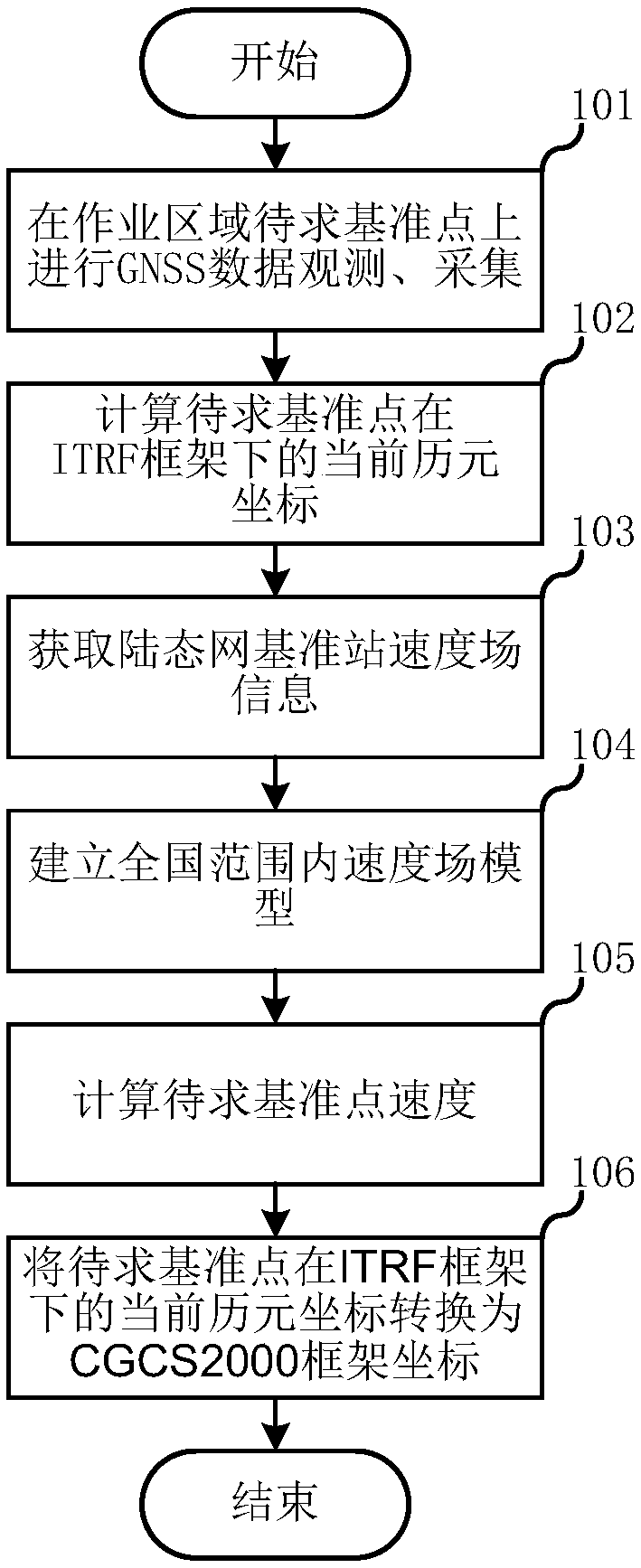
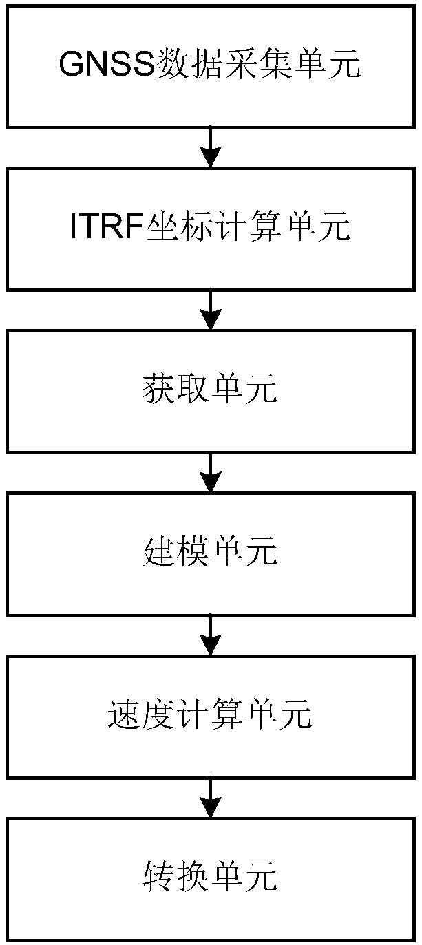
[0041] The first embodiment of the present invention relates to a method for rapidly establishing a national coordinate frame datum. figure 1 is a flow diagram of the method for quickly establishing a national coordinate frame datum.

[0042] Specifically, as figure 1 As shown, the method for quickly establishing a national coordinate frame datu...


PUM


Abstract

The invention relates to the technical field of surveying and mapping, and discloses a method and a device for rapidly establishing a national coordinate framework reference. The method comprises thefollowing steps of carrying out GNSS data observation and acquisition on the reference point to be solved on an operation area, calculating the current epoch coordinates of the datum points to be solved under an ITRF framework; acquiring the velocity field information of a landmark network reference station; establishing a speed field model in the national range according to the speed field information of the reference station; calculating the speed of the reference point to be solved according to the speed field model; carrying out framework conversion according to the speed of the referencepoint to be solved, and converting the current epoch coordinate of the reference point to be solved under the ITRF framework into a CGCS2000 framework coordinate. A national high-level control point is not needed to rapidly establish the national CGCS2000 coordinate framework reference in the national range.

Description

technical field [0001] The invention relates to the technical field of surveying and mapping, in particular to a technology for quickly establishing a national coordinate frame datum. Background technique [0002] On July 1, 2008, my country officially launched the new geocentric three-dimensional geodetic coordinate system CGCS2000. [0003] CGCS2000 is the abbreviation of the 2000 National Geodetic Coordinate System, which belongs to the geocentric geodetic coordinate system. The system is based on the ITRF97 reference frame, and the reference frame epoch is 2000.0. [0004] ITRF is the abbreviation of International Terrestrial Reference Frame, that is, the International Terrestrial Reference Frame, which is a geocentric reference frame. It is defined by the coordinates and motion speed of the space geodetic observation station. It is the ground reference frame of the international earth rotation service and the specific realization of the International Terrestrial Refere...

Claims


Application Information

Patent Timeline
Patent Type & Authority Applications(China)
IPC IPC(8): G01S19/42
CPCG01S19/42
Inventor 冯彦同
Owner QIANXUN SPATIAL INTELLIGENCE INC
Why Eureka
Try Eureka