Novel network RTK atmospheric interpolation method

A network and atmospheric technology, applied in the field of satellite navigation, can solve problems such as the accuracy of atmospheric interpolation, achieve the effect of improving the accuracy of atmospheric interpolation, improving the fixation rate and stability

Active Publication Date: 2018-07-31
QIANXUN SPATIAL INTELLIGENCE INC
View PDF8 Cites 8 Cited by
  • Summary
  • Abstract
  • Description
  • Claims
  • Application Information

AI Technical Summary

Problems solved by technology

[0007] The present invention provides a new network RTK atmospheric interpolation method, the present invention mainly solves the problem of atmospheric interpolation accuracy in network RTK (NRTK), and the present invention can improve the network RTK atmospheric interpolation accuracy

Method used


Image

  • Novel network RTK atmospheric interpolation method
  • Novel network RTK atmospheric interpolation method
  • Novel network RTK atmospheric interpolation method

Examples


Embodiment Construction

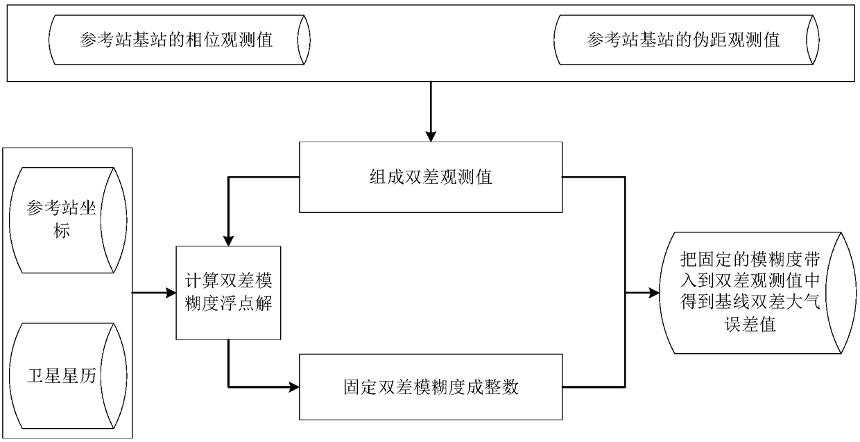
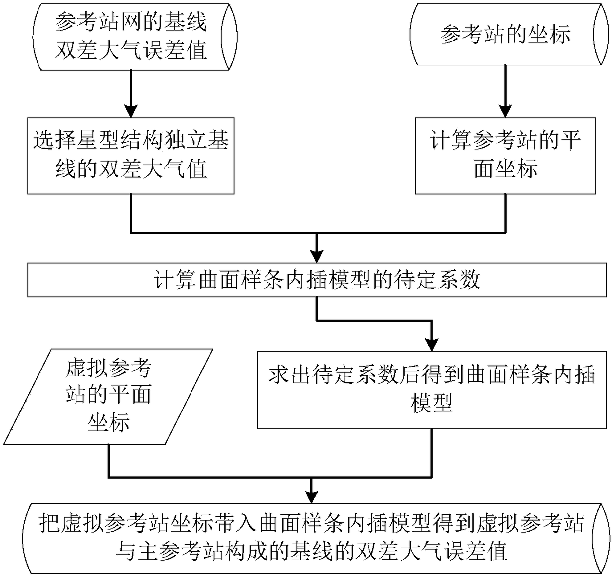
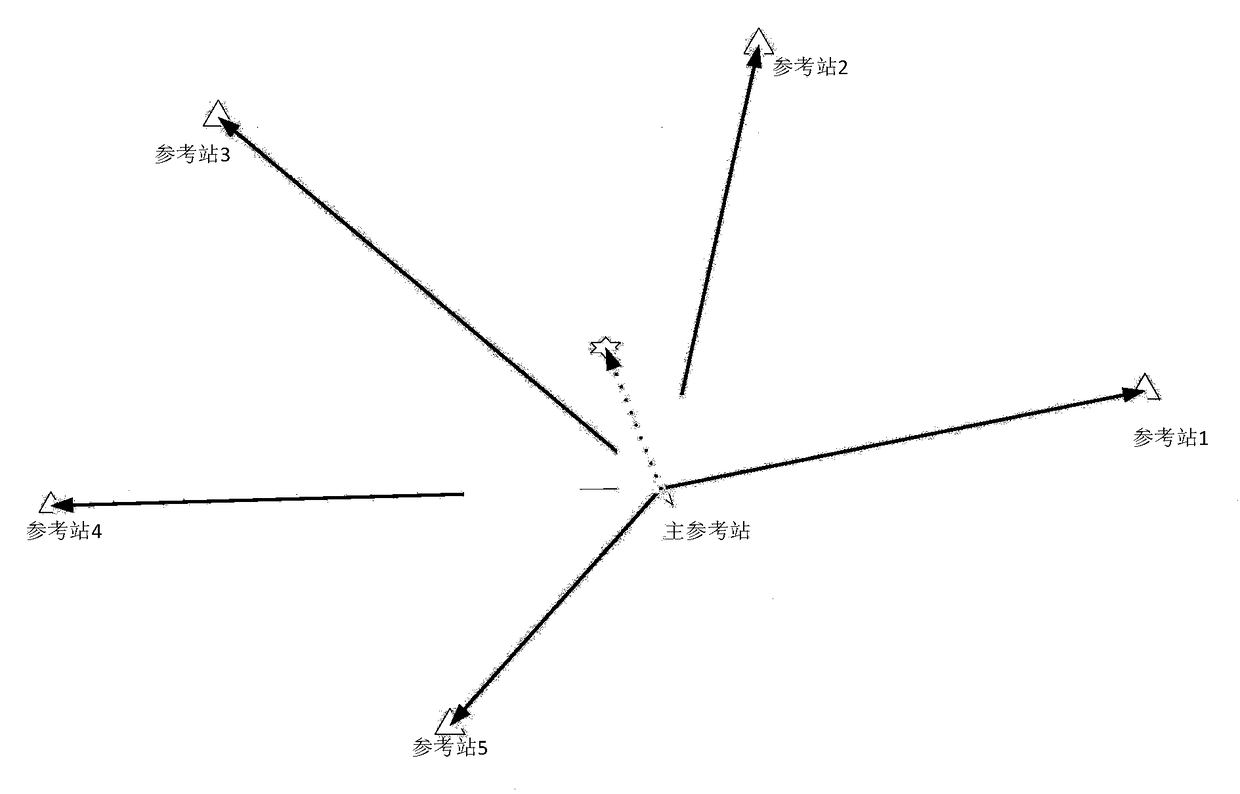
[0040] The new network RTK interpolation model in the present invention is the surface spline interpolation method, and this method draws lessons from the surface spline interpolation method in the height anomaly interpolation in the gravity field, and through some modifications. The main steps of the surface spline interpolation method in the elevation anomaly interpolation are as follows: first obtain the absolute value of the elevation anomaly of the discrete sampling points in the area, and then estimate the model coefficient of the surface spline interpolation method through the elevation anomaly values ​​of the discrete sampling points , so that the surface interpolation model suitable for this area is obtained, that is, formula (3). Next, through the relationship between the location coordinates of the elevation anomaly unknown point and the position of the discrete sampling point, the elevation anomaly of the unknown point is interpolated through the formula (3).

[00...


PUM


Abstract

The invention provides a novel network RTK atmospheric interpolation method. The method comprises the following steps of step1, calculating a base-line double-difference atmospheric error value; step2, interpolating the double-difference atmospheric error value of a virtual reference station from the base-line double-difference atmospheric error value by using a curved surface spline interpolationmethod; and step3, calculating the virtual observed value of the virtual reference station. In order to reliable interpolation precision, atmospheric error data of at least three base stations is limitedly used. When there is the atmospheric error data of the three base stations, a model is a plane interpolation model. The interpolation method can be freely switched between the plane interpolation and curved surface interpolation according to an actual condition. The atmospheric values of discrete sampling points are accurately located in a curved surface spline model and there is no deviation. Besides, a curved surface spline function has advantages that known point plane coordinates do not need to be arranged according to a regular lattice; and a natural boundary condition is adopted and boundary derivative information is not needed.

Description

technical field [0001] The invention relates to the technical field of satellite navigation, in particular to a network RTK atmospheric interpolation method. Background technique [0002] Conventional RTK (Real-Time Kinematic, carrier phase dynamic real-time differential) positioning technology is a real-time dynamic differential positioning technology based on high-precision carrier phase observations of GNSS (Global Navigation Satellite System) satellites. The accuracy of satellite positioning is affected by errors such as the atmosphere. When the distance between two receivers (generally less than 10 kilometers) is relatively close, the atmospheric errors above them are considered to be equal. Conventional RTK positioning technology uses a receiver near the user to make a difference To reduce the influence of atmospheric errors. However, as the distance increases, the difference between the user's receiver and the nearby receiver is difficult to eliminate atmospheric err...

Claims


Application Information

Patent Timeline
Patent Type & Authority Applications(China)
IPC IPC(8): G01S19/43G01S19/07
CPCG01S19/07G01S19/43
Inventor 赖允斌
Owner QIANXUN SPATIAL INTELLIGENCE INC
Why Eureka
Try Eureka