
Automatic obtaining method of deep learning sample library corresponding to remote sensing image land type identification

A technology of remote sensing imagery and deep learning, applied in scene recognition, character and pattern recognition, instruments, etc., can solve problems such as heavy workload, operator work emotions and work negligence, time-consuming and labor-intensive problems, reduce labor costs, solve problems Insufficient training samples for machine learning and the effect of fast sample acquisition methods

Active Publication Date: 2018-08-03
SOUTHEAST UNIV
View PDF6 Cites 11 Cited by
  • Summary
  • Abstract
  • Description
  • Claims
  • Application Information

AI Technical Summary

Problems solved by technology

Traditionally, training images are mostly obtained manually and marked manually, which is time-consuming and labor-intensive, with a huge workload, and is easily affected by the operator's work emotions and work negligence

Method used


Image

  • Automatic obtaining method of deep learning sample library corresponding to remote sensing image land type identification
  • Automatic obtaining method of deep learning sample library corresponding to remote sensing image land type identification
  • Automatic obtaining method of deep learning sample library corresponding to remote sensing image land type identification

Examples


Embodiment 1

[0031] In order to better understand the technical content of the present invention, the specific embodiments are specifically cited and described as follows in conjunction with the accompanying drawings:

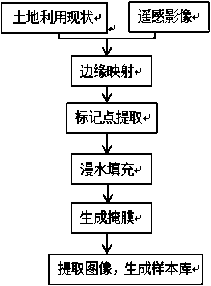
[0032] Such as figure 1 As shown, according to a preferred embodiment of the present invention, the automatic acquisition method of the deep learning sample library corresponding to the remote sensing image classification recognition includes the following steps:

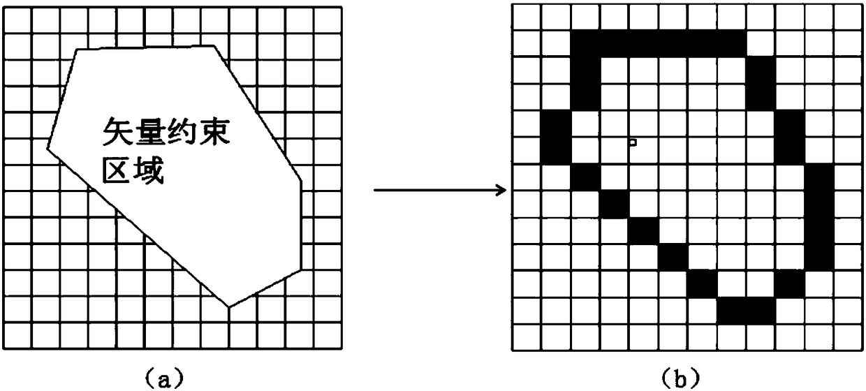
[0033] Step 1: Edge mapping, first by superimposing the current land use status and remote sensing map in the same coordinate system, and then mapping the boundary of the current land use vector map to a closed edge composed of continuous pixels in the remote sensing image;

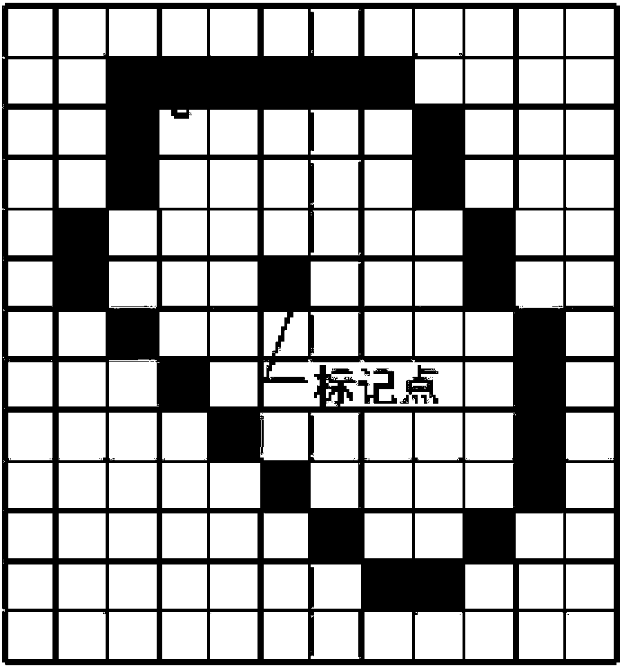
[0034] Step 2: Extraction of marker points, by setting a threshold to mark points with smaller gradient values ​​in the remote sensing image as marker points;

[0035] Step 3: Flood filling, perform flood filling through marked points, assi...


PUM


Abstract

The invention relates to an automatic obtaining method of a deep learning sample library corresponding to remote sensing image land type identification, and belongs to the technical field of remote sensing monitoring technologies of land utilization. a present land utilization situation vector graph and a remote sensing image are superposed in the same coordinate system, a point with a relativelylow gradient value is set in a threshold marking remote sensing image and serves as a marking point; the marking point is filled in a submersible way, and a mask layer corresponding to each filling area is assigned, and land type information is stored; and images after segmentation are extracted according to the mask layer, and are stored in a classified way according to land type information of the present land utilization situation stored by the mask layer, and the sample library is formed. The present land utilization situation data and the remote sensing data in the same time phase are superposed and compared to collect the remote sensing image characteristic library corresponding to different land types automatically, and compared with traditional manual sample obtaining which is large in workload and hard to obtain sample areas, the method of the invention is rapider and more accurate, and the labor cost is reduced substantially.

Description

technical field [0001] The invention belongs to the technical field of land use remote sensing monitoring, and in particular relates to an automatic acquisition method of a deep learning sample library corresponding to land type recognition of remote sensing images. Background technique [0002] In the field of land use status investigation technology, time-sensitive land use information is very important, and the automatic interpretation of land types from remote sensing images is a major technical problem that my country's land and resources science and technology are committed to solving! In recent years, with the rapid development of machine learning technology represented by deep learning, applying deep learning to automatic interpretation of remote sensing images and realizing land use type identification as automatic as possible is currently an important research goal and direction of Chinese researchers. However, the premise of deep learning corresponding to the work...

Claims


Application Information

Patent Timeline
Patent Type & Authority Applications(China)
IPC IPC(8): G06K9/00G06K9/32G06K9/62
CPCG06V20/13G06V10/25G06F18/214
Inventor 张小国贾友斌陈孝烽陈刚韦国钧
Owner SOUTHEAST UNIV
Learn More