An unmanned aerial vehicle surveying and mapping method
A drone and ground technology, applied in the field of surveying and mapping, can solve problems such as troublesome splicing and reduced accuracy, and achieve the effect of saving steps and improving accuracy
- Summary
- Abstract
- Description
- Claims
- Application Information
AI Technical Summary
Problems solved by technology
Method used
Image
Examples
Embodiment Construction
[0035] The present invention will be described in detail below in conjunction with the accompanying drawings.
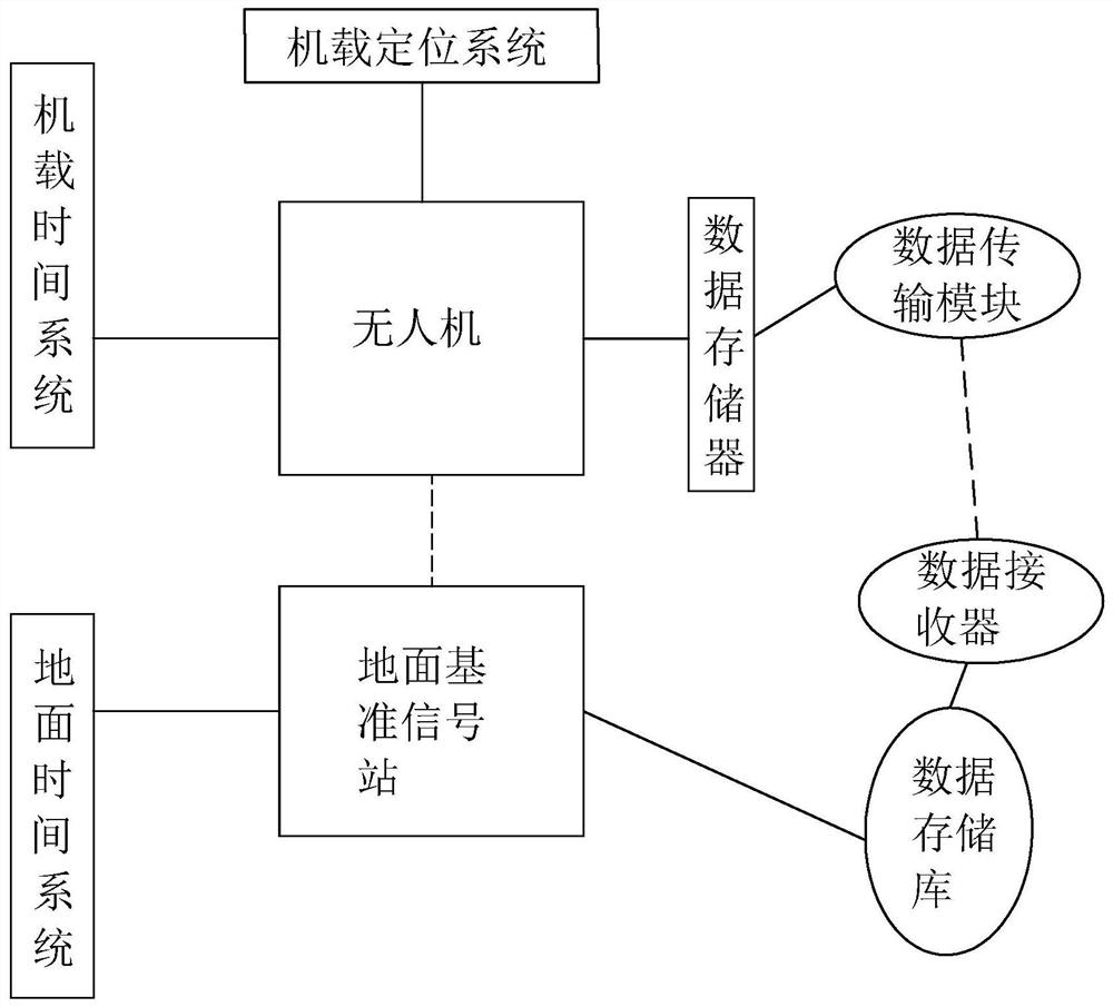
[0036] An unmanned aerial vehicle surveying and mapping method, such as figure 1 shown, including the following steps:
[0037] 1) Establish a ground reference signal station; as a static standard reference point for the entire UAV, it forms a fixed space coordinate system, and can measure the position signal of the UAV, and the measurement is relatively accurate; the ground reference signal station can use GNSS and other global The composition of the navigation satellite system;
[0038] 2) Calibrate the UAV airborne positioning system with the ground reference signal station; after the airborne positioning system is calibrated with the ground reference signal station, the data of the airborne system can be in one-to-one correspondence with the data of the ground reference signal station, and then Easy to read and pair; general drones also use the same navigation ...
PUM
 Abstract
Description
Claims
Application Information
 - R&D
- Intellectual Property
- Life Sciences
- Materials
- Tech Scout
- Unparalleled Data Quality
- Higher Quality Content
- 60% Fewer Hallucinations
Browse by: Latest US Patents, China's latest patents, Technical Efficacy Thesaurus, Application Domain, Technology Topic, Popular Technical Reports.
© 2025 PatSnap. All rights reserved.Legal|Privacy policy|Modern Slavery Act Transparency Statement|Sitemap|About US| Contact US: help@patsnap.com


