Lane line map construction method based on camera sensor and construction system

A construction method and sensor coordinate system technology, applied in the construction method of lane line map and the field of construction system, can solve the problems of large time and cost

Pending Publication Date: 2018-12-25
NIO ANHUI HLDG CO LTD
View PDF8 Cites 20 Cited by
  • Summary
  • Abstract
  • Description
  • Claims
  • Application Information

AI Technical Summary

Problems solved by technology

[0006] Since the construction of such a high-precision map at the lane line level takes a lot of time and cost, it is urgent to provide a method that can automatically form a lane line map

Method used


Image

  • Lane line map construction method based on camera sensor and construction system
  • Lane line map construction method based on camera sensor and construction system
  • Lane line map construction method based on camera sensor and construction system

Examples


Embodiment Construction

[0091] Introduced below are some of the various embodiments of the invention, intended to provide a basic understanding of the invention. It is not intended to identify key or critical elements of the invention or to delineate the scope of protection.
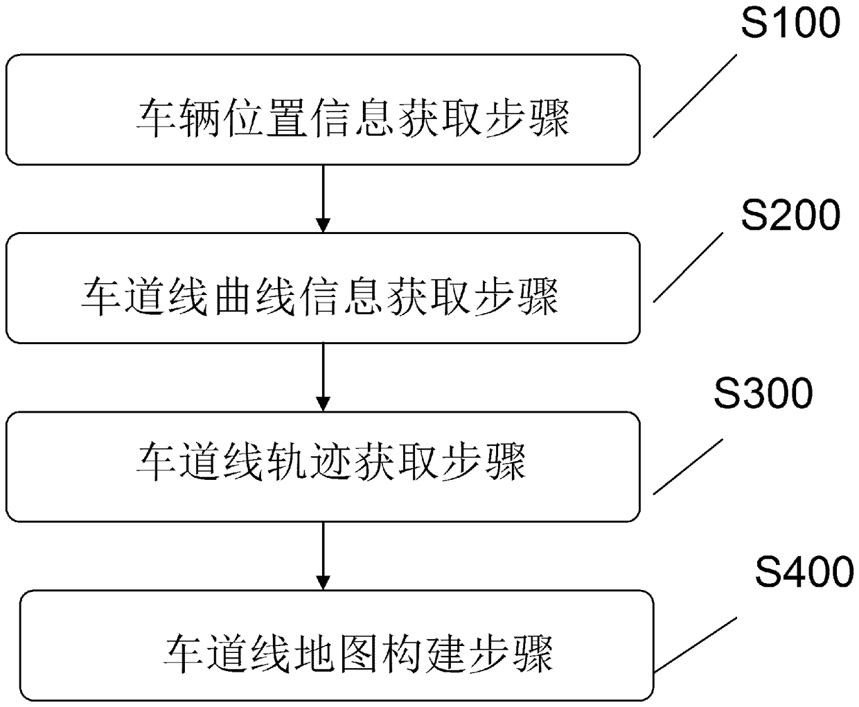
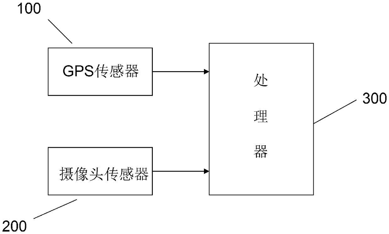
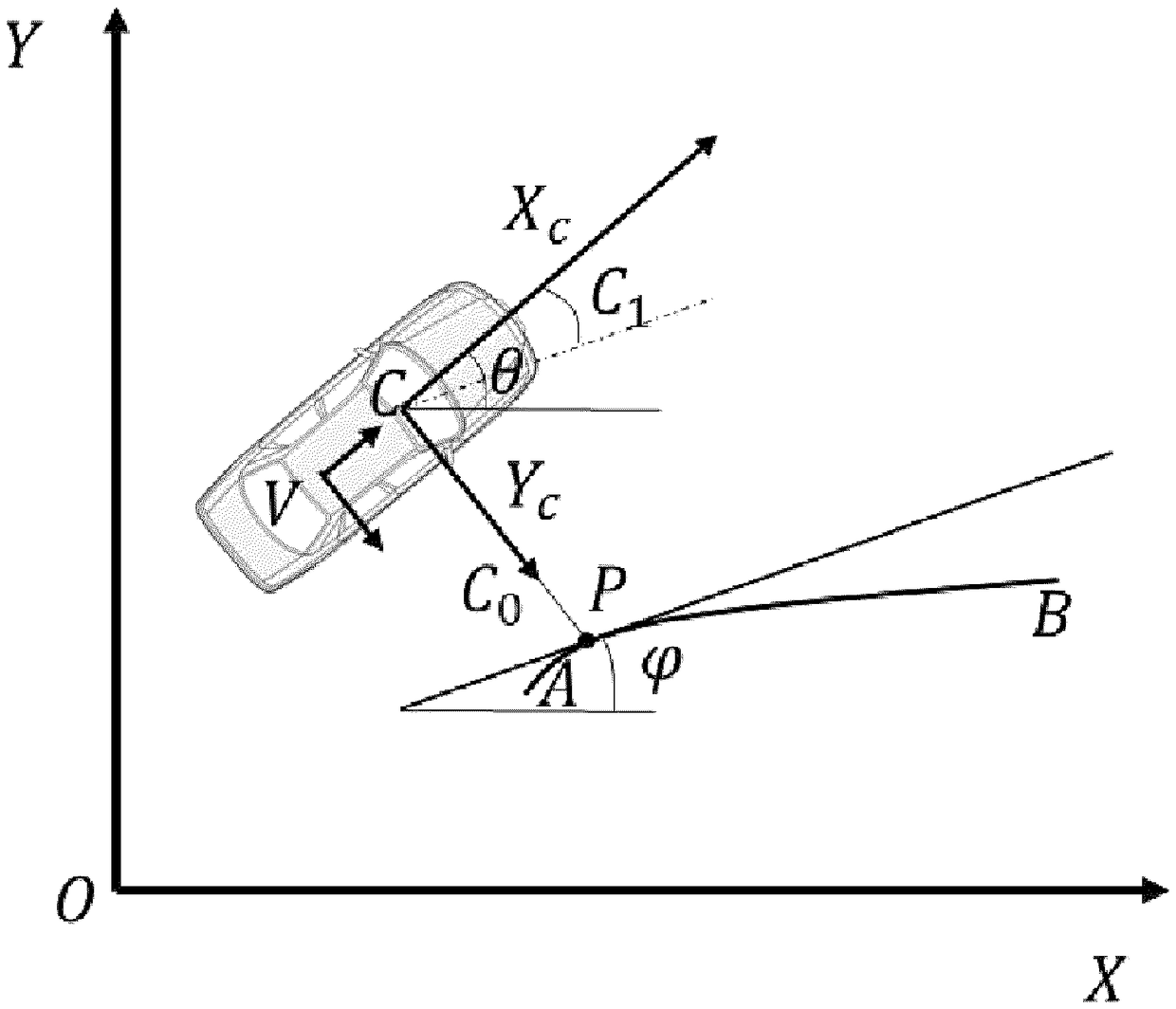
[0092] The technical idea of ​​the construction method of the lane line map of the present invention is to use the advantages of the camera sensor to recognize the texture information of the image, to identify the lane line on the road in real time through the image processing algorithm, and combine the position signal obtained by the high-precision GPS sensor to calculate The parameters of the current lane segment. Connect the detected lane segments to get a lane map.

[0093] Next, a method for constructing a lane marking map according to an embodiment of the present invention will be described.

[0094] figure 1 It is a flowchart showing a method of constructing a lane marking map according to an embodiment of the presen...


PUM


Abstract

The invention relates to a lane line map construction method and a construction system. The method comprises the following steps: acquiring location information of the vehicle by using a GPS sensor disposed on the vehicle; identifying a lane line with a camera sensor disposed on the vehicle and outputting lane line curve information; calculating a trajectory of the lane line according to the acquired location information of the vehicle and the acquired lane line curve information; and splicing the acquired trajectories of the lane line to form the lane line map. According to the lane line mapconstruction method based on camera sensor and construction system, the high-accuracy lane line map can be acquired at a lower cost.

Description

technical field [0001] The present invention relates to the field of geographic information data collection and map surveying and mapping, and in particular to a method and system for constructing a high-definition lane line map. Background technique [0002] The accuracy of existing navigation maps is generally not high, and the entire road is used as an object to provide road information data or issue navigation instructions. This kind of navigation map is called a road-level map, which greatly simplifies the actual traffic environment and can provide The amount of information is small, the accuracy is low, and the ability to assist the driver is low. [0003] With the development of assisted driving technology and unmanned driving technology, the requirements for map accuracy and information volume are gradually increasing. The original road-level map can no longer meet the requirements. A new type of high-level map that can provide high-precision and detailed road inform...

Claims


Application Information

Patent Timeline
Patent Type & Authority Applications(China)
IPC IPC(8): G01C21/32
CPCG01C21/3848G09B29/00
Inventor 孙鹏
Owner NIO ANHUI HLDG CO LTD
Why Eureka
Try Eureka