
A method and system for dividing administrative regions by real estate surveying and mapping

A technology for administrative areas and real estate, applied in image analysis, image enhancement, instruments, etc., can solve problems such as low work efficiency, and achieve the effect of improving the efficiency of determination and the accuracy of division

Inactive Publication Date: 2020-10-02
浙江省国土勘测规划有限公司 +1
View PDF5 Cites 0 Cited by
  • Summary
  • Abstract
  • Description
  • Claims
  • Application Information

AI Technical Summary

Problems solved by technology

However, this method of artificially identifying and dividing administrative regions makes the overall work efficiency low and needs further improvement

Method used


Image

  • A method and system for dividing administrative regions by real estate surveying and mapping
  • A method and system for dividing administrative regions by real estate surveying and mapping
  • A method and system for dividing administrative regions by real estate surveying and mapping

Examples


Embodiment 1

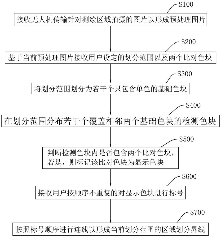
[0058] A method for dividing administrative areas of real estate surveying and mapping, such as figure 1 shown, including the following steps:

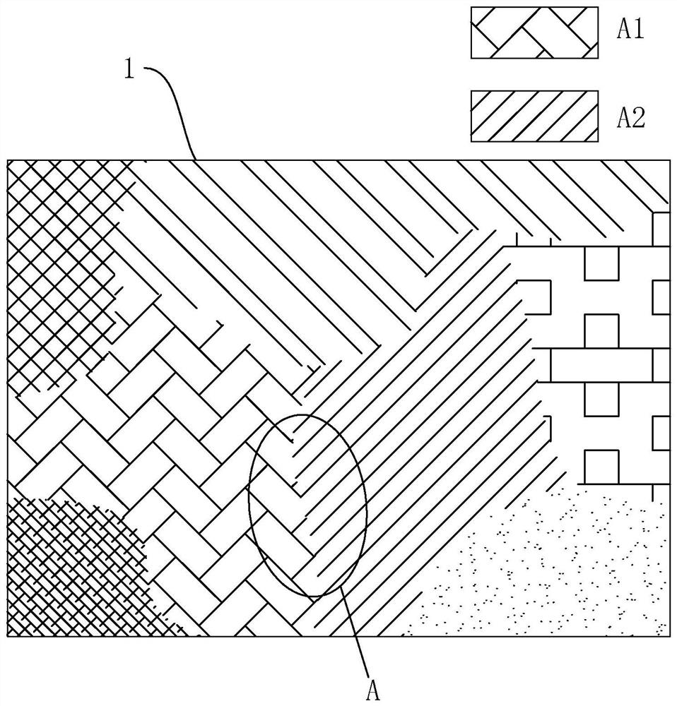
[0059] S100, receiving the pictures taken by the UAV for the surveying and mapping area to form a pre-processed picture 1;

[0060] S200, based on the current preprocessed picture 1, receive the division range set by the user and two comparison color blocks;

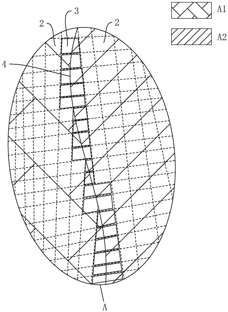
[0061] S300, dividing the division range into several basic color blocks 2 that only contain a single color;

[0062] S400, distributing several detection color blocks covering two adjacent basic color blocks 2 in the division range;

[0063] S500, judging whether the detection color block contains two comparison color blocks, if so, marking the comparison color block as display color block 3;

[0064] S600, the receiving user labels the display color block 3 in sequence without repetition;

[0065] S700, connect the lines according to the order of the numbers to form the ar...

Embodiment 2

[0088] A real estate surveying and mapping administrative area division system, such as Image 6 As shown, it includes a picture receiving module 5, a user setting module 6, a cutting module 7, a detection module 8, a judging module 9, a label setting module 10 and a generating module 11: wherein,

[0089] The picture receiving module 5 is used to receive the picture taken by the UAV transmission for the surveying and mapping area to form a preprocessed picture 1;

[0090] The user setting module 6 is used to receive the division range set by the user and two comparison color blocks based on the current preprocessing picture 1;

[0091] The cutting module 7 is used to divide the current division range into several basic color blocks 2 that only contain monochrome;


PUM


Abstract

The invention relates to the technical field of real estate surveying and mapping, particularly, the invention relates to a method and a system for dividing an administrative region of real estate surveying and mapping. In order to solve the problem of low efficiency of manual identification of administrative region boundaries in the prior art, the technical scheme of the invention comprises the following steps: receiving pictures taken for surveying and mapping regions from an unmanned aerial vehicle to form preprocessed pictures; receiving a partition range set by a user based on the currentpreprocessed picture and two comparison color blocks; dividing the partition range into several basic color blocks containing only monochrome; distributing a plurality of detection color blocks covering adjacent two basic color blocks in the partition range; 2, judging whether two compared color blocks are included in the detected color block, and if so, marking the compare color block as a display color block; the receiving user does not repeat labeling the display color blocks in sequence; connecting the lines according to the labeling order to form the regional demarcation boundaries of the current demarcation scope has the purpose of improving the efficiency of administrative region determination.

Description

technical field [0001] The invention relates to the technical field of real estate surveying and mapping, in particular to a method and system for dividing administrative regions of real estate surveying and mapping. Background technique [0002] Immovable property refers to property that is immovable according to its natural nature or legal provisions, such as land, houses, prospecting rights, mining rights and other land fixtures, land products that have not been separated from the land, things that are attached to the land due to nature or manpower and cannot be separated. other things. [0003] The characteristics of real estate as a natural object include: immovability, also known as position fixity, that is, fixed geographical location; individuality, also known as uniqueness and uniqueness, including differences in location, utilization degree, and rights; durability, also known as long life , if the land is not lost or destroyed due to use or placement, but also inc...

Claims


Application Information

Patent Timeline
Patent Type & Authority Patents(China)
IPC IPC(8): G06T7/181G06T7/90G06F16/29
CPCG06T7/181G06T7/90G06T2207/20021
Inventor 刘云波杨林叶茂何川
Owner 浙江省国土勘测规划有限公司
Learn More