Point cloud registration method from point to optimum plane in data acquisition of ground laser scanner

A laser scanner and data acquisition technology, applied in image data processing, instruments, image analysis, etc., can solve problems such as slow convergence rate, and achieve the effect of improving registration accuracy, fewer iterations, and accurate conversion parameters

Inactive Publication Date: 2019-02-22
WUHAN UNIV
View PDF4 Cites 9 Cited by
  • Summary
  • Abstract
  • Description
  • Claims
  • Application Information

AI Technical Summary

Problems solved by technology

This leads to a slow convergence rate...

Method used


Image

  • Point cloud registration method from point to optimum plane in data acquisition of ground laser scanner
  • Point cloud registration method from point to optimum plane in data acquisition of ground laser scanner
  • Point cloud registration method from point to optimum plane in data acquisition of ground laser scanner

Examples


Embodiment Construction

[0024] In order to facilitate those of ordinary skill in the art to understand and implement the present invention, each step of the method proposed by the present invention is described in detail below, and the experimental process is given. It should be understood that the implementation examples described here are only used to illustrate and explain the present invention, and It is not intended to limit the invention.

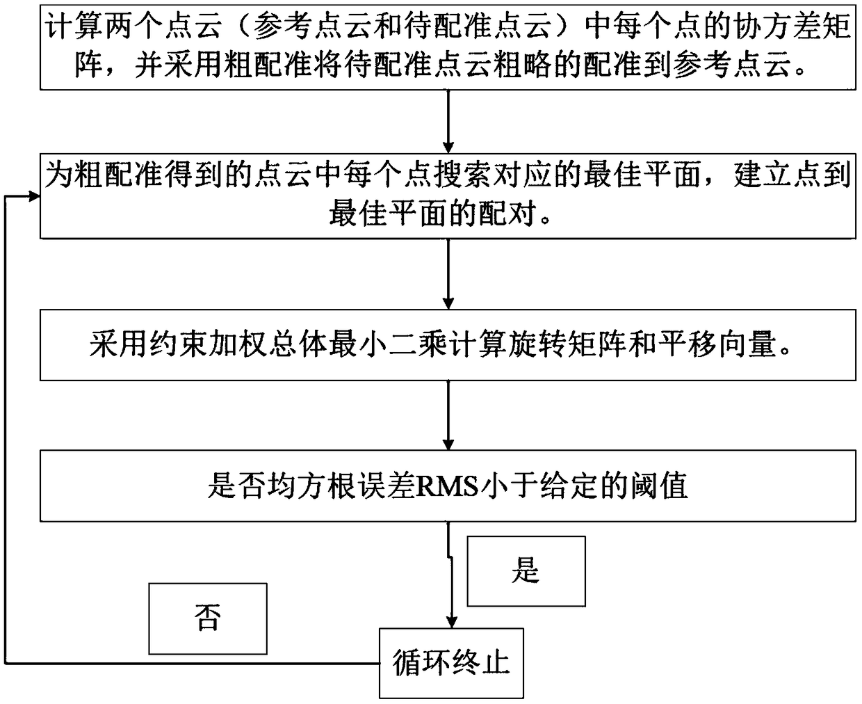
[0025] please see figure 1 , a point cloud registration method from the middle point of ground laser scanner data collection to the best plane provided by the present invention, assuming that there are two point clouds P 1 and P 2 , with P 1 As a reference point cloud, P 2 As the point cloud to be registered, P 2 Register to P 1 ; and assuming that coarse registration has been implemented, the point cloud is obtained which is where R C is the rotation matrix obtained by rough registration, t C is the translation vector obtained by rough registrat...


PUM


Abstract

The invention discloses a point cloud registration method from a point to an optimal plane in data acquisition of a ground laser scanner, which comprises the following steps: how to search the optimalplane corresponding to each point and establish a pair of points to the optimal plane; the constrained weighted total least square method is used to calculate the plane parameters; the constrained weighted total least square method is used to calculate the transformation parameters. The invention has better registration accuracy.

Description

technical field [0001] The invention belongs to the technical field of point cloud data processing of terrestrial three-dimensional laser scanners, and relates to a point cloud registration method, in particular to a point cloud registration method from the middle point of data acquisition of a terrestrial laser scanner to an optimal plane. Background technique [0002] During the data acquisition process of the terrestrial 3D laser scanner, there may be situations where the foreground blocks the background. Therefore, in order to obtain a complete 3D model of the scanned target, it is necessary to scan the target from different perspectives and obtain point cloud data under different perspectives. However, the point cloud data directly output by the terrestrial 3D laser scanner is based on the data in the local coordinates of the station coordinate system, so it is necessary to convert the point cloud data in different coordinate systems into a common coordinate system, tha...

Claims


Application Information

Patent Timeline
IPC IPC(8): G06T7/33G06T7/35
CPCG06T2207/10008G06T2207/10028G06T7/33G06T7/35
Inventor 陶武勇花向红续东吴伟冯绍权
Owner WUHAN UNIV
Why Eureka
Try Eureka