A method of integrating BIM data and GIS data based on glTF

A data collection technology, applied in the field of building intelligence, can solve problems such as data overload, information loss, and poor visualization effects

Active Publication Date: 2019-03-01
宁波睿峰信息科技有限公司
View PDF4 Cites 25 Cited by
  • Summary
  • Abstract
  • Description
  • Claims
  • Application Information

AI Technical Summary

Problems solved by technology

[0009] The purpose of the present invention is to provide a method for integrating BIM data and GIS data based on glTF, which can overcome the problems of information loss, data overload and poor visualization in the traditional integration process, and realize the integration of BIM data and GIS data. effective integration of

Method used


Image

  • A method of integrating BIM data and GIS data based on glTF
  • A method of integrating BIM data and GIS data based on glTF
  • A method of integrating BIM data and GIS data based on glTF

Examples


Embodiment Construction

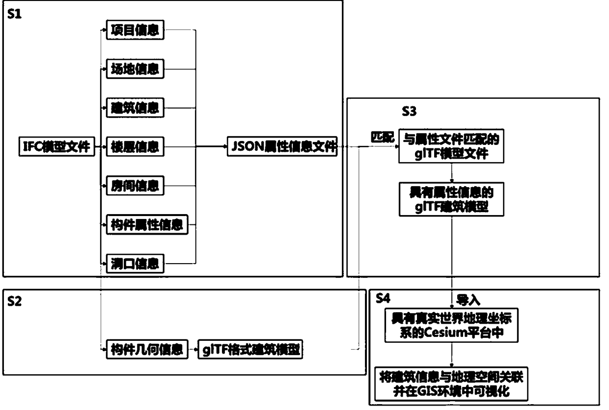
[0093] Such as figure 1 As shown, the present invention provides a method for integrating glTF-based BIM data and GIS data, comprising the following steps:

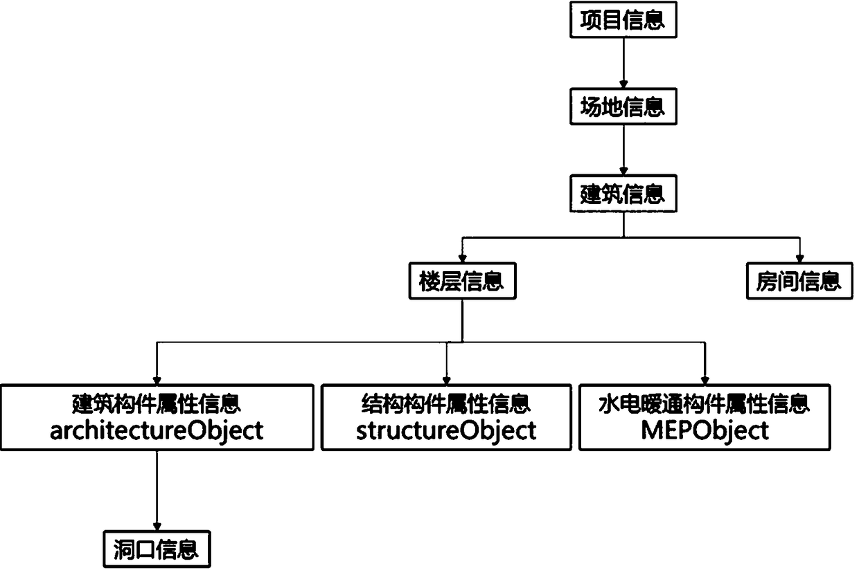
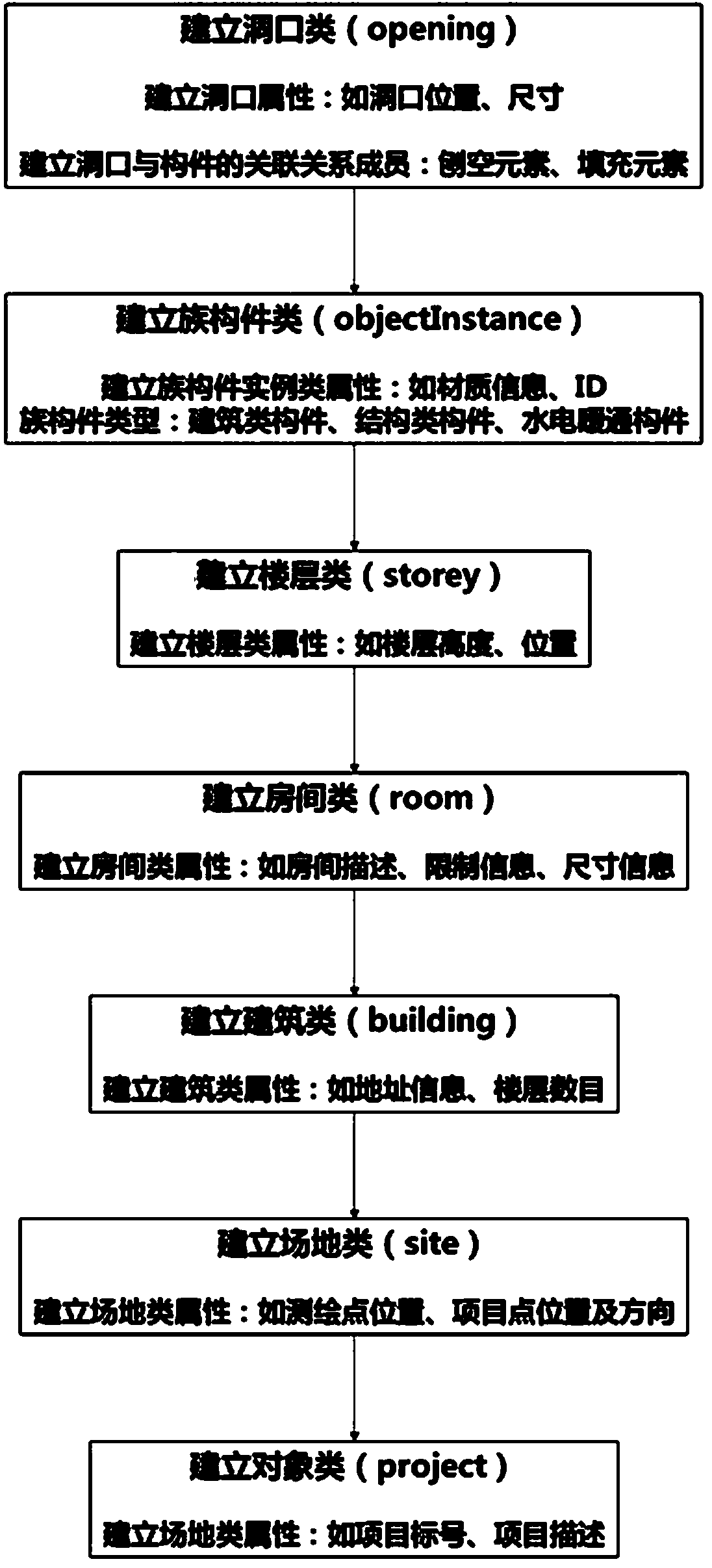
[0094] S1. Extract the project information, site information, building information, floor information, room information, opening information and building component attribute information in the IFC model file, generate an attribute information model when extracting the IFC model file, and generate a JSON based on the attribute information model Attribute information file in format;

[0095] S2. Preprocessing the component information of the IFC model file, extracting the geometric information of the component in the IFC model file, generating a glTF format architectural model through geometric transformation, and generating a glTF architectural model file matching the attribute information file; the preprocessing Add "@" and "component ID" after the name of the component in the IFC model file;

[0096] S3, matching the a...


PUM


Abstract

The invention discloses a method for integrating BIM data and GIS data based on glTF. The method comprises the following steps: S1, extracting BIM attribute information to generate a JSON format attribute information file; S2, extracting BIM attribute information to generate a JSON format attribute information file; S3, BIM attribute information is matched with geometric information to form glTF building model with attribute information; S4, BIM and GIS data are integrated, glTF building model is imported into Cesium platform, glTF building model is put into the world geographic coordinate system, and all the building information of glTF building model is related to geographic space, and visualized in GIS; this method can overcome the problems of information loss, data overload and poor visualization in the traditional integration process, and realize the effective integration of BIM data and GIS data.

Description

technical field [0001] The invention relates to the technical field of building intelligence, in particular to a method for integrating glTF-based BIM data and GIS data. Background technique [0002] In the construction industry, building information modeling and management (BIM) is widely recognized as a new tool that can improve production efficiency and delivery quality. BIM is mainly aimed at the building itself, transforming the architectural engineering drawings from the traditional two-dimensional model into a visualized three-dimensional model, and including all the building information in the building life cycle. It facilitates the extraction of project information by all parties such as design, construction, operation and maintenance, and greatly improves the accuracy and production efficiency of construction projects. In order to ensure that information data can be transmitted and exchanged completely, consistently and correctly within the construction industry, ...

Claims


Application Information

Patent Timeline
Patent Type & Authority Applications(China)
IPC IPC(8): G06F8/20G06F17/50
CPCG06F8/24G06F30/13
Inventor 尹梦天邓进明叶子豪闻雅吴卓倩徐黎明
Owner 宁波睿峰信息科技有限公司
Why Eureka
Try Eureka