A historical geographic information system based on three-dimensional panoramic immersion

A geographic information system, immersive technology, applied in geographic information database, mechanical mode conversion, electrical digital data processing and other directions, can solve the problems of poor sense of substitution, low user acceptance, unfavorable understanding of historical evolution process, etc., to achieve convenient storage Effect

Inactive Publication Date: 2019-03-22
青岛博海数字创意研究院
View PDF1 Cites 5 Cited by
  • Summary
  • Abstract
  • Description
  • Claims
  • Application Information

AI Technical Summary

Problems solved by technology

[0004] The above-mentioned existing technical solutions have the following defects: the map database in the existing historical geographic information platform is two-dimensional, which can be used for simple plane display, and cannot perform 360-degree full-scale map display, which is not conducive to comprehensive user experience. Understand the historical evolution process, the sense of substitution is poor during the observation process, and the user acceptance is low

Method used


Image

  • A historical geographic information system based on three-dimensional panoramic immersion
  • A historical geographic information system based on three-dimensional panoramic immersion
  • A historical geographic information system based on three-dimensional panoramic immersion

Examples


Embodiment

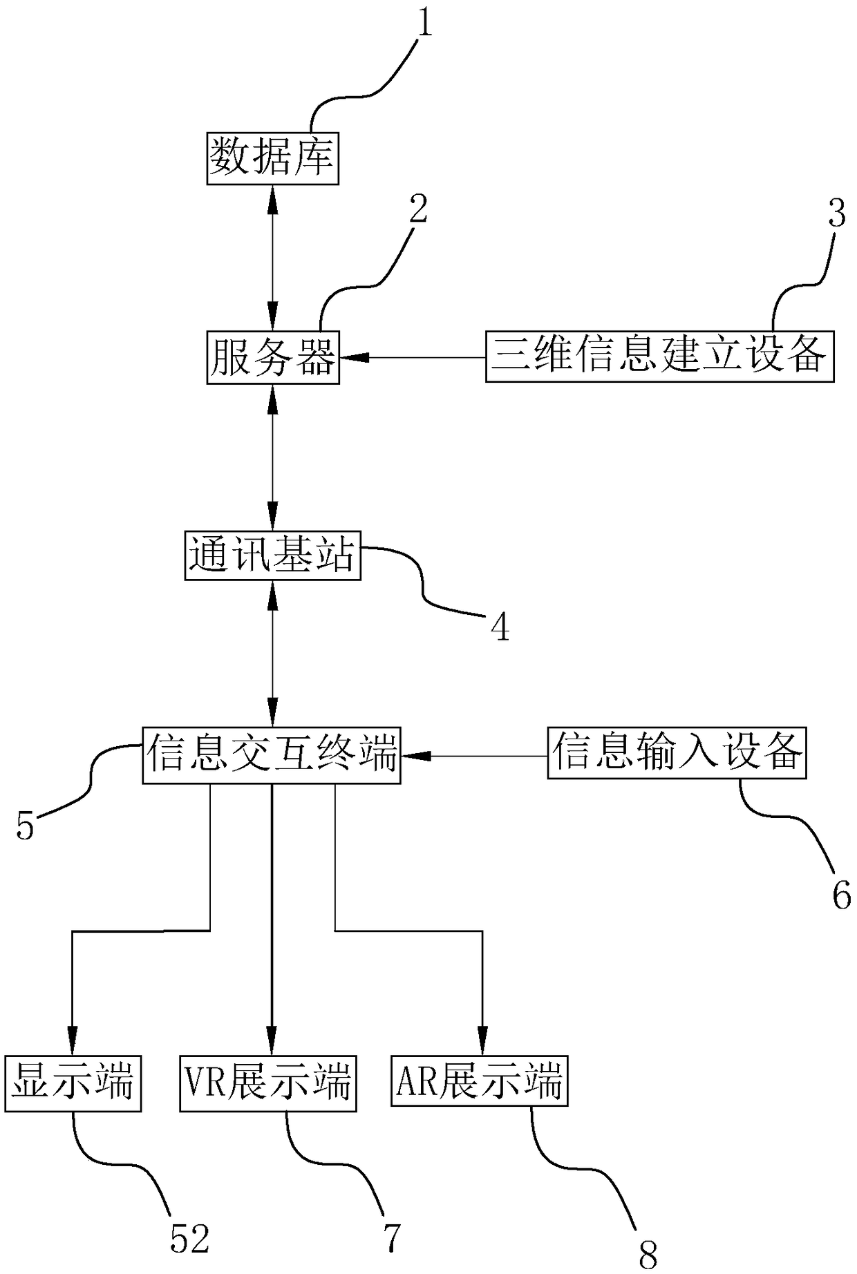
[0057] Embodiment: a kind of historical geographic information system based on three-dimensional panoramic immersion, such as figure 1 As shown, it includes a database 1, a server 2, a three-dimensional information creation device 3, a communication base station 4, an information interaction terminal 5, an information input device 6, a display terminal 52, a VR display terminal 7 and an AR display terminal 8. Database 1 stores the data information based on the "China Historical Geographic Information System CHGIS". The communication base station 4 is connected to the server 2 and the information interaction terminal 5 , and the communication base station 4 is used for remote wireless transmission of data between the server 2 and the information interaction terminal 5 .

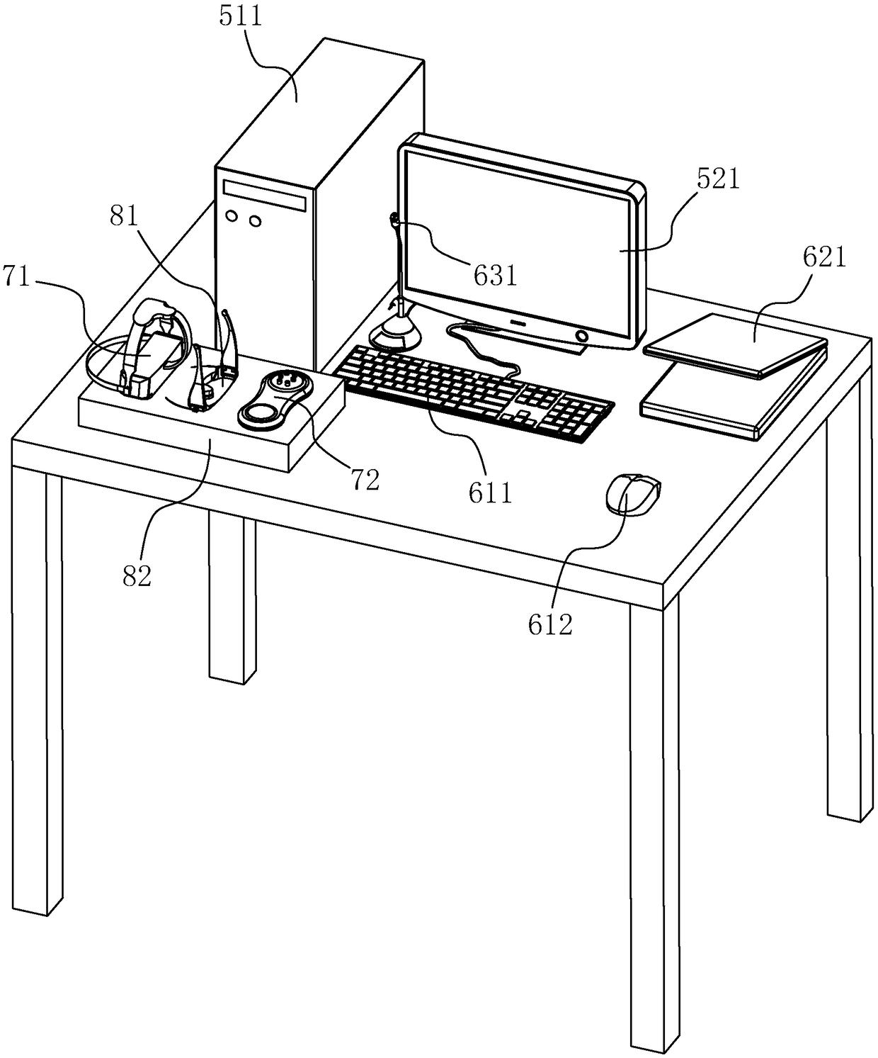
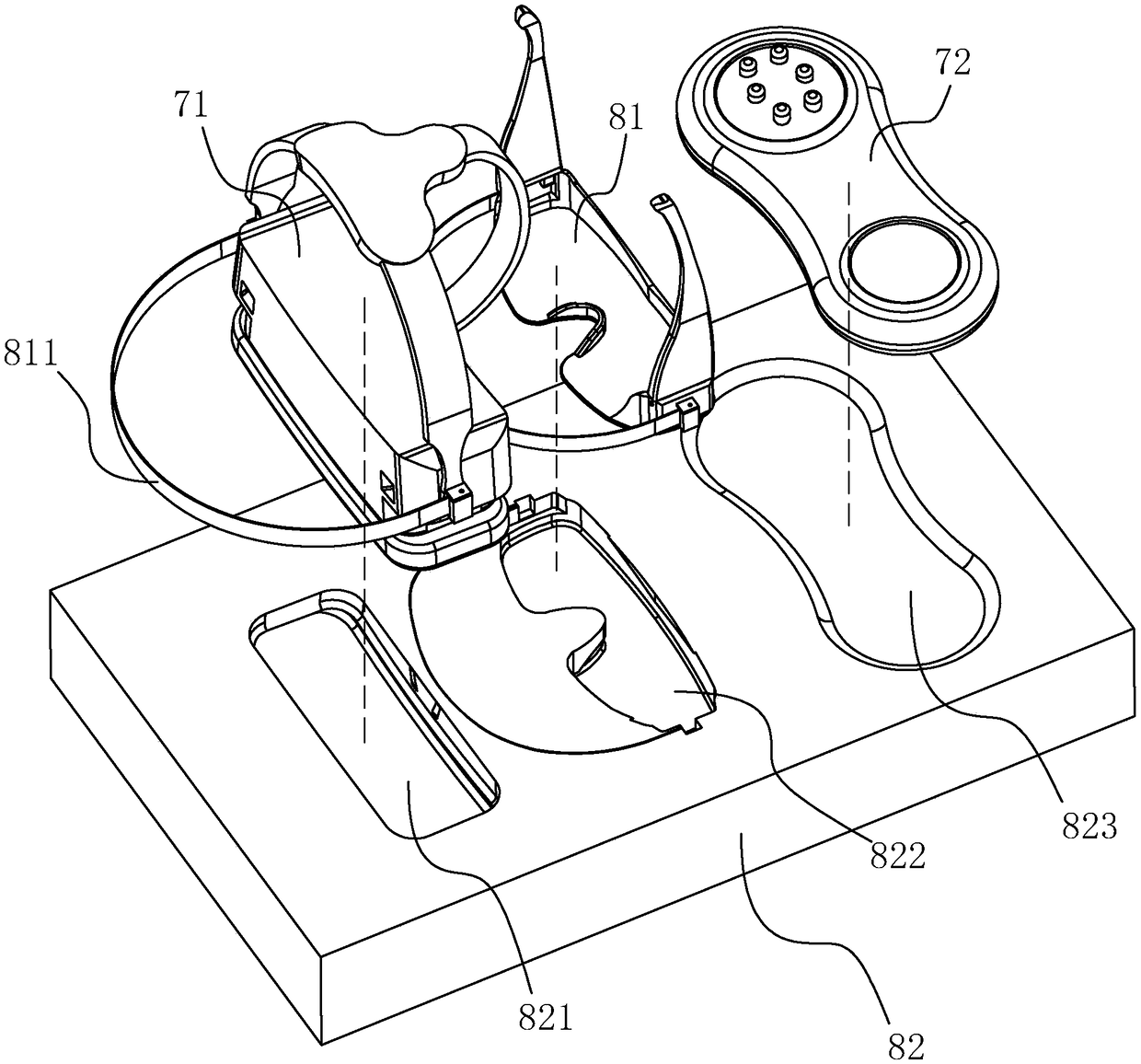
[0058] Such as figure 1 and figure 2 As shown, the information interaction terminal 5 is set as a host 511 (the information interaction terminal 5 can also be set as a smart device such as a notebook, a mob...


PUM


Abstract

The invention discloses a historical geographic information system based on three-dimensional panoramic immersion, belonging to the field of historical geographic information inquiry, which includes adatabase for storing data information, A server connected to the database and used to invoke and process information, a three-dimensional information establishing apparatus connected to a server andfor establishing a three-dimensional model, a communication base station for transmitting data, an information interaction terminal connected to a communication base station and configured to receiveand upload information, an information input device connected to the information interaction terminal, and a display terminal for receiving and displaying the three-dimensional scene, a VR display terminal connected to the information interaction terminal and for receiving and displaying the three-dimensional animation and an AR display terminal connected to the information interaction terminal and for receiving and displaying the three-dimensional animation, The invention can display three-dimensional historical geographic information of different historical periods to the user, and is helpful for the user to understand the effect of the historical evolution process.

Description

technical field [0001] The invention relates to the technical field of historical geographic information query, in particular to a three-dimensional panorama-based immersive historical geographic information system. Background technique [0002] Geographical information systems are sometimes referred to as "geoscience information systems". It is a specific and very important spatial information system. The historical geographic information system is to add the time dimension to the geographic information system, so that users can easily develop various thematic historical maps and thematic historical geographic information systems of literature, archaeology, economics, military and other disciplines. "China Historical Geographic Information System CHGIS" has a large amount of historical geographic information in memory, but it is not very convenient to query. [0003] For the prior art, please refer to the Chinese utility model patent whose authorized announcement number i...

Claims


Application Information

Patent Timeline
Patent Type & Authority Applications(China)
IPC IPC(8): G06F16/29G06F3/01
CPCG06F3/011
Inventor 肖永亮钟京玉王雪莹
Owner 青岛博海数字创意研究院
Why Eureka
Try Eureka