DEM-based terrain sketch automatic drawing method

A technology for automatic drawing and sketching. It is applied in 3D modeling, image data processing, instruments, etc. It can solve the problem that the terrain expression method has not been effectively passed down, and achieve the effect of simplifying the painting technology.

Active Publication Date: 2019-04-23
NANJING NORMAL UNIVERSITY
View PDF9 Cites 3 Cited by
  • Summary
  • Abstract
  • Description
  • Claims
  • Application Information

AI Technical Summary

Problems solved by technology

It is a pity that topographical sketching, a concise, general yet profound topographical expression method, has not been effectively passed down.

Method used


Image

  • DEM-based terrain sketch automatic drawing method
  • DEM-based terrain sketch automatic drawing method
  • DEM-based terrain sketch automatic drawing method

Examples


Embodiment Construction

[0052] The present invention will be further explained below in conjunction with the accompanying drawings and specific embodiments.

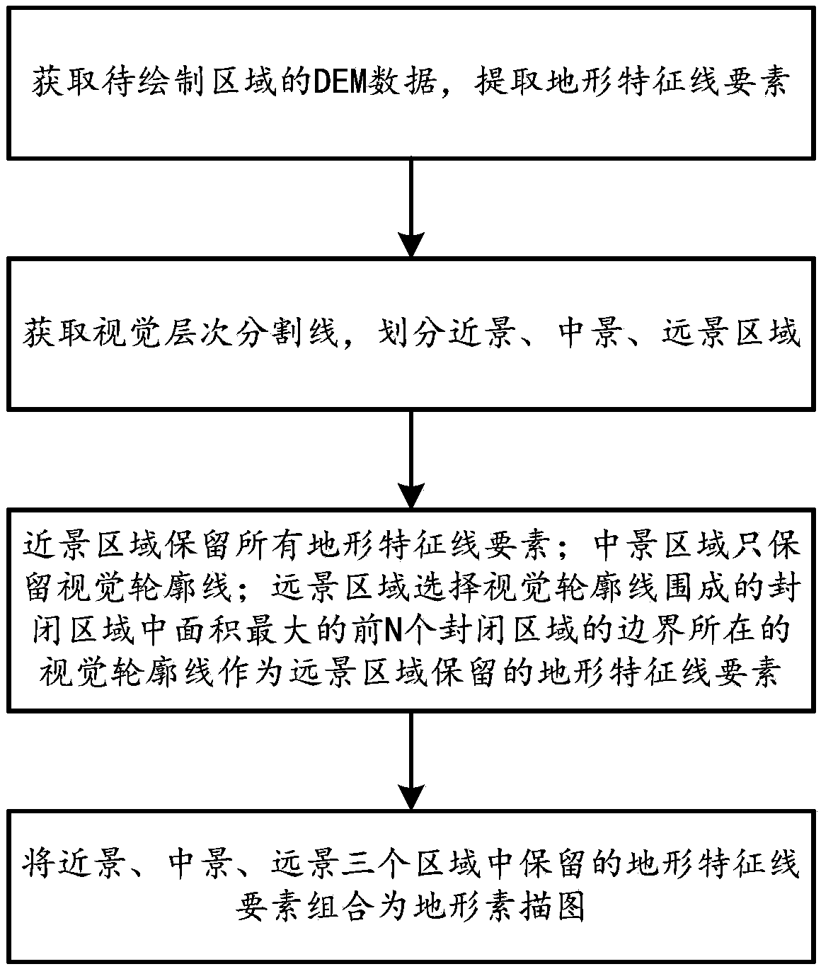
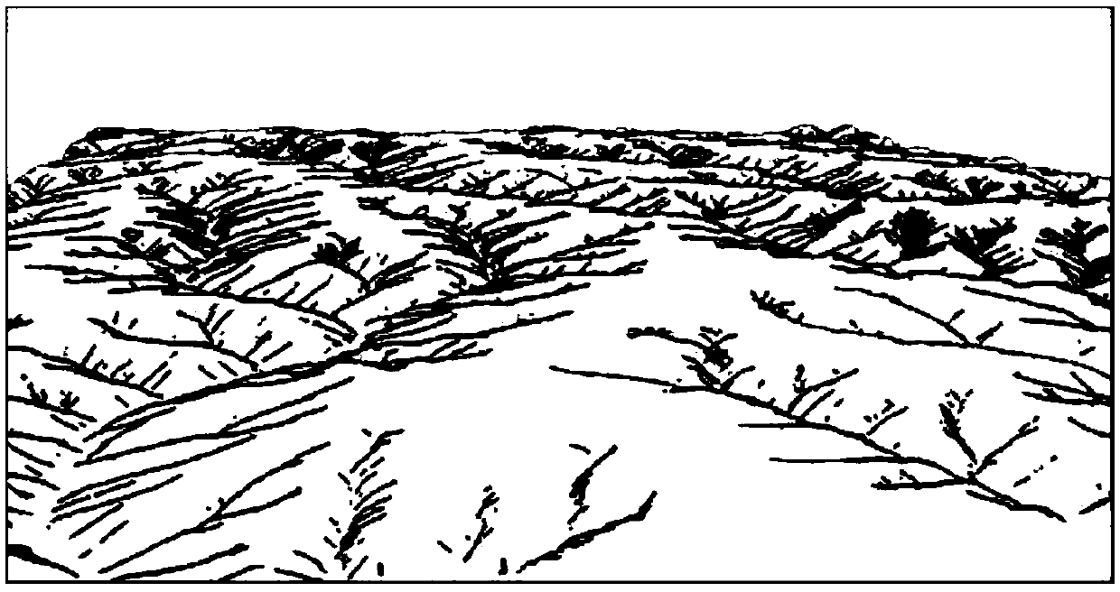
[0053] Such as figure 1 As shown, the automatic drawing method of terrain sketch map based on DEM includes the following steps:

[0054] Step 1, obtain the DEM data of the topographic sketch map area to be drawn, and extract the topographic feature line elements in the topographic sketch map area according to the observation point, viewing angle and observation distance requirements of the topographic sketch map; the topographic feature line elements include visual Contour line, along the ditch, cut ditch, frontier edge, slope flow line;

[0055] DEM is the English abbreviation of Digital Elevation Model (Digital Elevation Model), which is an important original data for research and analysis of terrain, watershed, and object recognition. The principle of DEM is to divide the watershed into quadrilaterals (grid, CELL) with m rows and n columns...


PUM


Abstract

The invention discloses a DEM-based terrain sketch automatic drawing method, which comprises the following steps of 1, acquiring DEM data of a to-be-drawn terrain sketch area, and extracting terrain feature line elements in the area; 2, dividing the to-be-drawn area into a close shot area, a middle shot area and a distant shot area by taking the basin division line as a visual hierarchical division line; 3, reserving all topographic feature line elements of the close-range area; and only reserving the visual contour line of the middle scene area; calculating the area of a closed area defined by the visual contour lines in the distant view area, and selecting the visual contour line where the boundary of the first N closed areas with the maximum area is located as the terrain characteristicline element reserved in the distant view area; and 4, combining topographic feature line elements reserved in the near scene, the middle scene and the distant scene into a topographic sketch map. According to the method, the DEM is used for drawing the topographic sketch map, the automatic drawing of the sketch map is achieved, the topographic sketch map drawing technology is simplified, and thetopographic sketch map capable of reflecting rich geographical environments and topographic structures can be rapidly provided.

Description

technical field [0001] The invention belongs to the automatic drawing technology of topographic sketch map, in particular to a method for automatically drawing topographic sketch map based on digital elevation model. Background technique [0002] With the rapid development of digital terrain acquisition and modeling technology, the pursuit of quantification and refinement of terrain expression has brought difficulties to terrain cognition. Faced with high-precision and large-scale digital terrain data, most people often fail to grasp the essential characteristics of terrain and landforms. Quantitative indicators based on a large number of terrain analyzes are more abstract and difficult to understand. [0003] Topographical sketching, mainly through the way of sketching, takes the geographical landscape as the object of description, and is used as a scientific method to study and explain the landscape in order to reflect the structure and inner nature of the geographical lan...

Claims


Application Information

Patent Timeline
IPC IPC(8): G06T17/05
CPCG06T17/05
Inventor 刘海龙程益涵杨昕代文汤国安
Owner NANJING NORMAL UNIVERSITY
Why Eureka
Try Eureka