UAV identification and positioning system based on rgb_d and deep convolutional network

A deep convolution, UAV technology, used in character and pattern recognition, computer parts, image analysis, etc.

Active Publication Date: 2020-07-07
GANZHOU DEYE ELECTRONICS TECH
View PDF7 Cites 0 Cited by
  • Summary
  • Abstract
  • Description
  • Claims
  • Application Information

AI Technical Summary

Problems solved by technology

Solve the security problem of drones in the area and avoid the impact of drones

Method used


Image

  • UAV identification and positioning system based on rgb_d and deep convolutional network
  • UAV identification and positioning system based on rgb_d and deep convolutional network
  • UAV identification and positioning system based on rgb_d and deep convolutional network

Examples


Embodiment 1

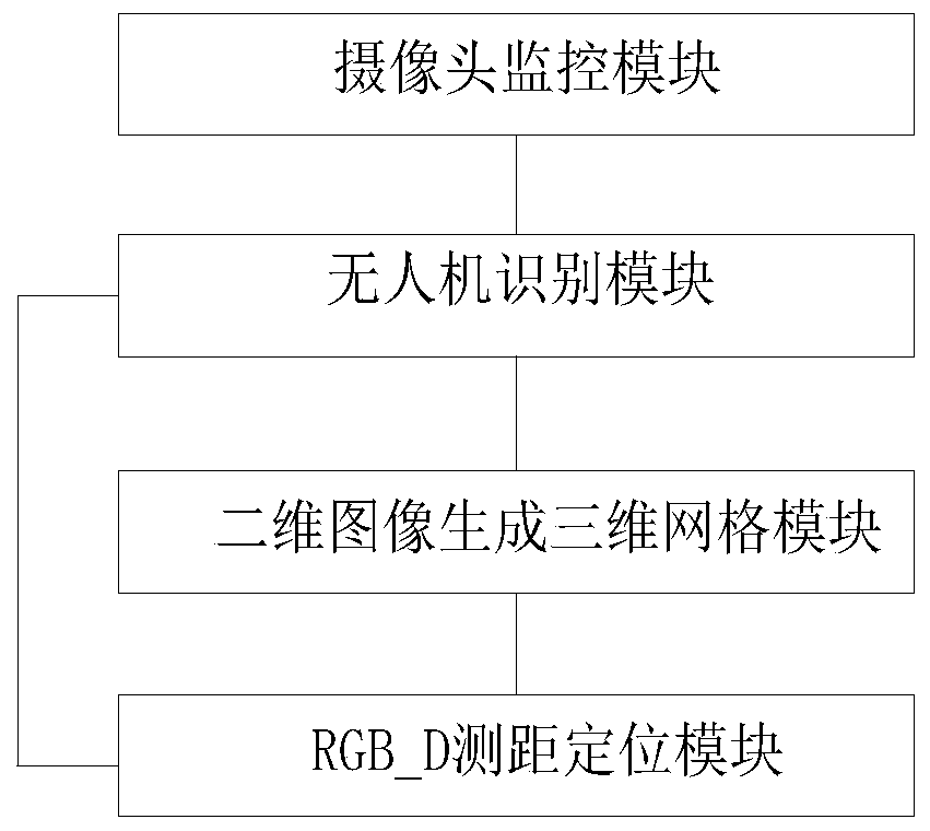
[0033] This embodiment provides a UAV identification and positioning system based on RGB_D and deep convolutional network, such as figure 1 As shown, it includes camera monitoring module, UAV identification module, 2D image generation 3D grid module and RGB_D distance measurement and positioning module;

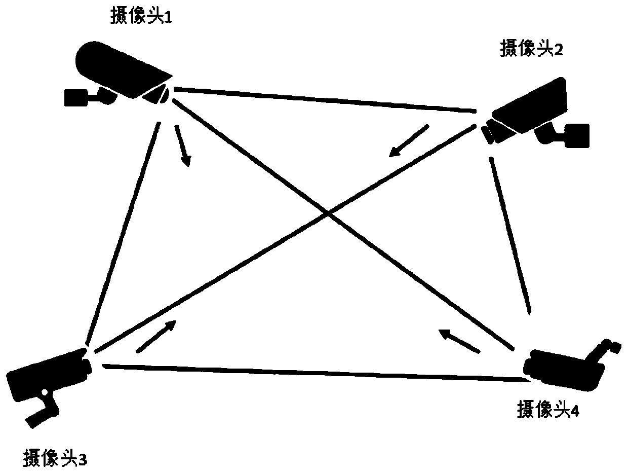
[0034] The camera monitoring module is used to obtain images of the entire monitoring area;

[0035] The UAV identification module receives the image of the monitoring area obtained by the camera monitoring module, matches with the pre-stored UAV image features, and identifies whether there is an UAV in the monitoring area;

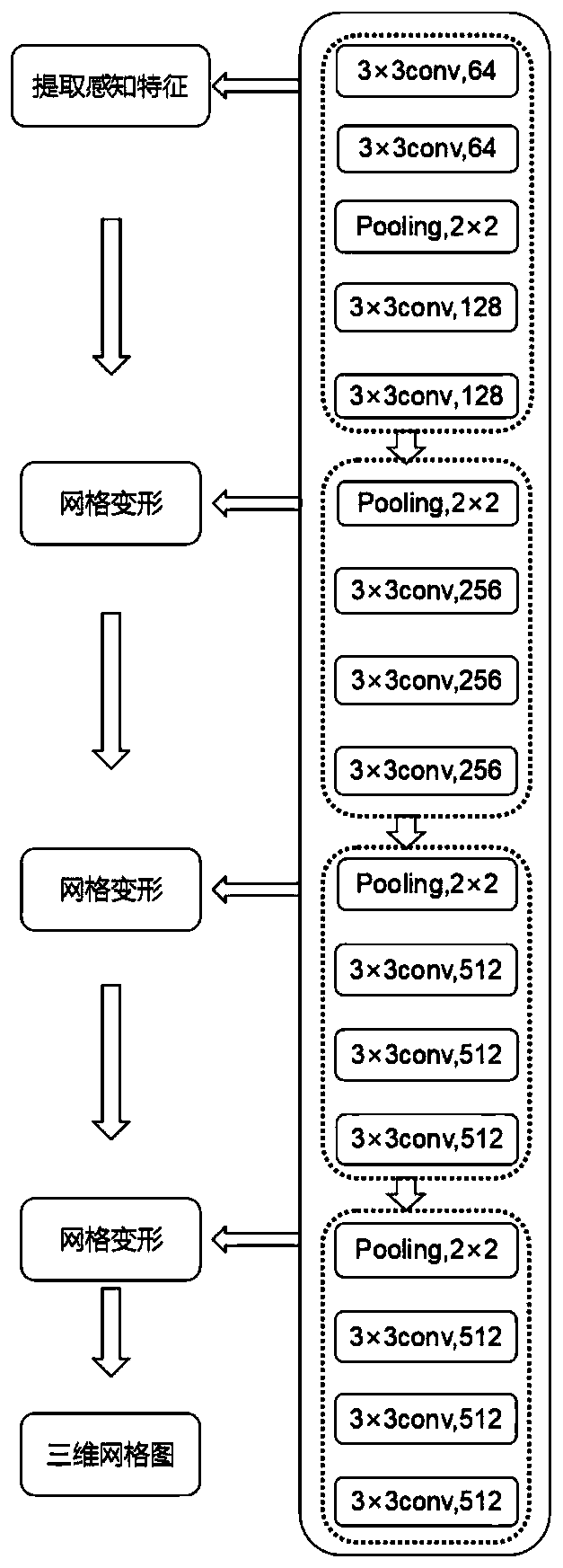
[0036] The two-dimensional image generation three-dimensional grid module is used to generate a three-dimensional grid image from the image of the monitoring area acquired by the camera monitoring module through the graph convolutional neural network when the drone recognition module recognizes that there is a drone in the monitoring area;

[0037] The ...

Embodiment 2

[0055] This embodiment provides a method for using the system described in Embodiment 1 to identify and locate the UAV, such as Figure 5 shown, including the following steps:

[0056] S1, the camera monitoring module is used to obtain images of the entire monitoring area;

[0057] S2. The UAV identification module receives the image of the monitoring area acquired by the camera monitoring module, matches with the pre-stored UAV image features, and identifies whether there is a UAV in the monitoring area;

[0058] S3. When the drone identification module recognizes that there is a drone in the monitoring area, the two-dimensional image generation three-dimensional grid module generates a three-dimensional grid image from the image of the monitoring area acquired by the camera monitoring module through the graph convolutional neural network; RGB_D The distance measurement and positioning module obtains the RGB_D image of the monitoring area through the binocular camera, and ca...


PUM


Abstract

The invention discloses a UAV identification and positioning system based on RGB_D and deep convolution network, including a camera monitoring module, an UAV identification module, a two-dimensional image generation three-dimensional grid module and an RGB_D distance measurement and positioning module; a camera monitoring module Obtain the image of the entire monitoring area; the UAV identification module matches the image of the monitoring area with the pre-stored UAV image features to identify whether there is a UAV in the monitoring area; the 2D image generation 3D grid module passes the image volume The integrated neural network generates a three-dimensional grid map from the image of the monitoring area obtained by the camera monitoring module; the RGB_D ranging positioning module obtains the RGB_D image of the monitoring area through the binocular camera, and according to the RGB_D image of the monitoring area in the UAV and the binocular camera The relationship between the color and depth is calculated to obtain the distance between the two, combined with the direction of the UAV obtained from the three-dimensional grid map, the specific positioning of the UAV is realized. The invention can realize high-precision identification and positioning of the unmanned aerial vehicle in the area.

Description

technical field [0001] The invention relates to the technical field of UAV identification and positioning, in particular to an UAV identification and positioning system based on RGB_D and a deep convolutional network. Background technique [0002] Unmanned aerial vehicles (UAVs) are the focus of a new round of scientific and technological revolution and industrial revolution in the world. They have been used in various fields. Today, UAVs are constantly making breakthroughs in this field. Extend in multiple directions for use and home use. In the face of difficult, high-risk and high-content tasks that humans cannot handle, unmanned aerial vehicles (UAVs) have emerged as the times require, and they replace manned aircraft to perform these tasks. A drone is a device that is controlled by radio, so some people call it a remote piloted aircraft. It can make perfect use of sophisticated technologies such as artificial intelligence, signal processing and automatic driving, and ...

Claims


Application Information

Patent Timeline
Patent Type & Authority Patents(China)
IPC IPC(8): G06K9/00G06K9/46G06T7/73
CPCG06T7/73G06T2207/10024G06T2207/30232G06V20/10G06V10/56
Inventor 樊宽刚邱海云王渠刘平川王文帅杨杰侯浩楠逄启寿陈宇航匡以顺
Owner GANZHOU DEYE ELECTRONICS TECH
Why Eureka
Try Eureka