Construction method of 3D geological model in plain area based on multi-source heterogeneous data
A three-dimensional geological and plain technology, applied in image data processing, 3D modeling, instruments, etc., can solve problems such as complex modeling standardization work, single types of modeling data, and complex modeling software processes
- Summary
- Abstract
- Description
- Claims
- Application Information
AI Technical Summary
Problems solved by technology
Method used
Image
Examples
Embodiment Construction
[0035] The content of the present invention will be described in further detail below in conjunction with the accompanying drawings.
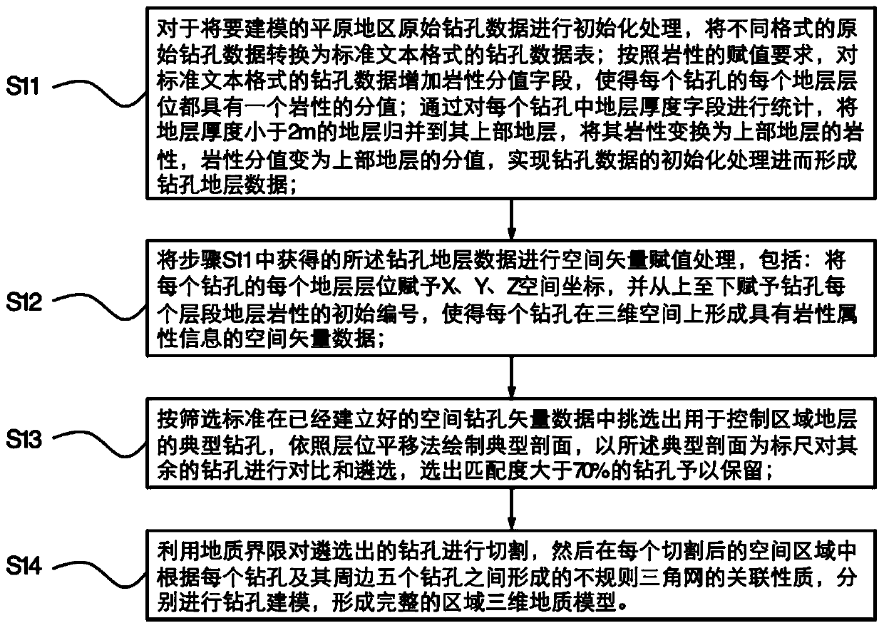
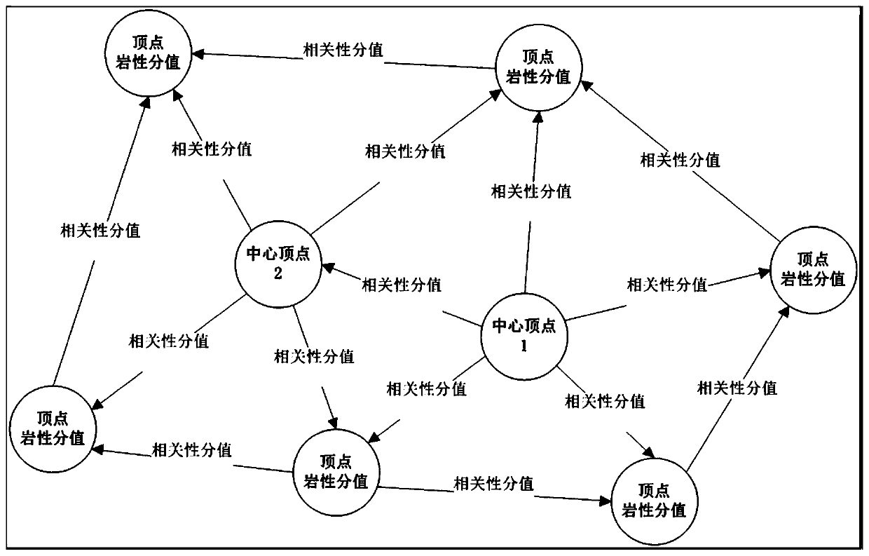
[0036] The main idea of the present invention is to make different types of candidate data have different vector characteristics through vectorization and spatialization processing of geological survey data from multiple sources, and to use the original multi-source heterogeneous data for these processed The vector iterative modeling method establishes three-dimensional geological models of different depths, different scales, and different types. The present invention can realize the construction of most three-dimensional geological models in plain areas without complex generalization and standardization processing of borehole data, and has strong accurate modeling ability.
[0037] The present invention provides a method for building a three-dimensional geological model in plain areas based on multi-source heterogeneous data. In step S11, th...
PUM
 Abstract
Description
Claims
Application Information
 - R&D
- Intellectual Property
- Life Sciences
- Materials
- Tech Scout
- Unparalleled Data Quality
- Higher Quality Content
- 60% Fewer Hallucinations
Browse by: Latest US Patents, China's latest patents, Technical Efficacy Thesaurus, Application Domain, Technology Topic, Popular Technical Reports.
© 2025 PatSnap. All rights reserved.Legal|Privacy policy|Modern Slavery Act Transparency Statement|Sitemap|About US| Contact US: help@patsnap.com


