A Method of Solving Aircraft Attitude Using Geomagnetic Information and Accelerometer

A technology of aircraft and accelerometer, which is applied in the field of calculating the attitude of flying objects, can solve the problems of roll angle calculation error divergence, geomagnetic sensor calculation roll angle calculation blind area, etc., to improve accuracy, eliminate measurement blind area, and avoid blind area Effect

Active Publication Date: 2021-08-27
BEIJING INSTITUTE OF TECHNOLOGYGY
View PDF9 Cites 0 Cited by
  • Summary
  • Abstract
  • Description
  • Claims
  • Application Information

AI Technical Summary

Problems solved by technology

Even if the measurement accuracy of the magnetoresistive sensor reaches an ideal state, when the angle between the projectile axis and the magnetic north is small, the error in the calculation of the roll angle will tend to a certain extent due to errors in the measurement of the pitch angle and yaw angle. to diverge
[0005] The inventors found that for low-speed rolling flying objects, such as missiles and satellites, when the angle between the launching direction and the magnetic north direction is small, there will be a blind area when using the geomagnetic sensor to calculate the roll angle.

Method used


Image

  • A Method of Solving Aircraft Attitude Using Geomagnetic Information and Accelerometer
  • A Method of Solving Aircraft Attitude Using Geomagnetic Information and Accelerometer
  • A Method of Solving Aircraft Attitude Using Geomagnetic Information and Accelerometer

Examples


Embodiment 1

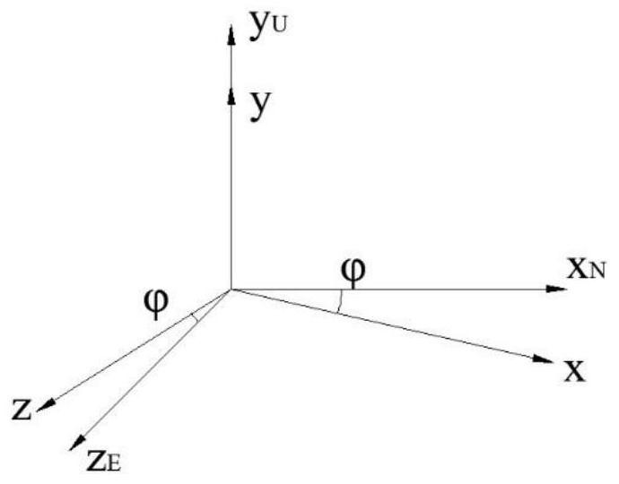
[0114] The geomagnetic information in the Korla area is: magnetic field strength M=55585.6nT, magnetic inclination I=61°33′36″, magnetic declination D=2°31′22″. For convenience, the angle between the launch direction of the missile and the magnetic north is ψ, and the east direction of the magnetic north is taken as positive.

[0115] Among them, the symbols are distinguished as follows:

[0116] ψ—the angle between the projection of the axial direction of the missile on the horizontal plane and the magnetic north;

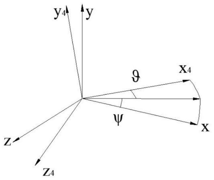
[0117] ψ—the angle between the projection of the missile axis in the horizontal plane and the launch direction (yaw angle).

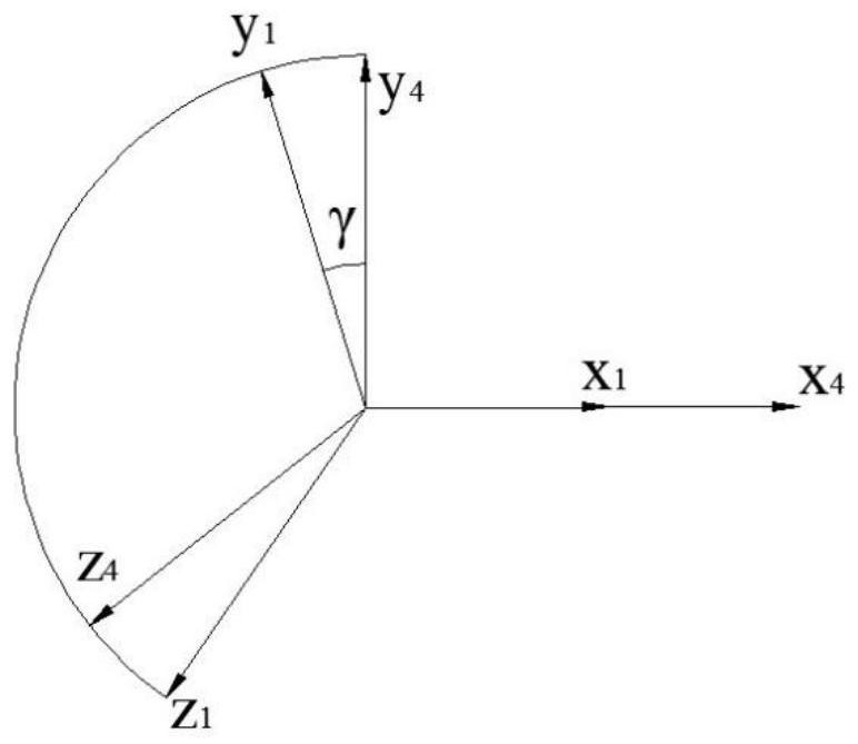
[0118] Through the simulation calculation performed by Matlab software, the components of the magnetic field strength on the projectile section are obtained under different launch directions and different pitch angles, as shown in Figure 6-1 and Figure 6-2 shown.

[0119] Depend on Figure 6-1 and Figure 6-2 It can be obtained that...


PUM


Abstract

The invention provides a method for calculating the attitude of an aircraft by using geomagnetic information and an accelerometer. The measurement error of the magnetoresistive sensor and the accelerometer is used as the weight, and the measurement noise covariance matrix determined by the angle change between the longitudinal axis of the aircraft and the geomagnetic vector is calculated. Adjust to achieve an optimal estimate of the vehicle's roll angle. The method uses geomagnetic information and accelerometer together to eliminate the influence of the blind area of ​​the aircraft measurement.

Description

technical field [0001] The invention relates to a method for calculating the attitude of a flying object by using geomagnetic information and an accelerometer, in particular to a method for calculating the spatial blind area and inherent deviation of the roll angle of the flying object by using the geomagnetic information and the accelerometer. Background technique [0002] The earth is a natural magnet, which is similar to a dipole placed at the center of the earth. Any point on the ground has a certain magnetic field strength and direction, so the geomagnetic field can be considered as a known vector field. According to the principle of vector attitude determination, if the direction of the geomagnetic vector can be measured by the sensor fixed on the aircraft, the attitude angle of the aircraft can be calculated by vector calculation. Due to its small size, low cost, and high overload resistance, the magnetoresistive sensor is widely used in the roll attitude measurement...

Claims


Application Information

Patent Timeline
Patent Type & Authority Patents(China)
IPC IPC(8): G01C1/00G01C21/00G01C21/08G01C21/20G05D1/08
CPCG01C1/00G01C21/005G01C21/08G01C21/20G05D1/0808
Inventor 李虹言林德福王江王伟王辉杨世超段鑫尧陈斯程文伯王亚东
Owner BEIJING INSTITUTE OF TECHNOLOGYGY
Why Eureka
Try Eureka