Multi-scale segmentation constrained remote sensing image semantic segmentation method
A multi-scale segmentation, remote sensing image technology, applied in the field of image processing, can solve the problem of unable to directly obtain the semantic information of closed areas, unable to preserve the accurate boundaries of ground objects, etc., and achieve the effect of high merging efficiency.
- Summary
- Abstract
- Description
- Claims
- Application Information
AI Technical Summary
Problems solved by technology
Method used
Image
Examples
Embodiment Construction
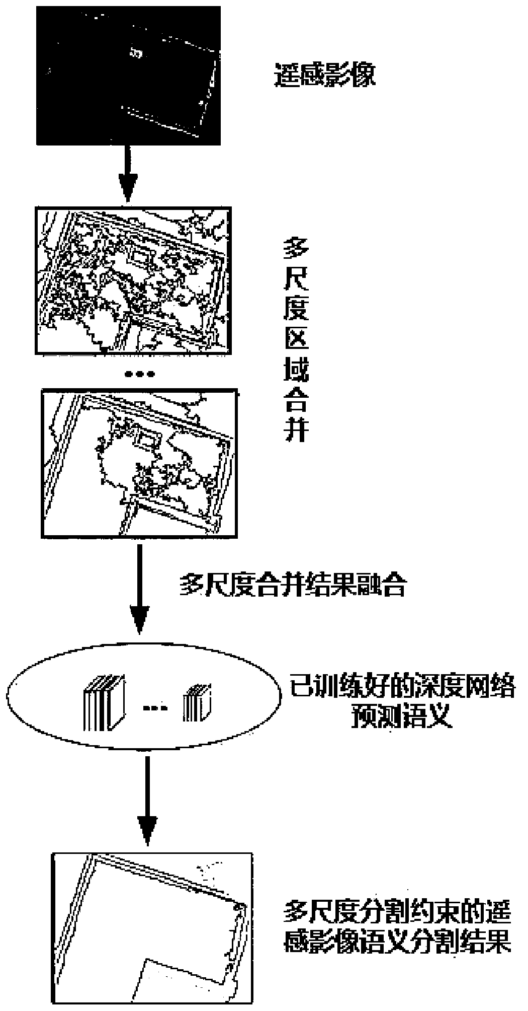
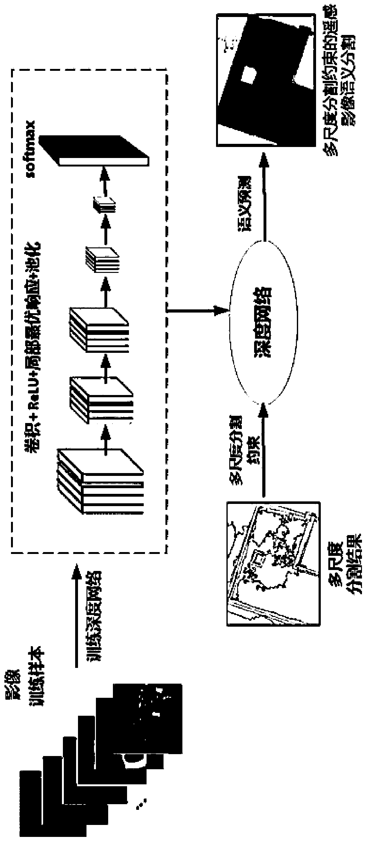
[0034] Such as figure 1 As shown, it is a remote sensing image semantic segmentation method with multi-scale segmentation constraints involved in this embodiment, including the following steps:
[0035] Step A. The scale of the same object in remote sensing images of different resolutions will also change. Therefore, when setting scale parameters for multi-scale segmentation, it is necessary to set appropriate scale parameters for remote sensing images of different resolutions based on past experience. Including start scale, end scale, and scale interval. The starting scale generally starts from scale 10, and if the size of the ground objects in the image is large, you can start from a larger scale. The termination scale is set reasonably based on the largest feature in the image. The scale interval is generally set to 10. Then set the segmentation parameters used to measure regional homogeneity for region merging, mainly including spectral factor and shape factor, and the ...
PUM
 Abstract
Description
Claims
Application Information
 - R&D
- Intellectual Property
- Life Sciences
- Materials
- Tech Scout
- Unparalleled Data Quality
- Higher Quality Content
- 60% Fewer Hallucinations
Browse by: Latest US Patents, China's latest patents, Technical Efficacy Thesaurus, Application Domain, Technology Topic, Popular Technical Reports.
© 2025 PatSnap. All rights reserved.Legal|Privacy policy|Modern Slavery Act Transparency Statement|Sitemap|About US| Contact US: help@patsnap.com


