Method for determining comprehensive reclamation utilization direction of coal mine temporary construction land
A technology for construction land and determination methods, applied in data processing applications, instruments, predictions, etc., can solve problems such as lack of data system evaluation, low public satisfaction, and lack of
- Summary
- Abstract
- Description
- Claims
- Application Information
AI Technical Summary
Problems solved by technology
Method used
Image
Examples
Embodiment Construction
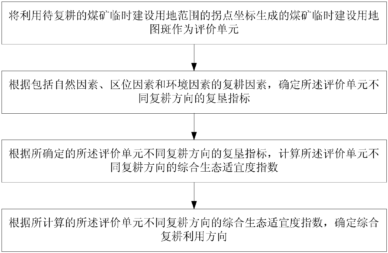
[0032] figure 1 It shows a method for determining the direction of comprehensive reclamation and utilization of temporary coal mine construction land of the present invention, such as figure 1 As shown, a method for determining the direction of comprehensive reclamation and utilization of temporary coal mine construction land of the present invention comprises:
[0033] The map spot for temporary construction of coal mine generated by using the inflection point coordinates of the temporary construction land of coal mine to be reclaimed is taken as the evaluation unit;
[0034] According to the reclamation factors including natural factors, location factors and environmental factors, determine the reclamation indicators for different reclamation directions of the evaluation unit;
[0035] According to the determined reclamation indicators of different reclamation directions of the evaluation unit, calculate the comprehensive ecological suitability index of the different reclam...
PUM
 Abstract
Description
Claims
Application Information
 - R&D
- Intellectual Property
- Life Sciences
- Materials
- Tech Scout
- Unparalleled Data Quality
- Higher Quality Content
- 60% Fewer Hallucinations
Browse by: Latest US Patents, China's latest patents, Technical Efficacy Thesaurus, Application Domain, Technology Topic, Popular Technical Reports.
© 2025 PatSnap. All rights reserved.Legal|Privacy policy|Modern Slavery Act Transparency Statement|Sitemap|About US| Contact US: help@patsnap.com


