Multi-view remote sensing image stereo reconstruction method based on disparity maps and key points
A remote sensing image and three-dimensional reconstruction technology, which is applied in image data processing, character and pattern recognition, 3D modeling, etc., can solve problems such as poor calculation reliability, inability to adapt to reconstruction requirements, and poor image quality, so as to improve accuracy Effect
- Summary
- Abstract
- Description
- Claims
- Application Information
AI Technical Summary
Problems solved by technology
Method used
Image

Examples
Embodiment Construction
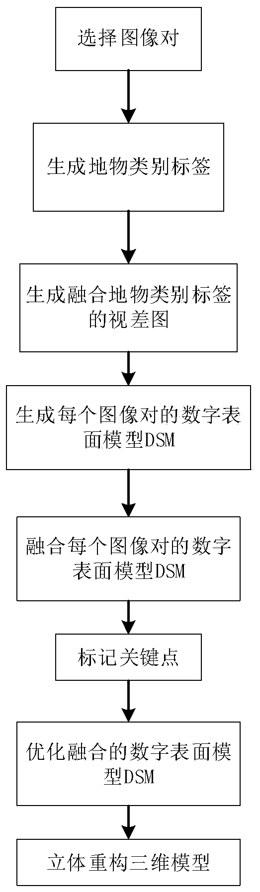
[0048] The present invention will be described in further detail below in conjunction with the accompanying drawings.
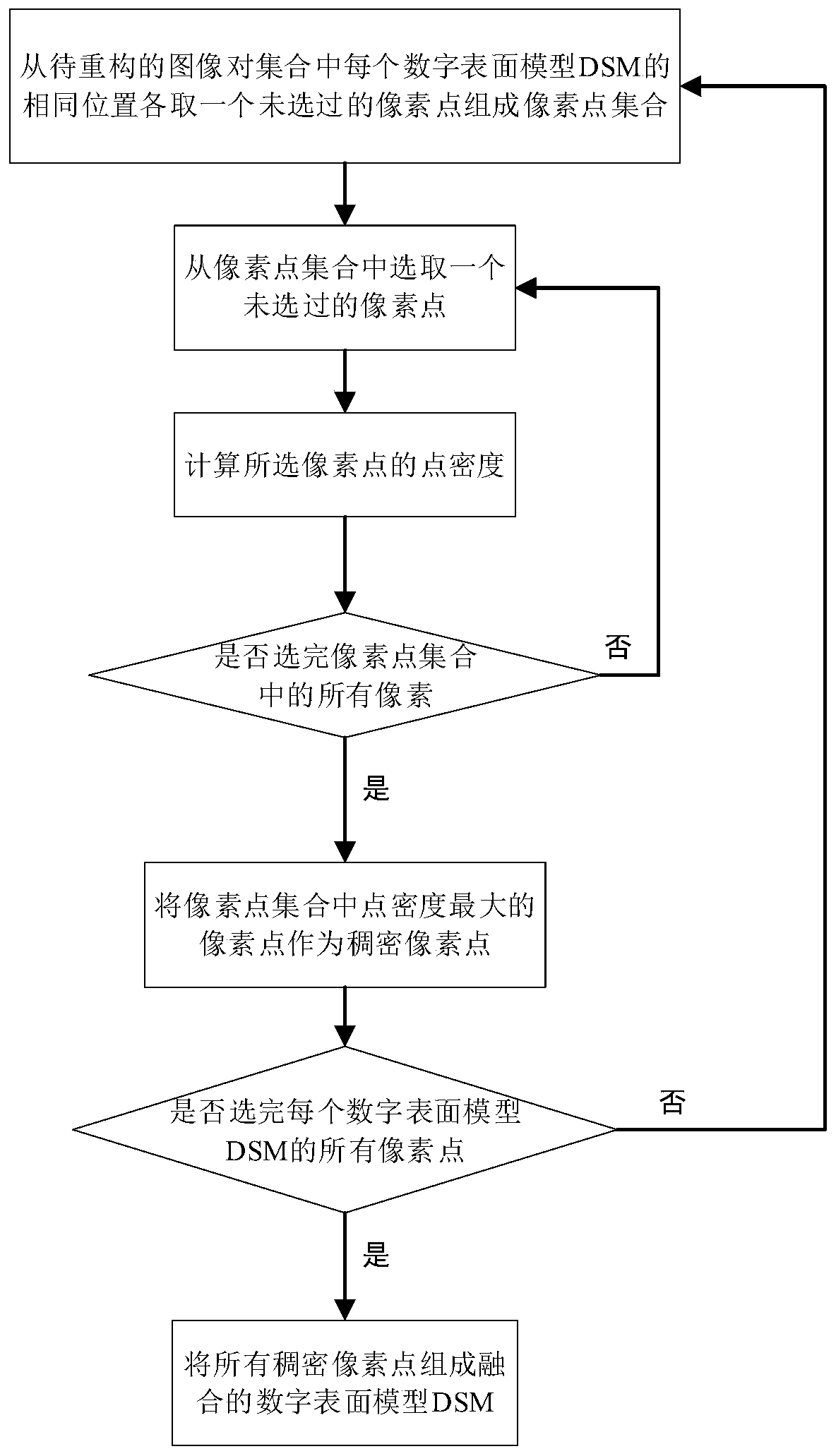
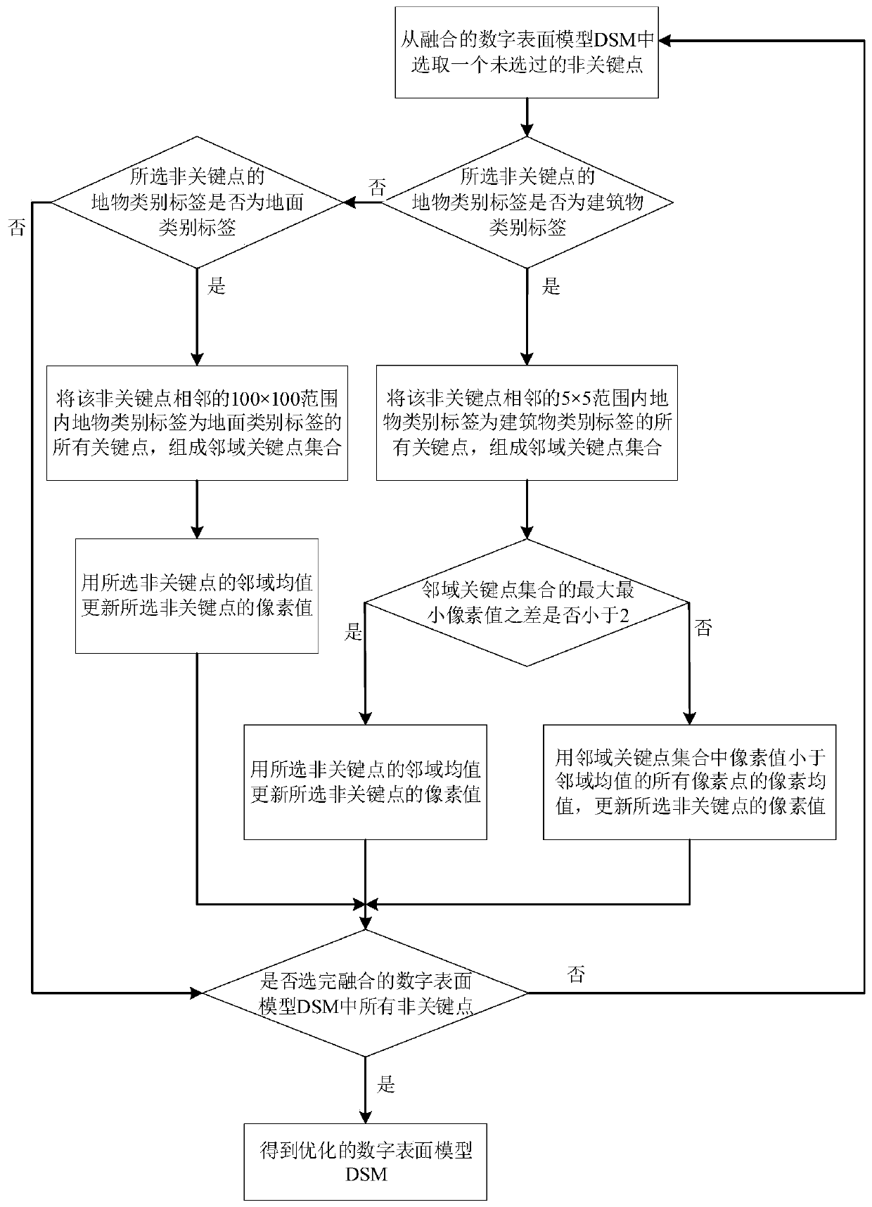
[0049] Refer to attached figure 1 , the steps of the present invention are further described in detail.
[0050] Step 1, select image pairs.
[0051] Input at least 10 images taken by the same satellite in the same area, and each image is combined with other images to form an image pair. Each image in each image pair includes roads, viaducts, buildings, vegetation and ground features Both objects also contain header information.
[0052] The header information includes the normalized focal length of the satellite camera corresponding to the input image, the position of the optical center when the input image is captured, the deflection angle of satellite shooting, and the time of satellite shooting.
[0053] From all the image pairs, select the image pairs with the difference between the satellite shooting deflection angle greater than 5° and less than 45°...
PUM
 Abstract
Description
Claims
Application Information
 - R&D Engineer
- R&D Manager
- IP Professional
- Industry Leading Data Capabilities
- Powerful AI technology
- Patent DNA Extraction
Browse by: Latest US Patents, China's latest patents, Technical Efficacy Thesaurus, Application Domain, Technology Topic.
© 2024 PatSnap. All rights reserved.Legal|Privacy policy|Modern Slavery Act Transparency Statement|Sitemap