Bird investigation method and device

A bird and location point technology, applied in the field of bird ecology research, can solve problems such as positioning or survey data errors, deviation of research results, and inability to measure the distance between birds and roads, so as to improve quality and accuracy and reduce work Effects of Strength and Safety Risk

Active Publication Date: 2019-11-19
RES INST OF FORESTRY NEW TECH CHINESE ACAD OF FORESTRY +1
View PDF7 Cites 2 Cited by
  • Summary
  • Abstract
  • Description
  • Claims
  • Application Information

AI Technical Summary

Problems solved by technology

[0003] In order to overcome at least to a certain extent the distance between birds and man-made disturbance sources such as roads and residential areas, which cannot be measured by traditional positioning methods, it can only be estimated by investigators based on experien

Method used


Image

  • Bird investigation method and device
  • Bird investigation method and device
  • Bird investigation method and device

Examples


Example Embodiment

[0052] The present invention will be described in detail below with reference to the drawings and embodiments.

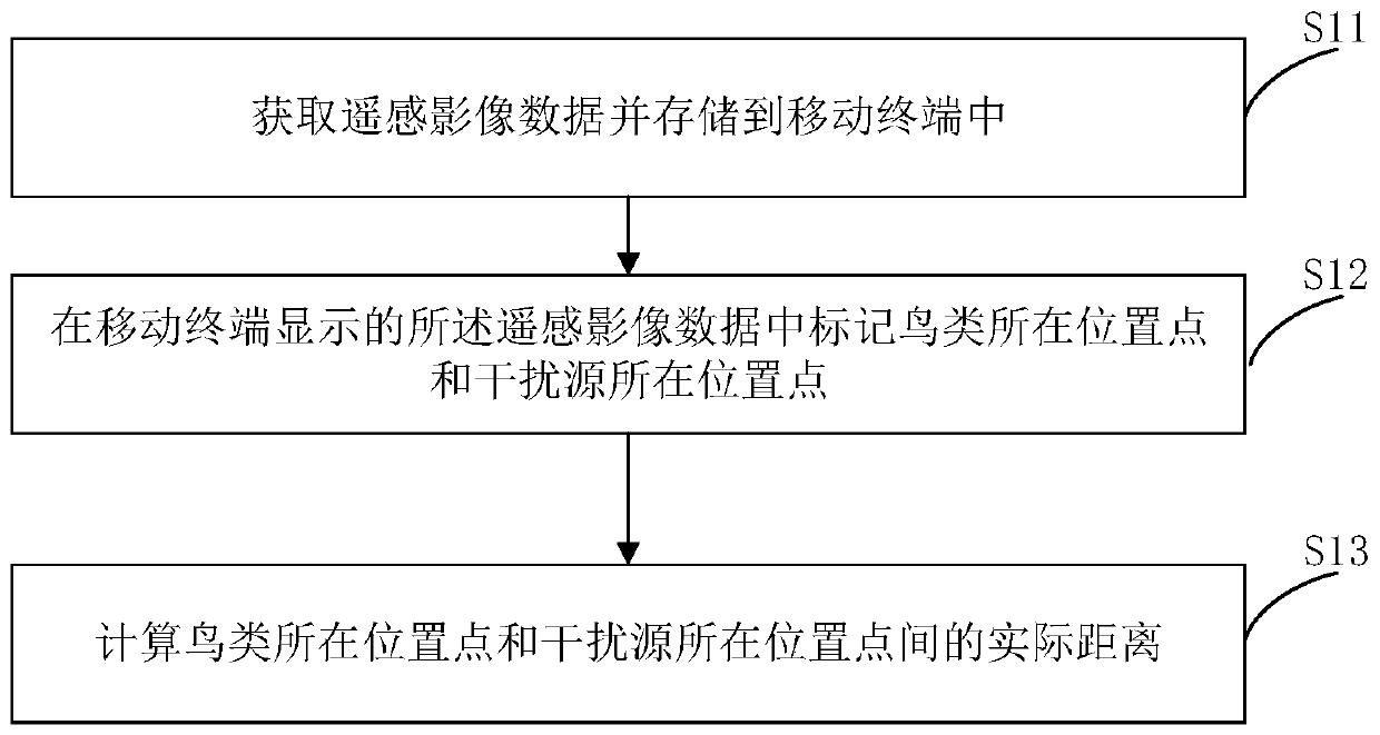
[0053] figure 1 It is a flowchart of a bird survey method provided by an embodiment of this application.

[0054] Such as figure 1 As shown, the bird survey method provided in this embodiment includes:

[0055] S11: Obtain remote sensing image data and store it in the mobile terminal;

[0056] S12: Mark the location of the birds and the location of the interference source in the remote sensing image data displayed by the mobile terminal;

[0057] S13: Calculate the actual distance between the location of the birds and the location of the interference source.

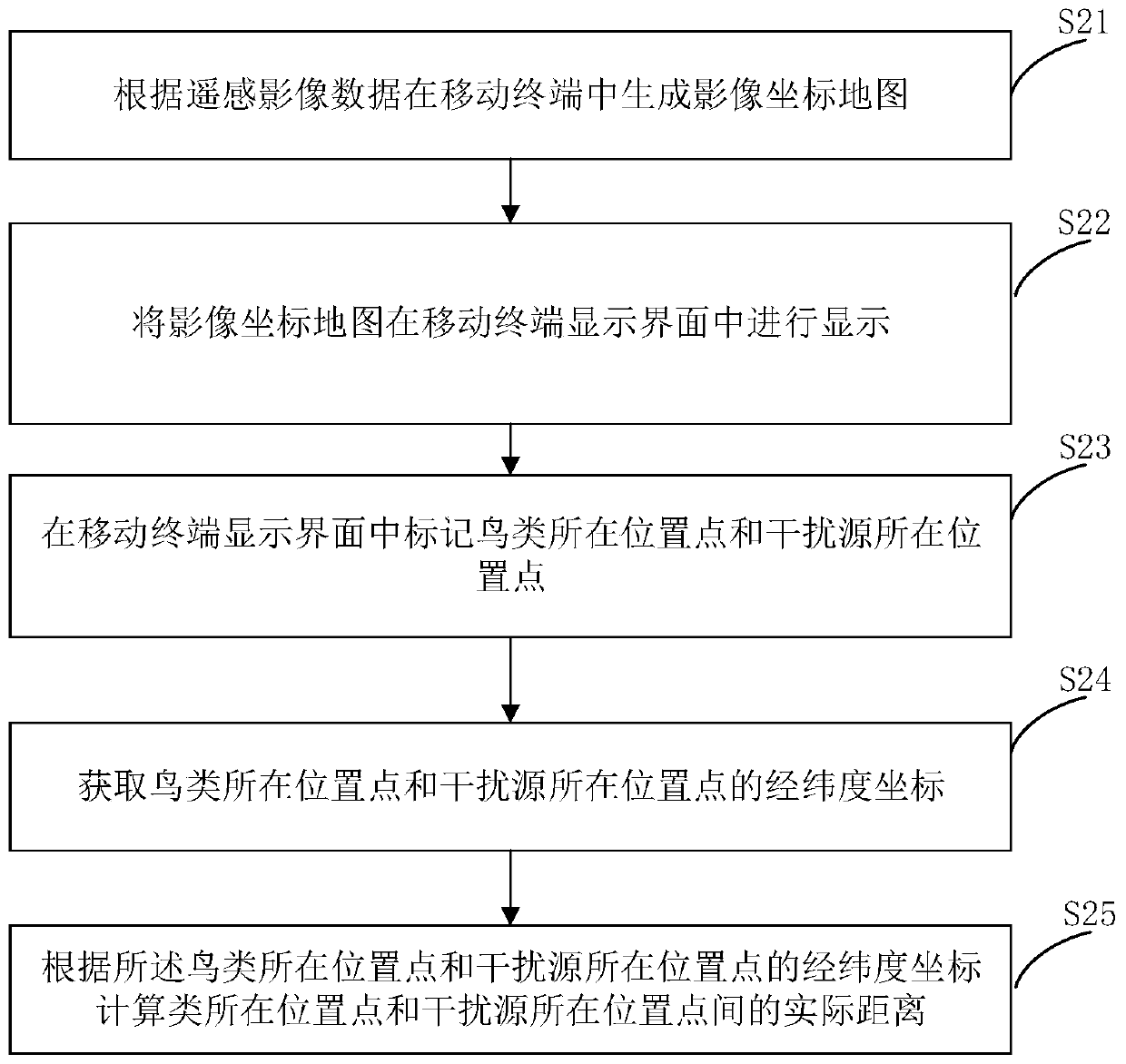
[0058] The traditional bird survey method is to locate the bird’s position by GPS. When surveying the bird’s position, the investigator needs to hold a mobile terminal and slowly approach the bird to prepare for the location. Although this survey method can obtain the bird However, since most of the investigators can on...


PUM


Abstract

The invention relates to a bird investigation method and device. The bird investigation method comprises the steps of obtaining remote sensing image data and storing the remote sensing image data in amobile terminal; marking the position point of the bird and the position point of the interference source in the remote sensing image data displayed by the mobile terminal; and calculating the actualdistance between the position point of the bird and the position point of the interference source. According to the invention, the distance between birds and human interference sources such as roadsand residential areas can be accurately measured, the investigator can accurately understand and know the survival condition of the species, the investigator does not need to reach the bird living site, the working intensity and safety risk of the investigator are reduced, interference to birds is avoided, and the quality and accuracy of wetland waterfowl investigation and monitoring results are remarkably improved.

Description

Technical field [0001] This application relates to the technical field of bird ecology research, especially a bird survey method and device. Background technique [0002] Investigation and monitoring are the main ways to understand the dynamics and management of species populations, as well as the daily work of various protected areas, national parks and other protected areas. Using sample lines and sample points to conduct ground surveys is a conventional method for bird resource surveys. The sample line method means that the observer travels along the sample line at a certain speed while recording the individual birds found on both sides of the sample line (including what they see and hear). The spot method means that the observer stays at a predetermined interval selected in advance for 5-10 minutes, and counts the birds found in a certain range around it. When using the sample line or sample point method to conduct bird surveys, it is necessary to locate the bird's position....

Claims


Application Information

Patent Timeline
IPC IPC(8): G06K9/00G06T7/73
CPCG06T7/73G06T2207/10032G06T2207/30181G06V20/13
Inventor 龚明昊文菀玉王汉维陈卓鹰
Owner RES INST OF FORESTRY NEW TECH CHINESE ACAD OF FORESTRY
Why Eureka
Try Eureka