Map GIS data processing and storage method and device and readable storage medium

A data processing and map technology, applied in special data processing applications, geographic information databases, still image data retrieval, etc., can solve the problems of difficult updating and large storage space, and achieve the solution of difficult updating, large storage space and small demand. Effect

Active Publication Date: 2019-12-17
四川易利数字城市科技有限公司
View PDF11 Cites 2 Cited by
  • Summary
  • Abstract
  • Description
  • Claims
  • Application Information

AI Technical Summary

Problems solved by technology

[0003] Today, when geospatial data is updated frequently, once an update is required, all two-dimensional spatial data needs to be re-rasterized and sliced, making it difficult to update
In addition, rasterized slice content is actually stored in png or jpg format, which requires a large amount of storage space, especially when generating different styles of rasterized sliced ​​map services for the same set of geographic information system data, a large amount of disk storage space is required for storage Rasterize slices

Method used


Image

  • Map GIS data processing and storage method and device and readable storage medium
  • Map GIS data processing and storage method and device and readable storage medium
  • Map GIS data processing and storage method and device and readable storage medium

Examples


Embodiment Construction

[0047] The specific embodiments of the present invention will be described in detail below in conjunction with the accompanying drawings, so that those skilled in the art can understand the present invention. However, it should be clear that the embodiments described below are only some, not all, embodiments of the present invention. Without departing from the spirit and scope of the present invention defined and determined by the appended claims, all other embodiments obtained by persons of ordinary skill in the art without any creative effort shall fall within the protection scope of the present invention.

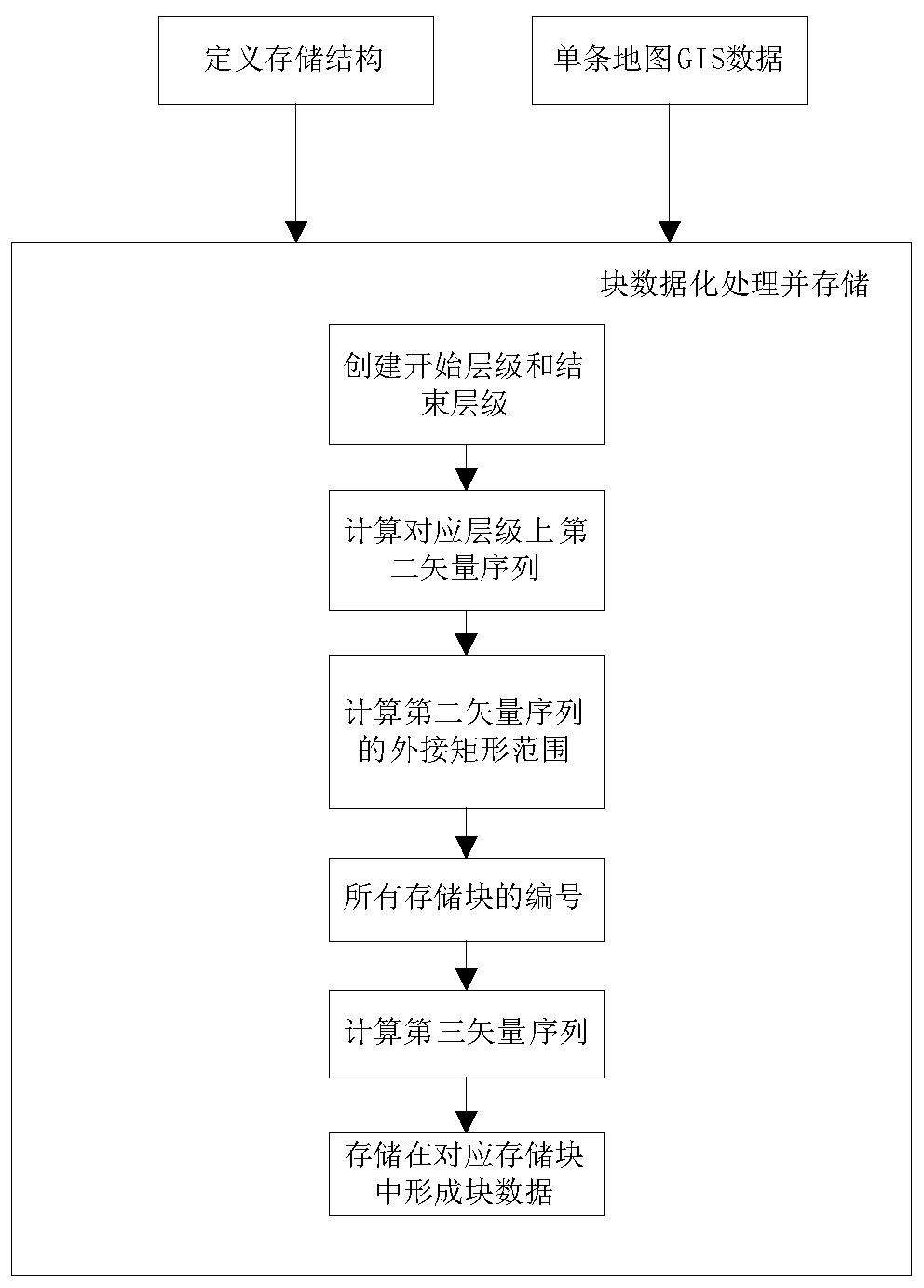
[0048] A method for processing and storing map GIS data is provided, which includes:

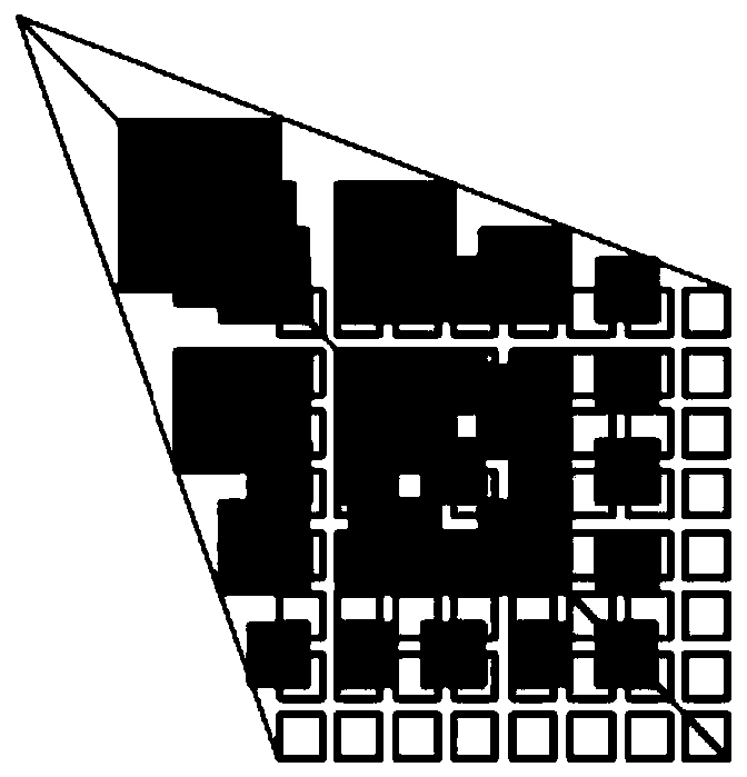
[0049] Define the storage structure according to the quadtree hierarchical subdivision structure to obtain a number of storage blocks of the sorted hierarchical structure, and the display resolutions corresponding to all storage blocks are the same set value;

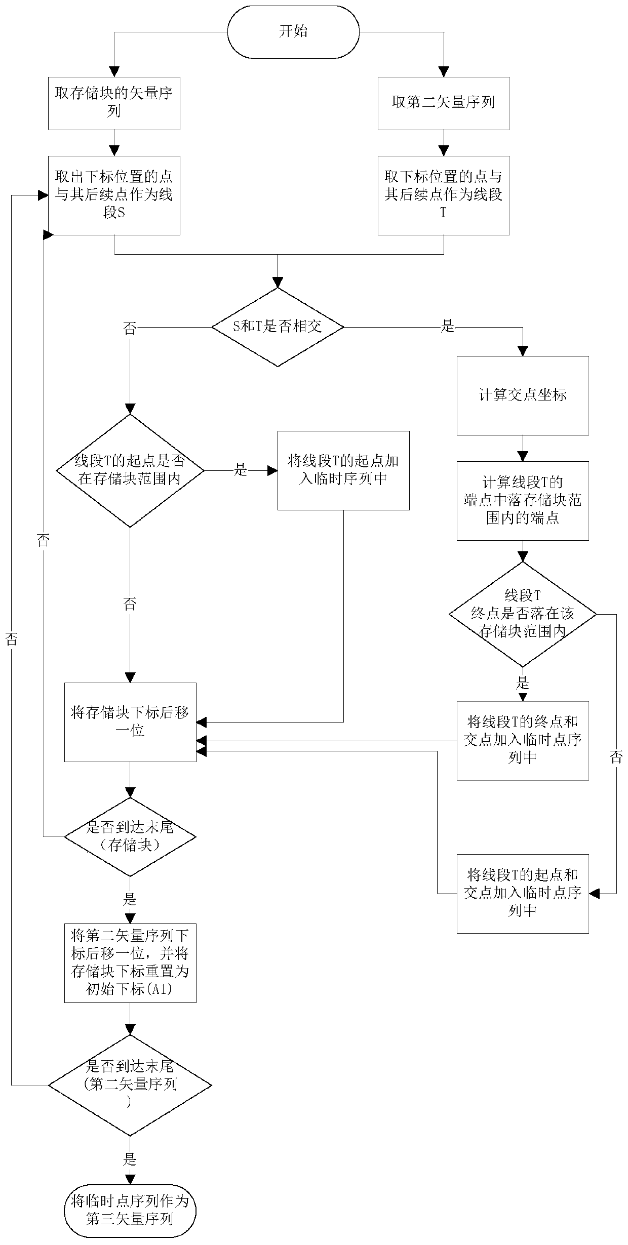
[0050] Receive map GIS ...


PUM


Abstract

The invention discloses a map GIS data processing and storage method and device, a computer readable storage medium, a two-dimensional image display method and a block data calling method formed by the method designed by the scheme, and belongs to the field of data processing and storage. The map GIS data processing and storage method comprises the following steps: defining a storage structure according to a quadtree hierarchical subdivision structure to obtain a plurality of storage blocks of a sorting hierarchical structure, wherein the display resolutions corresponding to all the storage blocks are the same set value; receiving map GIS data, independently performing block datamation processing on each piece of map GIS data, and storing the map GIS data into a corresponding storage blockto form block data, wherein each piece of map GIS data comprises a primitive type, a first vector sequence, a unique data type number and a unique record number.

Description

technical field [0001] The present invention relates to the field of data processing and storage, in particular to a method and device for processing and storing map GIS data, a computer-readable storage medium, a two-dimensional image display method, and a calling method for block data formed by the method designed in this scheme. Background technique [0002] When the two-dimensional spatial map data is displayed, in order to speed up the query speed of the data, the data to be displayed will be stored as a picture in advance. This kind of picture is called a rasterized slice. The rasterized tiles of the are returned, reducing the frequency of reading the map data. [0003] Today, when geospatial data is frequently updated, once an update is required, all two-dimensional spatial data needs to be re-rasterized and sliced, making it difficult to update. In addition, rasterized slice content is actually stored in png or jpg format, which requires a large amount of storage sp...

Claims


Application Information

Patent Timeline
IPC IPC(8): G06F16/29G06F16/51
CPCG06F16/29G06F16/51
Inventor 杨斌彭真洪睿
Owner 四川易利数字城市科技有限公司
Why Eureka
Try Eureka