Unmanned aerial vehicle for aerial mapping and use method thereof

A drone and aviation technology, applied in the field of surveying and mapping precision equipment, can solve the problems of increasing the assembly burden of staff and the inconvenience of drone launching, and achieve the effect of simple assembly, lightening assembly work, and ensuring elastic potential energy

Active Publication Date: 2020-01-31
苏州华瑞测绘有限公司
View PDF10 Cites 4 Cited by
  • Summary
  • Abstract
  • Description
  • Claims
  • Application Information

AI Technical Summary

Problems solved by technology

[0005] Although the above-mentioned technical solution can realize the catapult launch of the UAV, it needs

Method used


Image

  • Unmanned aerial vehicle for aerial mapping and use method thereof
  • Unmanned aerial vehicle for aerial mapping and use method thereof
  • Unmanned aerial vehicle for aerial mapping and use method thereof

Examples


Embodiment 1

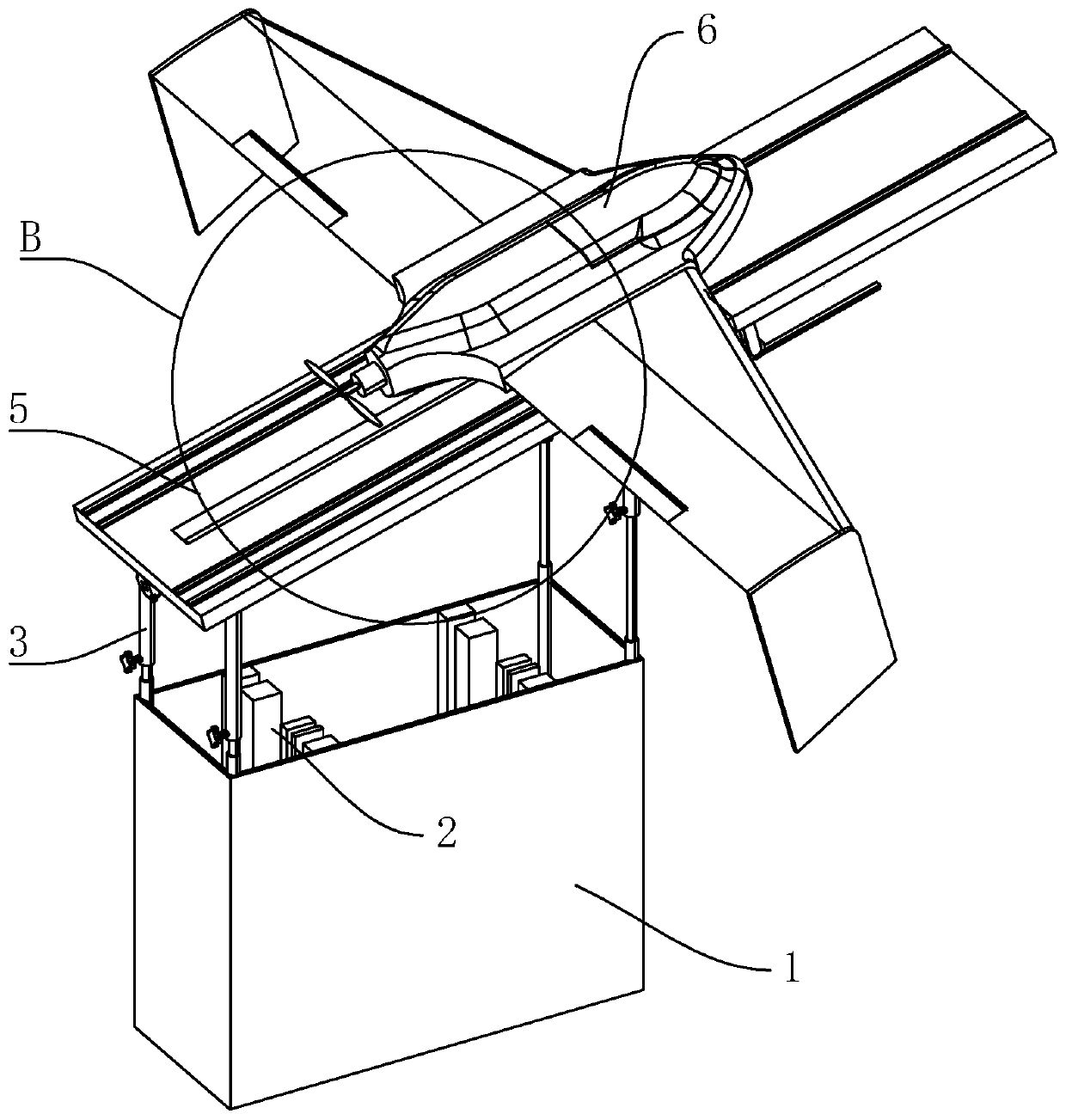
[0050] Embodiment one: a kind of unmanned aerial vehicle for aerial surveying and mapping, such as figure 1 As shown, it includes a placement box 1, and a placement partition 2 is arranged in the placement box 1. During transportation, the drone body 6 and other components can be placed in the placement box 1, which is convenient to carry.

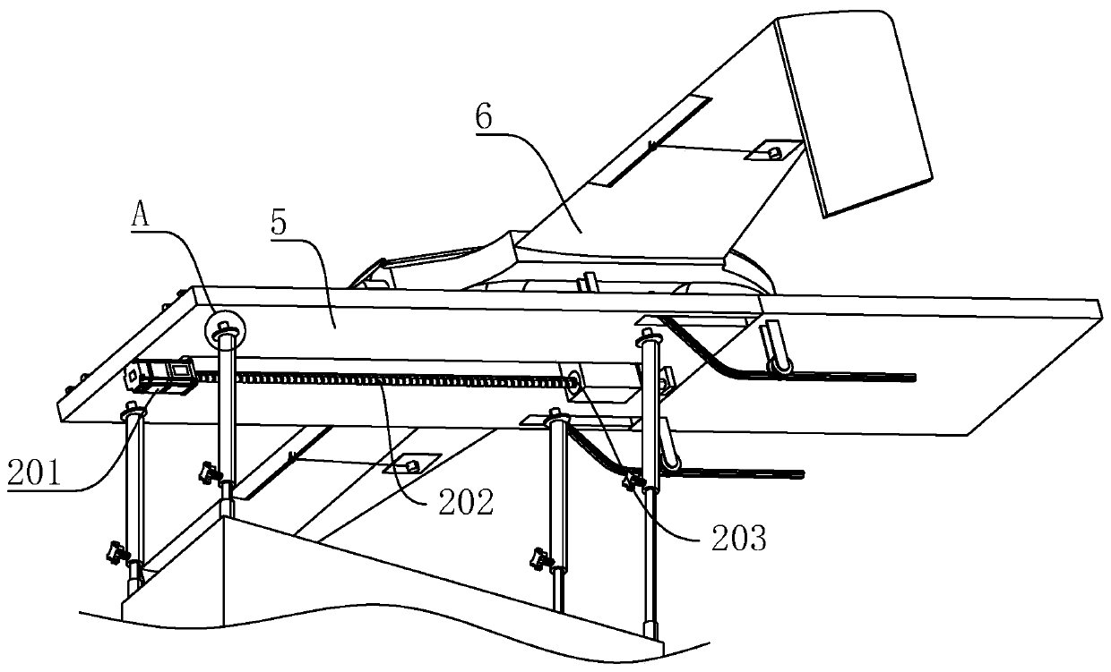
[0051] Such as figure 1 As shown, four fixed rods 3 are movably plugged into the upper end surface of the box body 1. The fixed rods 3 are set as telescopic rods, and the length of the fixed rods 3 can be adjusted according to the launch angle. The first ejection rods are placed on the four fixed rods 3. platform5.

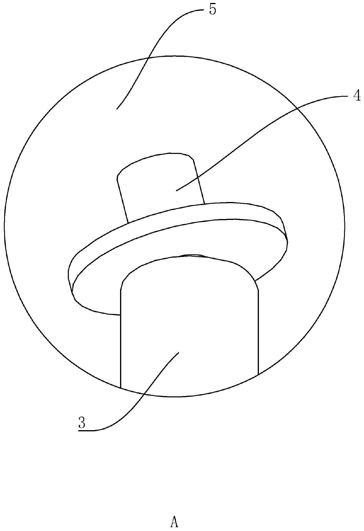
[0052] Such as figure 2 and image 3 As shown, the upper end of the fixed rod 3 is ball-connected with the first connecting rod 4, and the lower end of the first ejection platform 5 is provided with an insertion groove that is plugged and matched with the first connecting rod 4, and the first ejection platform 5 can be con...


PUM


Abstract

The invention relates to an unmanned aerial vehicle for aerial mapping and a use method thereof. The unmanned aerial vehicle comprises a placement box body. Four fixed rods are movably inserted in theupper end face of the placement box body. The upper ends of the four fixed rods are detachably connected with a first ejection platform. An unmanned aerial vehicle body is placed on the first ejection platform. The lower end of the unmanned aerial vehicle body is connected with guide wheels and an ejection limiting plate. The first ejection platform is provided with first guide rails and connected with an elastic string. The first ejection platform is provided with a slide groove. A slider is slidingly connected into the slide groove and provided with an ejection release block. When the unmanned aerial vehicle is launched, the ejection platform can be directly established at the upper end of the placement box body, the first ejection platform is placed on the four fixed rods, then the unmanned aerial vehicle is placed on the first ejection platform, carrying and assembling are more convenient, assembling is simple, and the assembling work of workers is relieved.

Description

technical field [0001] The invention relates to the technical field of surveying and mapping precision equipment, in particular to an unmanned aerial vehicle used for aerial surveying and mapping and its usage method. Background technique [0002] UAV aerial survey is a powerful supplement to traditional aerial photogrammetry. It has the characteristics of flexible maneuverability, high efficiency and speed, precision and accuracy, low operating cost, wide application range, and short production cycle. Obtaining has obvious advantages. With the development of UAV and digital camera technology, digital aerial photography technology based on UAV platform has shown its unique advantages. The combination of UAV and aerial photogrammetry makes "UAV "Digital low-altitude remote sensing" has become a new development direction in the field of aerial remote sensing. UAV aerial photography can be widely used in major national project construction, disaster emergency response and treat...

Claims


Application Information

Patent Timeline
IPC IPC(8): B64F1/06
CPCB64F1/06B64U70/70
Inventor 张善文张曾金胜哲唐磊许晓显
Owner 苏州华瑞测绘有限公司
Why Eureka
Try Eureka