Method and device for controlling GPS satellite searching in Android system

A control method and GPS positioning technology, which are applied in the directions of measurement devices, radio wave measurement systems, satellite radio beacon positioning systems, etc., can solve problems such as high power consumption of terminals, and achieve the effect of reducing power consumption and reducing the time for turning on GPS.

Pending Publication Date: 2020-07-03
CHENGDU TD TECH LTD
View PDF23 Cites 0 Cited by
  • Summary
  • Abstract
  • Description
  • Claims
  • Application Information

AI Technical Summary

Problems solved by technology

[0009] In this processing method, as long as the terminal turns on GPS, since the GPS will update the positioning information once per se

Method used


Image

  • Method and device for controlling GPS satellite searching in Android system
  • Method and device for controlling GPS satellite searching in Android system
  • Method and device for controlling GPS satellite searching in Android system

Examples


Embodiment Construction

[0038] In order to make the purpose, technical means and advantages of the present application clearer, the present application will be further described in detail below in conjunction with the accompanying drawings.

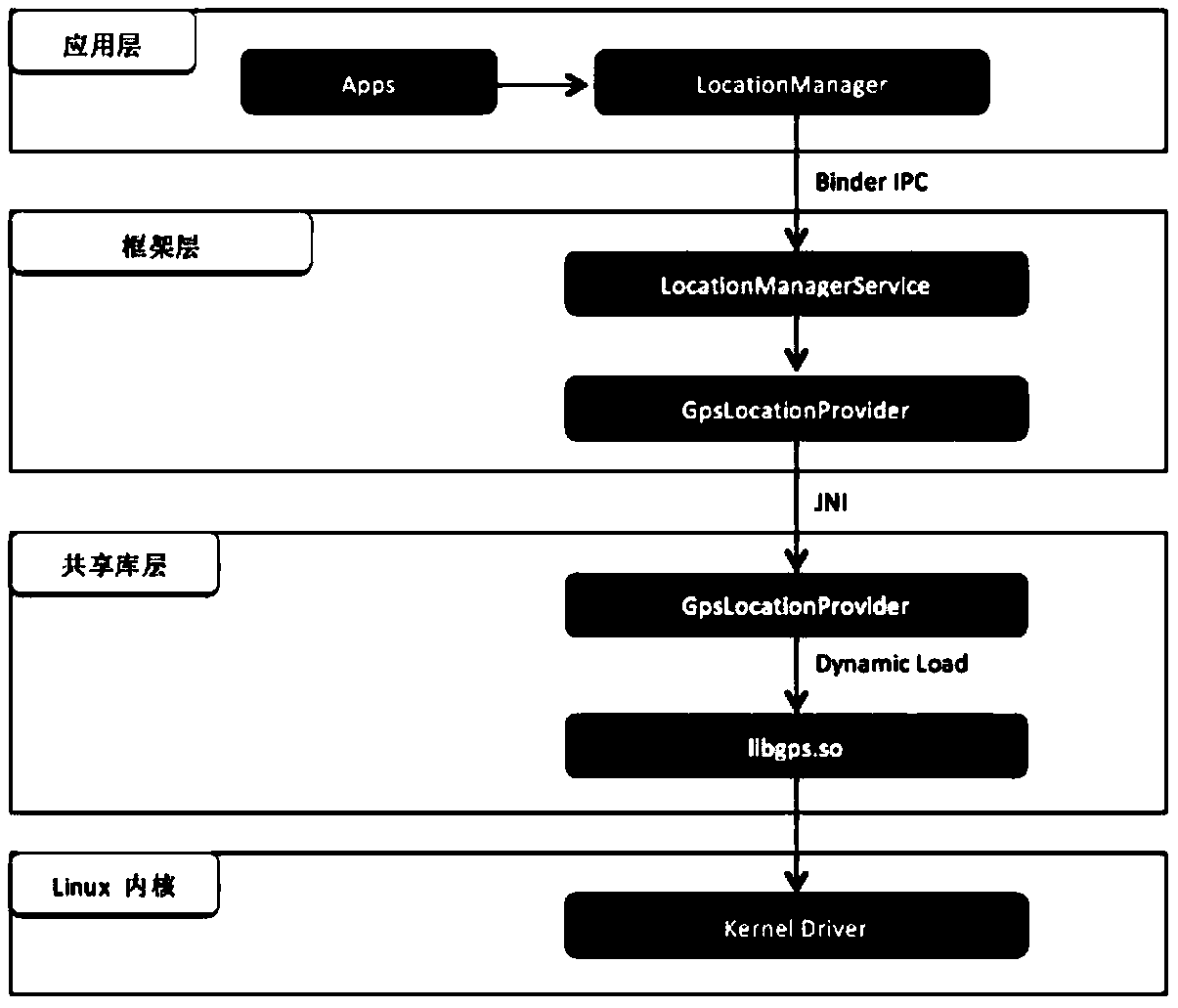
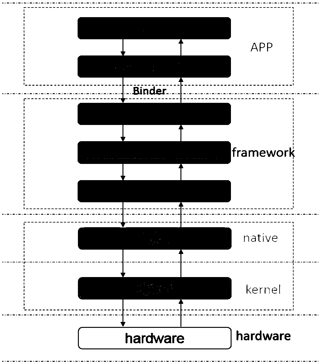
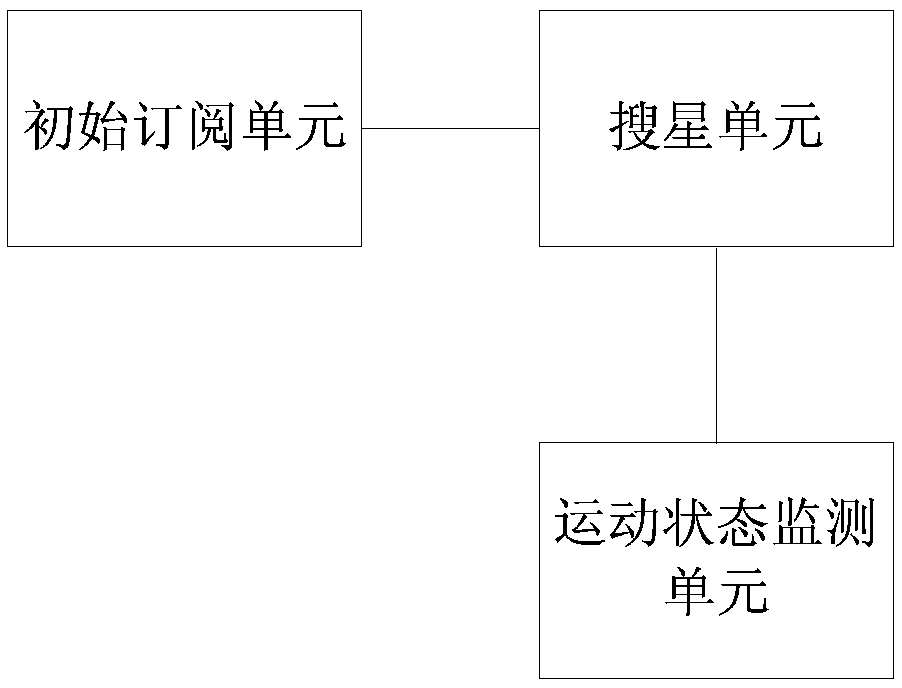
[0039] This application introduces the processing of terminal motion state monitoring, and turns on or off GPS satellite search according to the monitoring results, thereby reducing the power consumption of the terminal.

[0040] The control method of GPS star search in this application specifically includes:

[0041] 1. When the application layer business subscribes to GIS for the first time, start GPS search;

[0042] Specifically, when subscribing to GIS for the first time, regardless of whether the current terminal's motion state is stationary or moving, GPS search needs to be turned on for satellite search and positioning processing;

[0043] 2. Monitor the motion status of the terminal, and turn on or off the GPS search star according to the monitoring re...


PUM


Abstract

The invention discloses a method for controlling GPS satellite searching in an Android system. The method comprises the following steps: starting GPS satellite searching when an application layer business subscribes a GIS for the first time; monitoring the motion state of a terminal, turning off the GPS and storing the latest GPS positioning result when the terminal is changed from the motion state to the static state and the satellite searching processing which is not overtime is not executed at present; when the terminal is converted into the motion state from the static state, starting GPSsatellite searching; in the GPS closed state, when the GPS distance parameter of the service is not zero, enabling the GPS positioning result to be not reported to the service; and when the GPS distance parameter of the service is 0, reporting the stored latest GPS positioning result to the service at the reporting time limited by the GPS period parameter of the service. The method can reduce thepower consumption of the terminal.

Description

technical field [0001] The present application relates to the terminal technology in the communication system, in particular to a control method and device for GPS satellite search in the Android system. Background technique [0002] A system that uses GPS positioning satellites to perform real-time positioning and navigation around the world is called the global satellite positioning system, or GPS for short. GPS can provide functions such as vehicle positioning, anti-theft, anti-robbery, driving route monitoring and call command. After the GPS chip is installed on the terminal, the real-time location information of the terminal can be obtained through the GPS system. Searching for satellites is a prerequisite for GPS positioning. If you cannot search for satellites smoothly, GPS will not work properly. [0003] When the original Android system collects GPS data, the framework is as follows: figure 1 Shown: [0004] The top is the application layer (AP), that is, the co...

Claims


Application Information

Patent Timeline
IPC IPC(8): G01S19/28
CPCG01S19/28
Inventor 王征牟伦荣
Owner CHENGDU TD TECH LTD
Why Eureka
Try Eureka