Remote sensing image quality definition comprehensive evaluation module and evaluation method
A technology for image clarity and comprehensive evaluation, applied in the field of remote sensing image processing, can solve problems such as inability to evaluate the results to determine whether the image is good or bad
- Summary
- Abstract
- Description
- Claims
- Application Information
AI Technical Summary
Problems solved by technology
Method used
Image

Examples
Embodiment Construction
[0100] In order to make the object, technical solution and advantages of the present invention clearer, the present invention will be further described in detail below in combination with specific embodiments and with reference to the accompanying drawings. It should be understood that these descriptions are exemplary only, and are not intended to limit the scope of the present invention. Also, in the following description, descriptions of well-known structures and techniques are omitted to avoid unnecessarily obscuring the concept of the present invention.
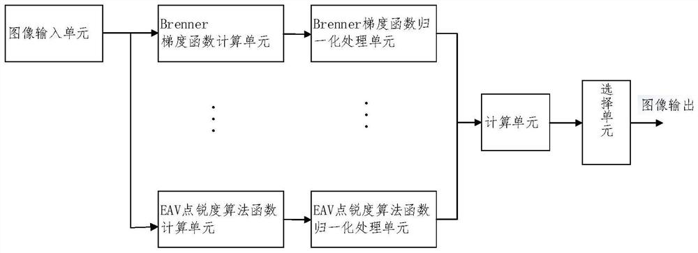
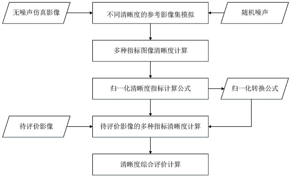
[0101] One aspect of the present invention provides a remote sensing image quality evaluation module, which evaluates the clarity of the image, and according to the clarity of the image, for the same target, there are multiple imaging images at different times for the remote sensing payload, and the one with the highest imaging quality, that is, the highest definition is selected An output of an image that improves the qu...
PUM
 Abstract
Description
Claims
Application Information
 - R&D
- Intellectual Property
- Life Sciences
- Materials
- Tech Scout
- Unparalleled Data Quality
- Higher Quality Content
- 60% Fewer Hallucinations
Browse by: Latest US Patents, China's latest patents, Technical Efficacy Thesaurus, Application Domain, Technology Topic, Popular Technical Reports.
© 2025 PatSnap. All rights reserved.Legal|Privacy policy|Modern Slavery Act Transparency Statement|Sitemap|About US| Contact US: help@patsnap.com