Data extraction and display method for three-dimensional ground penetrating radar

A technology for ground penetrating radar and data extraction, which is applied in image data processing, re-radiation, and 3D image processing, etc. It can solve the problems of lack of display means, lack, and deviation of ground penetrating radar data positioning and extraction.

Active Publication Date: 2020-12-25
深圳安德空间技术有限公司
View PDF13 Cites 3 Cited by
  • Summary
  • Abstract
  • Description
  • Claims
  • Application Information

AI Technical Summary

Problems solved by technology

At present, for the data interpretation results, although the processing software can output profile waveforms in various directions, how to intuitively reflect the shape, position, and direction of underground diseased bodies and buried objects for non-professionals to un

Method used


Image

  • Data extraction and display method for three-dimensional ground penetrating radar
  • Data extraction and display method for three-dimensional ground penetrating radar
  • Data extraction and display method for three-dimensional ground penetrating radar

Examples


Embodiment Construction

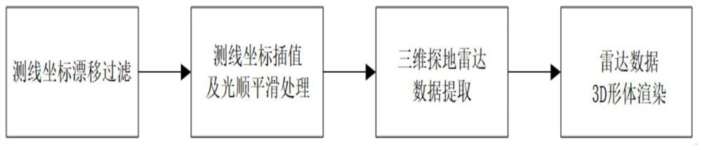
[0096]Seefigure 1 , The present invention provides a technical solution:

[0097]A data extraction and display method for 3D ground penetrating radar, including the following steps:

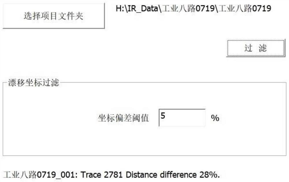
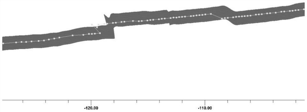
[0098]Step 1: Filter drift coordinates of survey line;

[0099]The implementation method of filtering drift coordinates is:

[0100]First, calculate the linear distance D between two adjacent coordinate points collected along the survey line1

[0101]Coordinate point P1And P2It is obtained through real-time dynamic difference equipment (RTK), using the geodetic coordinate system, the origin of the coordinate is in the center of the earth, and the WGS-84 reference ellipsoid is used as the datum plane, which is represented by the geodetic longitude L, the geodetic latitude B and the geodetic height H, namely WGS-84 latitude and longitude coordinates. Calculate P1And P2The distance between the two points needs to be converted from the geodetic coordinate system to the Gaussian projection plane coordinate system and obta...


PUM


Abstract

The invention relates to the technical field of ground penetrating radars, in particular to a data extraction and display method for a three-dimensional ground penetrating radar, and particularly relates to a method for data acquisition, extraction, correction and conversion of a three-dimensional ground penetrating radar array and three-dimensional display through volume rendering, which comprises the following steps of: 1, filtering drift coordinates of a survey line; 2, performing coordinate interpolation and fairing smoothing processing on the measuring line; 3, performing radar data extraction on the measuring line according to a specified position; and 4, carrying out three-dimensional volume rendering on the extracted radar data.

Description

Technical field[0001]The present invention relates to the technical field of ground penetrating radar, in particular to a data extraction and display method for three-dimensional ground penetrating radar.Background technique[0002]Ground Penetrating Radar (Ground Penetrating Radar), also known as geological radar, detects underground media by emitting high-frequency pulse electromagnetic waves (frequency between 1MHz-1GHz) and determines the distribution of underground media. It has simple operation, high detection accuracy, no damage, and acquisition. Fast speed and other characteristics are currently the most active detection technology for engineering inspection and reconnaissance, and its application in the detection of underground diseases on urban roads is becoming more and more extensive. Compared with the traditional two-dimensional radar with only one longitudinal and vertical profile waveform, the three-dimensional radar array uses real-time rapid sampling, seamlessly splic...

Claims


Application Information

Patent Timeline
IPC IPC(8): G06T15/08G01S7/41G01S13/86G01S13/88G01S13/89G01S19/43
CPCG06T15/08G01S13/885G01S13/89G01S13/86G01S19/43G01S7/418
Inventor 项芒
Owner 深圳安德空间技术有限公司
Why Eureka
Try Eureka