
Mobile equipment positioning method based on multi-sensor coupling

A mobile device and positioning method technology, applied in the field of image recognition, can solve the problems of the actual deployment of autonomous mobile robots, regardless of how to generate a map, etc. Effect

Active Publication Date: 2021-02-05
上海懒书智能科技有限公司
View PDF8 Cites 0 Cited by
  • Summary
  • Abstract
  • Description
  • Claims
  • Application Information

AI Technical Summary

Problems solved by technology

Method (3) only considers how to use the environment map or the generated position calibration table, but does not consider how to generate the map, which brings certain difficulties to the actual deployment of autonomous mobile robots using multi-sensor localization methods

Method used


Image

  • Mobile equipment positioning method based on multi-sensor coupling
  • Mobile equipment positioning method based on multi-sensor coupling
  • Mobile equipment positioning method based on multi-sensor coupling

Examples


Embodiment Construction

[0042]In order to make the purpose, technical solutions and advantages of the embodiments of the present invention clearer, the technical solutions in the embodiments of the present invention will be clearly and completely described below in conjunction with the drawings in the embodiments of the present invention. Obviously, the described embodiments It is a part of embodiments of the present invention, but not all embodiments. Based on the embodiments of the present invention, all other embodiments obtained by persons of ordinary skill in the art without making creative efforts belong to the protection scope of the present invention.

[0043] In the present invention, the term "frame" refers to the data currently acquired by the sensor, such as a picture taken by a camera, a scanned point cloud, a measured acceleration of gravity, and the like. Pose includes horizontal and vertical coordinates and angles, and can also include vertical coordinates and pitch and roll.

[0044...


PUM


Abstract

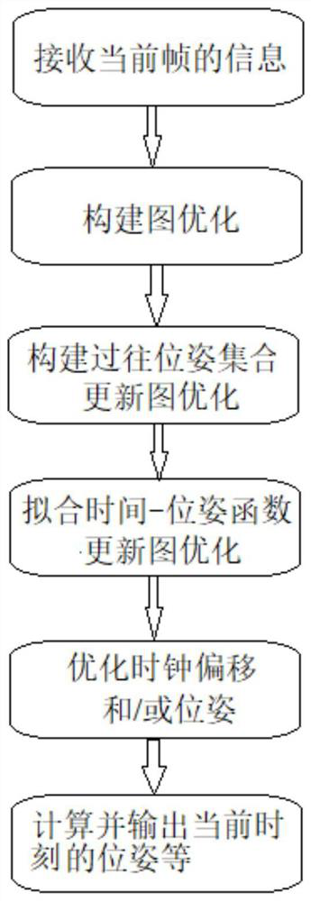
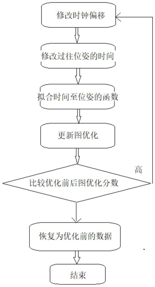
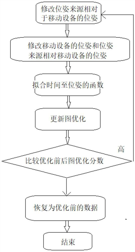
The invention relates to a mobile equipment positioning method based on multi-sensor coupling. The mobile equipment positioning method comprises the steps of: S1, receiving information of a current frame; S2, optimizing a generated graph; S3, correcting the time of the current frame according to the clock offset corresponding to a pose source, and calculating the pose of mobile equipment ; S4, storing the pose and the corresponding moment of the mobile equipment into a previous pose set of the mobile equipment, acquiring a function from the time to the pose of the mobile device, and solving toobtain a graph optimization score; S5, optimizing the clock skew and the pose; and S6, calculating and outputting the pose of the mobile device at the current moment, the clock offset corresponding to the category of the pose source or the pose of the pose source relative to the mobile equipment according to a time-to-pose function of the mobile equipment. According to the mobile equipment positioning method, accurate positioning can be carried out by integrating the poses output by the sensors and the action characteristics of the trolley, and the poses can be sent to an environment map optimization method, so that an environment map can be established or adjusted.

Description

technical field [0001] The invention relates to the technical field of image recognition, in particular to a positioning method for mobile devices based on multi-sensor coupling. Background technique [0002] Autonomous walking robots require stable and precise navigation methods. Since there are practical problems such as low precision and insufficient stability when using a single type of sensor, the method of using multiple sensors for positioning at the same time has received high attention. The common multi-sensor positioning method will combine the advantages and disadvantages of various sensors to combine a set of practical multi-sensor navigation methods. for example: [0003] (1) Use multiple fixed types of sensors, such as using a combination of lidar and IMU, using a combination of vision sensors and lidar, etc. [0004] (2) Coupling methods using multiple sensors of the same type at the same time, typical coupling methods such as binocular vision navigation, v...

Claims


Application Information

Patent Timeline
IPC IPC(8): G01C21/00G01C21/20
CPCG01C21/00G01C21/20
Inventor 刘诗聪
Owner 上海懒书智能科技有限公司
Learn More