Inter-band calibration method of optical remote sensing satellite
An optical remote sensing and satellite technology, applied in the field of aerospace, can solve the problems that no effective literature and works have been found yet
- Summary
- Abstract
- Description
- Claims
- Application Information
AI Technical Summary
Problems solved by technology
Method used
Image
Examples
Embodiment Construction
[0031] The present invention will be described in detail below based on specific embodiments and with reference to the accompanying drawings. It should be understood that the specific embodiments described here are only used to explain the present invention, not to limit the present invention.
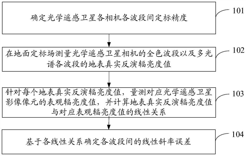
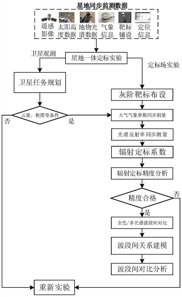
[0032] In the present invention, based on the synchronous measurement data of the optical remote sensing satellite-ground calibration field, the linear relationship between the real inversion radiance value and the apparent radiance value of the panchromatic band surface of the satellite camera is measured, and the real inversion radiance value of each band of the multi-spectrum is measured. It has a linear relationship with the apparent radiance value, and calculates the linear slope error between each band. The inter-band calibration reflects the ratio value relationship of the absolute calibration measurement results in different bands. Based on this concept, the inter-band calibrat...
PUM
 Abstract
Description
Claims
Application Information
 - R&D
- Intellectual Property
- Life Sciences
- Materials
- Tech Scout
- Unparalleled Data Quality
- Higher Quality Content
- 60% Fewer Hallucinations
Browse by: Latest US Patents, China's latest patents, Technical Efficacy Thesaurus, Application Domain, Technology Topic, Popular Technical Reports.
© 2025 PatSnap. All rights reserved.Legal|Privacy policy|Modern Slavery Act Transparency Statement|Sitemap|About US| Contact US: help@patsnap.com


