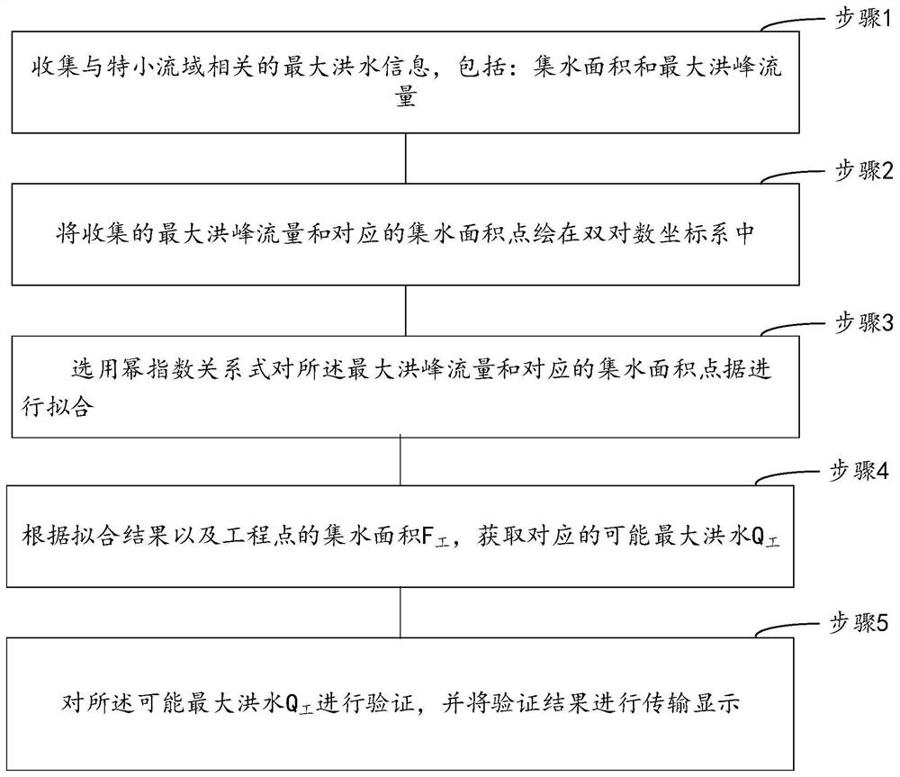
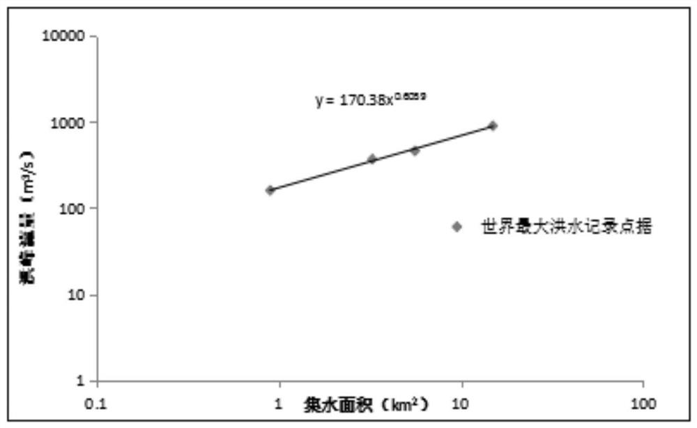
Possible maximum flood calculation method for extra-small watershed
A computing method and technology for small watersheds, applied in computing, complex mathematical operations, data processing applications, etc., can solve problems such as the difficulty in verifying the applicability of the inference formula method or the unit line method, and the high requirements for the professional ability of the calculator.
- Summary
- Abstract
- Description
- Claims
- Application Information
AI Technical Summary
Problems solved by technology
Method used
Image
Examples
Embodiment 3
[0079] The present invention provides a possible maximum flood calculation method, before fitting the maximum flood peak flow and the corresponding catchment area point data, it also includes:
[0080] Obtain the flow data field of the maximum peak flow and the point data field of the catchment area point data;
[0081] Merge the flow data field and the point data field to obtain a field set;
[0082] Traversing and scanning the fields in the field set based on the field set and the preset phrase width to obtain field phrases;
[0083] Obtain the bit number of the field phrase, and calculate the frequency of occurrence of the field phrase in the same bit number;
[0084] Simultaneously, select the phrase that described frequency is greater than preset frequency as key field phrase, and obtain the start bit and end bit of described key field phrase;
[0085] Based on the start bit and the end bit, the bit width of the key field phrase is obtained, and the bit width is average...
Embodiment 4
[0098] The present invention provides a possible maximum flood calculation method, for the possible maximum flood Q 工 The verification process includes:
[0099] Calculate the catchment area F 工 , and according to the catchment area F 工 Calculate the possible maximum flood Q 工 , and calculate the possible maximum flood Q for the 工 The accuracy of verification, the specific work process includes:
[0100] Extracting the water collection shape parameters of the engineering point, wherein the shape parameters include the water collection length, width, radian, concave degree value, and convex degree value of the engineering point;
[0101] According to the catchment shape parameter of the engineering point, calculate the catchment area F 工 ;
[0102]
[0103] Among them, F 工 Indicates the water collection area, γ represents the water collection concave degree value of the engineering point, δ represents the water collection convex degree value of the engineering point, c ...
Embodiment 5
[0122] Based on Example 1, in step 1, before collecting the possible maximum flood information related to the ultra-small watershed, it includes:
[0123] Get a collection of URLs that collect information on the largest possible floods associated with very small watersheds;
[0124] Perform a traversal search for each URL in the URL collection, and the filtering interface displays the first URL that has been accessed successfully;
[0125] At the same time, preprocessing is performed on each of the first URLs, and the second URLs are obtained by screening according to the preprocessing results;
[0126] Obtain interface information of a display interface corresponding to the second URL;
[0127] Obtaining the number of times the second website has been visited, the number of times it has been reported, and the user's evaluation information on the second website from the creation time to the current time;
[0128] inputting the interface information, the number of visits, the...
PUM
 Abstract
Description
Claims
Application Information
 - R&D
- Intellectual Property
- Life Sciences
- Materials
- Tech Scout
- Unparalleled Data Quality
- Higher Quality Content
- 60% Fewer Hallucinations
Browse by: Latest US Patents, China's latest patents, Technical Efficacy Thesaurus, Application Domain, Technology Topic, Popular Technical Reports.
© 2025 PatSnap. All rights reserved.Legal|Privacy policy|Modern Slavery Act Transparency Statement|Sitemap|About US| Contact US: help@patsnap.com


