Automatic ship route planning method based on adaptive triangulation network
A technology of automatic planning and triangulation, applied in navigation, mapping and navigation, navigation calculation tools, etc., can solve the problem of inability to take into account the rigor of results, calculation efficiency, errors, etc., and achieve the effect of shortening the time used
- Summary
- Abstract
- Description
- Claims
- Application Information
AI Technical Summary
Problems solved by technology
Method used
Image
Examples
Embodiment Construction
[0032] The technical solutions of the present invention will be further described below in conjunction with specific examples and accompanying drawings.
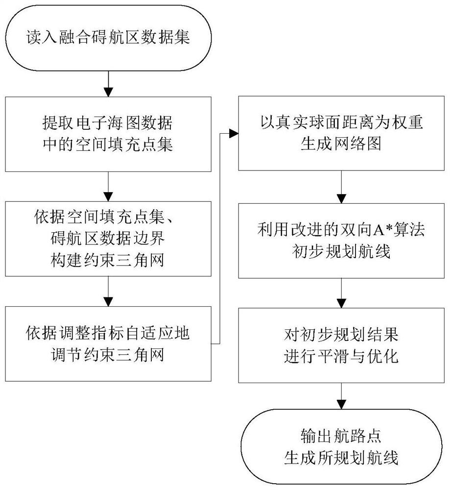
[0033] The automatic planning method of the ship route proposed by the present invention, the realization process is to use the computer to realize the efficient planning of the ship route based on the real marine geographic information data. The above method is used to carry out efficient automatic planning of routes, including the following steps, such as figure 1 Shown:
[0034] Step S1: According to the electronic chart data standard, analyze the electronic chart data required for navigation on the computer, and obtain the obstructive area data set O={o 1 ,o 2 ,o 3 ,...,o n}.
[0035] Step S2: According to the acquired electronic chart data, according to the actual navigation requirements, extract the space-filling point set P={p in the electronic chart data 1 ,p 2 ,p 3 ,...,pn}, reducing the dependence of the fr...
PUM
 Abstract
Description
Claims
Application Information
 - R&D
- Intellectual Property
- Life Sciences
- Materials
- Tech Scout
- Unparalleled Data Quality
- Higher Quality Content
- 60% Fewer Hallucinations
Browse by: Latest US Patents, China's latest patents, Technical Efficacy Thesaurus, Application Domain, Technology Topic, Popular Technical Reports.
© 2025 PatSnap. All rights reserved.Legal|Privacy policy|Modern Slavery Act Transparency Statement|Sitemap|About US| Contact US: help@patsnap.com


