Method and device for constructing geological section three-dimensional model
A geological section and three-dimensional model technology, applied in the field of geological section three-dimensional model construction, can solve problems that are difficult to meet user scientific research and application needs
- Summary
- Abstract
- Description
- Claims
- Application Information
AI Technical Summary
Problems solved by technology
Method used
Image
Examples
Embodiment Construction
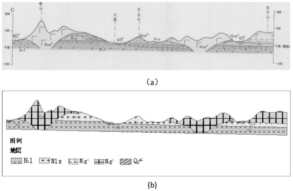
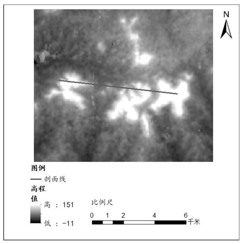
[0068] The technical scheme of the present invention is described in further detail below, what the experimental data of the present embodiment adopted is the geological profile of a certain research area ( figure 1 ) and section line and DEM data ( figure 2 ), the projected coordinate system adopted by the section line and DEM data is WGS_1984_UTM_Zone_50N. Further explanation will be given below by describing a specific embodiment in conjunction with the accompanying drawings.
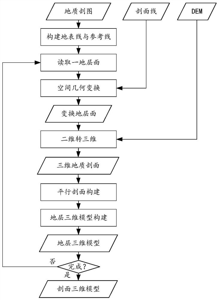
[0069] like image 3 As shown, the present invention provides a method for building a three-dimensional model of a geological section, including:
[0070] (1) Form the profile set SP, the stratigraphic profile set S, the profile line set SL and the grid set GEoDEM according to the two-dimensional graph cut profile vector data, profile line vector data and DEM respectively.
[0071] This step specifically includes:
[0072] (1-1) Read the vector data of the two-dimensional geological section and ...
PUM
 Abstract
Description
Claims
Application Information
 - R&D
- Intellectual Property
- Life Sciences
- Materials
- Tech Scout
- Unparalleled Data Quality
- Higher Quality Content
- 60% Fewer Hallucinations
Browse by: Latest US Patents, China's latest patents, Technical Efficacy Thesaurus, Application Domain, Technology Topic, Popular Technical Reports.
© 2025 PatSnap. All rights reserved.Legal|Privacy policy|Modern Slavery Act Transparency Statement|Sitemap|About US| Contact US: help@patsnap.com


