
Method for realizing train positioning on two-dimensional electronic map

A technology of train positioning and two-dimensional electronics, which is applied in the direction of railway signals and safety, and can solve problems such as GNSS signal instability and positioning errors

Pending Publication Date: 2022-02-15
CASCO SIGNAL
View PDF3 Cites 1 Cited by
  • Summary
  • Abstract
  • Description
  • Claims
  • Application Information

AI Technical Summary

Problems solved by technology

[0005] In the current technology, there are positioning errors caused by unstable GNSS signals when there are complex scenarios where the operating line may be switched through the station jurisdiction boundary and throat area. In order to solve the above problems, the present invention proposes a satellite navigation positioning The stability and accuracy of the system provide credible positioning support for traffic command and intelligent management of train operation
The present invention proposes a one-dimensional projection on the predicted track section based on the track structure described by the fixed application data, and solves the positioning caused by the instability of the GNSS signal, especially when passing through complex scenes such as station jurisdiction boundaries and throat areas that may switch operating lines. Error problem, improve the stability and accuracy of satellite navigation and positioning, and provide credible positioning support for traffic command and intelligent management of train operation

Method used


Image

  • Method for realizing train positioning on two-dimensional electronic map
  • Method for realizing train positioning on two-dimensional electronic map
  • Method for realizing train positioning on two-dimensional electronic map

Examples


Embodiment Construction

[0043] The following will be combined in the embodiment of the present invention Figure 1 to Figure 5 , to describe in detail the technical solutions, structural features, achieved goals and effects in the embodiments of the present invention.

[0044] It should be noted that the drawings are in a very simplified form and all use inaccurate proportions, which are only used to facilitate and clearly illustrate the purpose of the implementation of the present invention, and are not used to limit the limiting conditions for the implementation of the present invention, so they do not have technical In the substantive meaning above, any modification of structure, change of proportional relationship or adjustment of size should still fall within the scope of the technical contents disclosed in the present invention without affecting the effects and goals that can be achieved by the present invention. within the scope covered.

[0045]It should be noted that in the present inventio...


PUM


Abstract

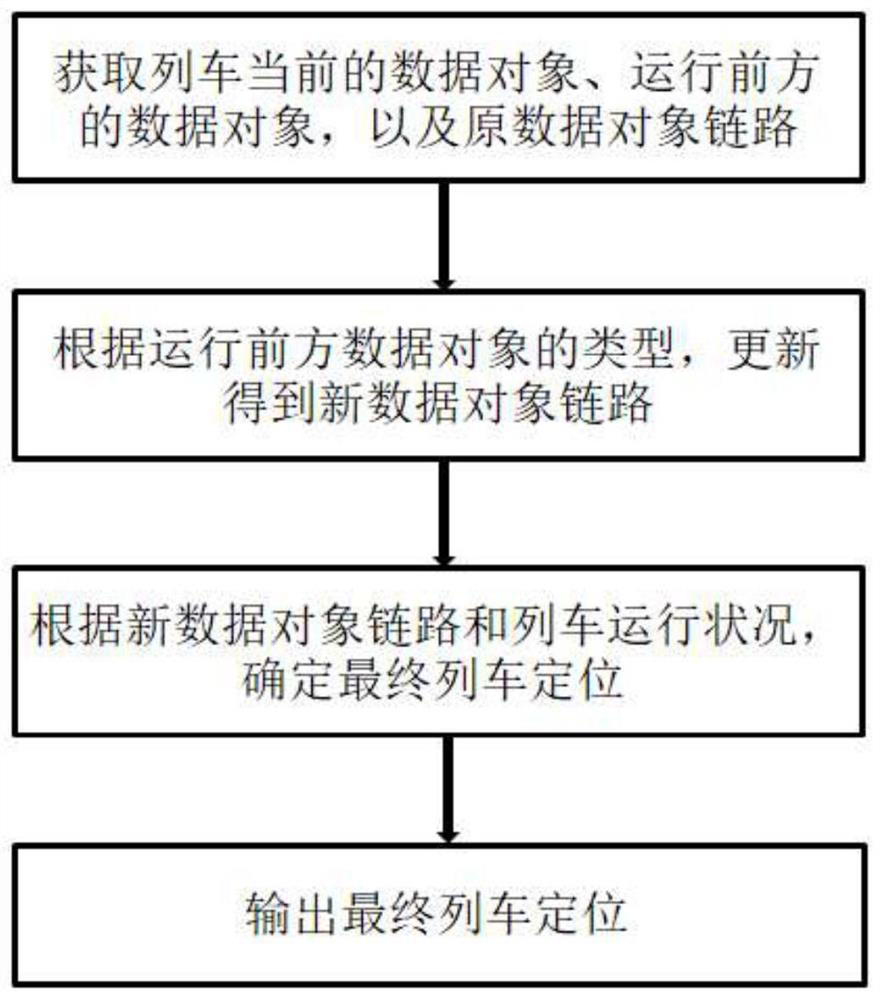
The invention discloses a method for realizing train positioning on a two-dimensional electronic map, the method comprises the following steps: S1, according to satellite navigation, train operation conditions and the two-dimensional electronic map, acquiring a current data object of the train, a data object in front of the running of the train and an original data object link based on the current data object of the train and the data object in front of the running of the train; s2, updating the original data object link according to different types of data objects in front of the running of the train to obtain a new data object link; s3, monitoring and correcting a real-time train positioning result according to the new data object link and the running condition of the train, and determining final train positioning; and S4, outputting the final train positioning. According to the invention, the stability and the accuracy of satellite navigation positioning are improved, and credible positioning support is provided for driving command and train operation intelligent management.

Description

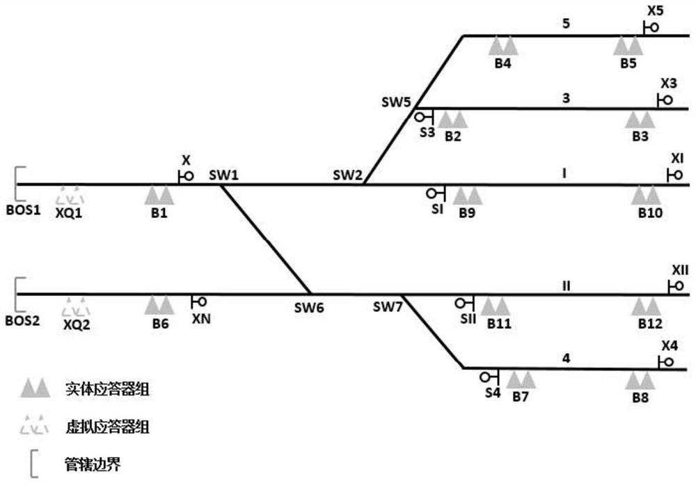
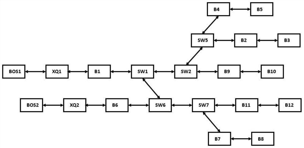
technical field [0001] The invention relates to the field of train operation control, in particular to a method for locating a train on a two-dimensional electronic map. Background technique [0002] Train positioning is the key technology of the train operation control system. High-precision train position information and accurate track occupancy information are crucial to the safe operation of trains in the interval and overrunning, rendezvous or shunting operations in the station. Traditional train positioning projects the position of satellite signals on a one-dimensional track section to obtain the parallel offset value of the train relative to the end point of the track. When the train changes its running route on the track network, the transponder method is widely used to convert the position of the train , using the track circuit method to check the occupancy of the train track, and the large amount of ground equipment required by these two methods has brought proble...

Claims


Application Information

Patent Timeline
Patent Type & Authority Applications(China)
IPC IPC(8): B61L25/02
CPCB61L25/025
Inventor 李紫薇徐先良赵国智安鸿飞袁花明杨奉伟苏天琪闫琪张剑宇崔君晓王梦雪
Owner CASCO SIGNAL
Learn More