Ground subsidence monitoring system based on GNSS and InSAR
A ground subsidence and monitoring point technology, applied in the field of substations, can solve the problems of high overall cost, inability to reflect changes in ground subsidence in real time, poor real-time performance, etc., and achieve the effect of improving temporal and spatial resolution
- Summary
- Abstract
- Description
- Claims
- Application Information
AI Technical Summary
Problems solved by technology
Method used
Image
Examples
Embodiment Construction
[0017] Various exemplary embodiments, features, and aspects of the present disclosure will be described in detail below with reference to the accompanying drawings. In addition, in order to better illustrate the present invention, numerous specific details are given in the following specific examples. It will be understood by those skilled in the art that the present invention may be practiced without certain of the specific details. In some instances, means well known to those skilled in the art are not described in detail in order to highlight the gist of the present invention.
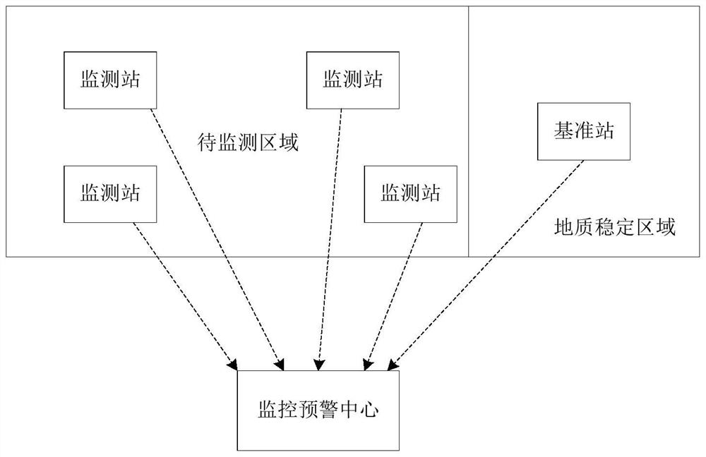
[0018] refer to figure 1 , the embodiment of the present invention proposes a land subsidence monitoring system based on GNSS and InSAR, including a plurality of monitoring stations set at different locations in the area to be monitored, a reference station set in a geologically stable area outside the area to be monitored, monitoring and early warning Center; the monitoring station is used to obt...
PUM
 Abstract
Description
Claims
Application Information
 - R&D
- Intellectual Property
- Life Sciences
- Materials
- Tech Scout
- Unparalleled Data Quality
- Higher Quality Content
- 60% Fewer Hallucinations
Browse by: Latest US Patents, China's latest patents, Technical Efficacy Thesaurus, Application Domain, Technology Topic, Popular Technical Reports.
© 2025 PatSnap. All rights reserved.Legal|Privacy policy|Modern Slavery Act Transparency Statement|Sitemap|About US| Contact US: help@patsnap.com


