Navigation assistance data and route planning for drones
a technology of navigation assistance and route planning, applied in the direction of traffic control systems, transportation and packaging, instruments, etc., can solve the problems of the aviation community's challenge in introducing drones into airspa
- Summary
- Abstract
- Description
- Claims
- Application Information
AI Technical Summary
Benefits of technology
Problems solved by technology
Method used
Image
Examples
Embodiment Construction
[0029]Several illustrative embodiments will now be described with respect to the accompanying drawings, which form a part hereof. The ensuing description provides embodiment(s) only, and is not intended to limit the scope, applicability or configuration of the disclosure. Rather, the ensuing description of the embodiment(s) will provide those skilled in the art with an enabling description for implementing an embodiment. It is understood that various changes may be made in the function and arrangement of elements without departing from the spirit and scope of this disclosure.
I. Network System
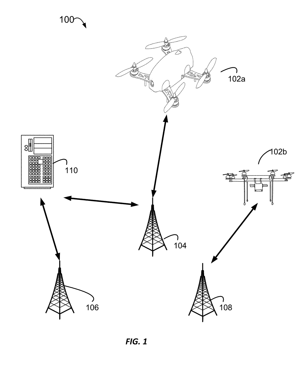
[0030]A wide spectrum of users are using or are expected to use unmanned aerial vehicles (UAVs), which are also commonly referred to as drones. Drones may play a transformative role in fields such as urban infrastructure management, farming, public safety, transportation, coastal security, military training, search and rescue, and disaster response. For example, following the FAA's relaxation of...
PUM
 Abstract
Description
Claims
Application Information
 - R&D
- Intellectual Property
- Life Sciences
- Materials
- Tech Scout
- Unparalleled Data Quality
- Higher Quality Content
- 60% Fewer Hallucinations
Browse by: Latest US Patents, China's latest patents, Technical Efficacy Thesaurus, Application Domain, Technology Topic, Popular Technical Reports.
© 2025 PatSnap. All rights reserved.Legal|Privacy policy|Modern Slavery Act Transparency Statement|Sitemap|About US| Contact US: help@patsnap.com


