

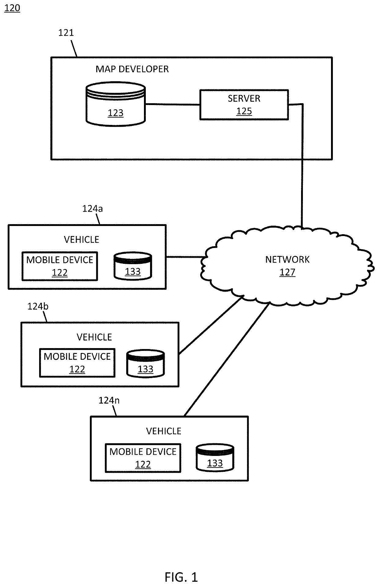
Local window-based 2D occupancy grids for localization of autonomous vehicles
a technology for autonomous vehicles and localization, applied in the field of 2d occupancy grids, can solve the problems of large blind spots, application requirements that require greater accuracy than, and additional challenges for the environment in improving this accuracy
- Summary
- Abstract
- Description
- Claims
- Application Information
AI Technical Summary
Problems solved by technology
Method used
Image

Examples
embodiment 1
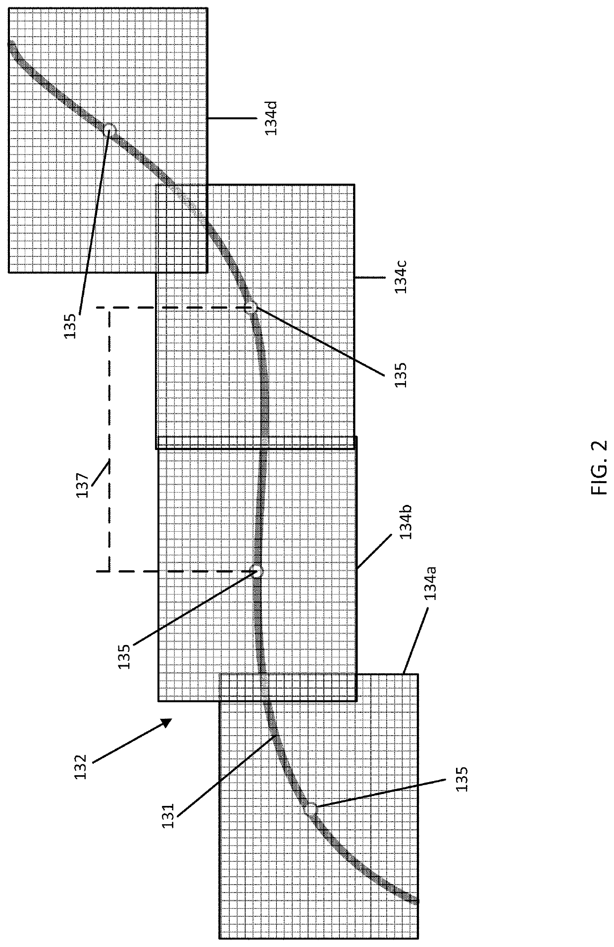
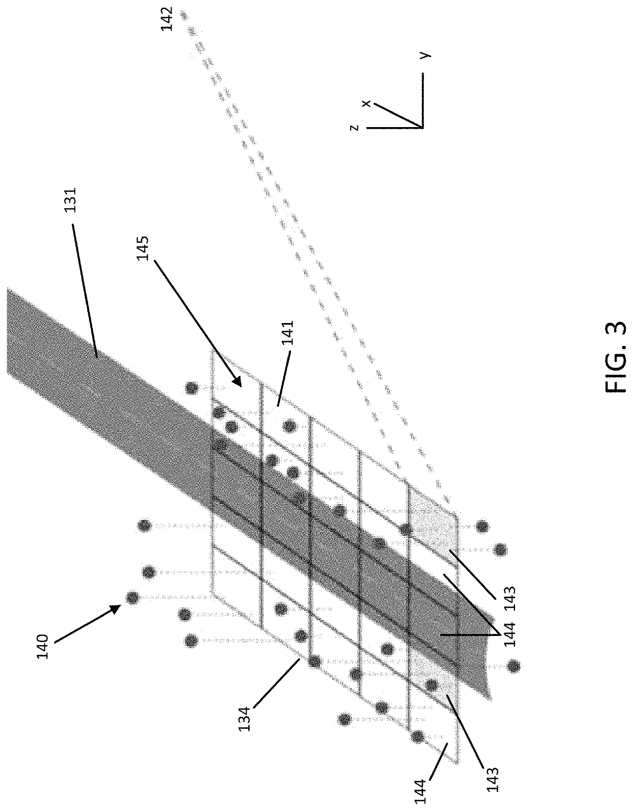
[0128]A method for generating a local window-based two-dimensional (2D) occupancy grid that provides a signature for a location along a region of a roadway, the method comprising:[0129]identifying, by a processor, a set of local windows associated with the region of a roadway, the local windows comprising a plurality of grid cells;[0130]receiving, by the processor, point cloud data for the region of the roadway;[0131]assigning, by the processor, the point cloud data to corresponding grid cells within the set of local windows based on a predetermined altitude range;[0132]determining, by the processor, a grid cell occupancy for the grid cells within the set of local windows based on a predetermined threshold of point cloud data assigned to corresponding grid cells; and[0133]generating, by the processor, a 2D occupancy grid as the signature for the location along the region of the roadway, the 2D occupancy grid being generated for a window of the set of local windows based on the deter...
embodiment 2
[0134]The method of embodiment 1, wherein identifying the set of local windows comprises:[0135]identifying a maximum separation distance between center points of adjacent local windows, wherein the center points are points equally spaced along a center-line of the region of the roadway based on the maximum separation distance;[0136]determining a size and a resolution of the adjacent local windows;[0137]calculating, based on the size of the adjacent local windows, a minimum number of local windows that cover the region of the roadway; and[0138]defining the local windows that cover the region of the roadway as the set of local windows.
embodiment 3
[0139]The method of embodiment 1 or 2, wherein the set of local windows cover the region of the roadway such that gaps are not present between the local windows.
PUM
 Abstract
Description
Claims
Application Information