
Method for identifying resistivity anomalies in electromagnetic survey data

a resistivity anomaly and electromagnetic survey technology, applied in the field of geophysical prospecting, can solve problems such as loss of valuable information, confusion of picture, and inability to select one unique offset optimally

Active Publication Date: 2006-09-07
EXXONMOBIL UPSTREAM RES CO
View PDF4 Cites 19 Cited by
  • Summary
  • Abstract
  • Description
  • Claims
  • Application Information

AI Technical Summary

Problems solved by technology

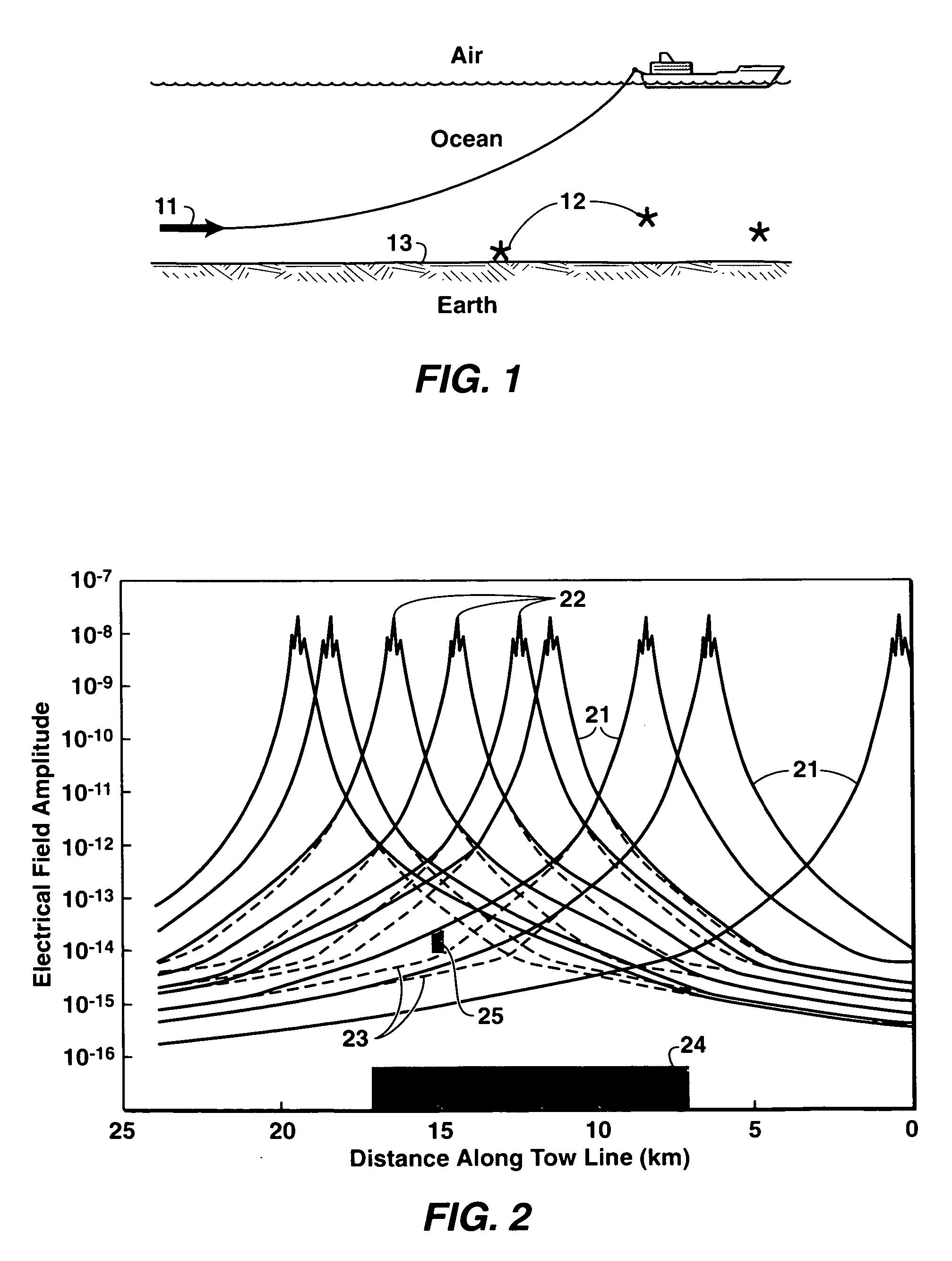
As FIG. 2 illustrates, the picture becomes very confusing if the data corresponding to all receivers of the same tow line are displayed together.
The selection of one unique offset may not be optimal, and valuable information is lost if one cannot look at the whole-offset curve.

Method used


Image

  • Method for identifying resistivity anomalies in electromagnetic survey data
  • Method for identifying resistivity anomalies in electromagnetic survey data
  • Method for identifying resistivity anomalies in electromagnetic survey data

Examples


Embodiment Construction

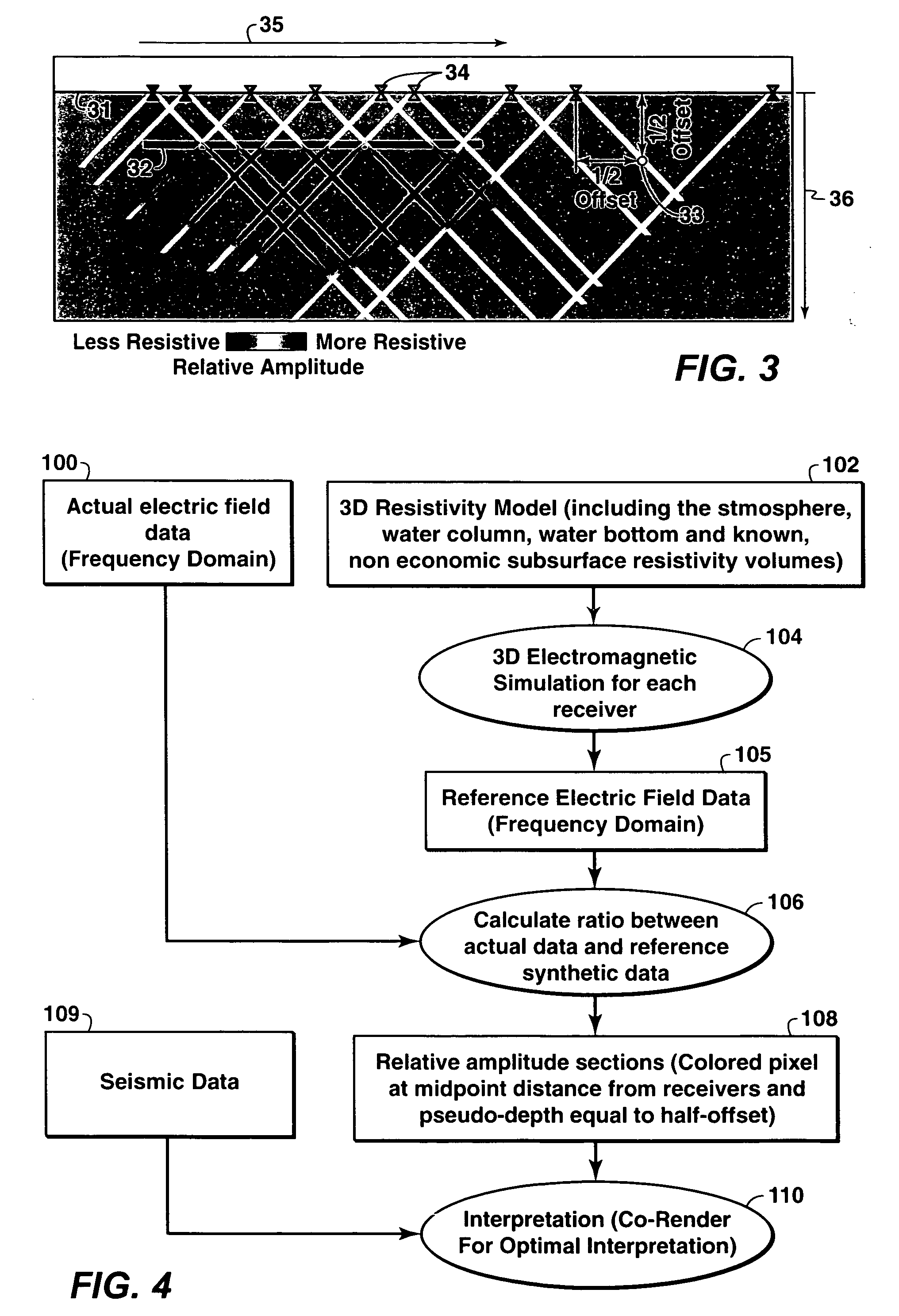
[0016] The present invention is a method for displaying the electromagnetic data as relative amplitudes along the tow line in a cross-section format. In this way, the information corresponding to all receivers and all offsets (source-receiver separations) can be displayed and interpreted at the same time. It also permits the co-rendering of the electromagnetic data with seismic data or a geologic model. If the different cross-sections of a survey are displayed together in their spatial coordinates, the shape of the resistivity anomalies can be seen in three dimensions.

[0017] The amplitudes (in the frequency domain) of the recorded electric field are color-coded after being scaled by a reference signal. In some embodiments of the present invention, what is displayed is the relative amplitude of the horizontal component of the electric field that is parallel to the direction of the tow line. Alternatively, other components (vertical and horizontal—perpendicular to the tow line direct...


PUM


Abstract

Method for enhancing resistive anomalies in electromagnetic geophysical survey data. Scaled values of a measured electromagnetic field parameter are plotted on a depth section at locations related to corresponding source / receiver locations. Scaling is performed relative to a reference signal selected to represent a baseline free of unknown resistive bodies. Scaled values are represented by a color scale in the display, and the color scale may be adjusted to enhance perceived anomalies. The method may be employed in either the frequency domain or the time domain.

Description

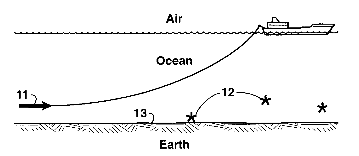
[0001] This application claims the benefit of U.S. Provisional Patent Application No. 60 / 659,325 filed on Mar. 7, 2005.FIELD OF THE INVENTION [0002] This invention relates generally to the field of geophysical prospecting and, more particularly, to electromagnetic surveys. Specifically, the invention is a method for interpretation of data gathered with controlled source electromagnetic surveys in offshore environment (a controlled electromagnetic transmitter is towed above receivers fixed on the sea floor). BACKGROUND OF THE INVENTION [0003] Controlled-source electromagnetic (“CSEM”) geophysical surveys use man-made sources to generate electromagnetic fields to excite the earth, and deploy receiver instruments on the earth's surface, on the seafloor, in the air, or inside boreholes to measure the resulting electric and magnetic fields, i.e., the earth's response to the source excitation. FIG. 1 illustrates the basic elements of an offshore CSEM survey. A vessel tows a submerged CSEM...

Claims


Application Information

Patent Timeline
IPC IPC(8): G01V3/08
CPCG01V3/083G01V3/12
Inventor GREEN, KENNETHBURTZ, OLIVIER M.WILLEN, DENNY E.
Owner EXXONMOBIL UPSTREAM RES CO
Learn More