
Navigation system

a navigation system and navigation system technology, applied in the field of navigation systems, can solve problems such as difficulty in determining which roads

Inactive Publication Date: 2008-01-24
DENSO CORP
View PDF9 Cites 29 Cited by
  • Summary
  • Abstract
  • Description
  • Claims
  • Application Information

AI Technical Summary

Benefits of technology

[0009]It is an object of the present invention to provide a navigation system, in which, when a vehicle enters a service area such as a rest area or parking area of an expressway such as a highway or a freeway, a position of a subject vehicle can be displayed on a road in the service area on the displayed map as promptly as possible.
[0011]For instance, a vehicle enters a service area that includes a service-area road having a shape similar to that of the main road of an expressway. In this case, the resultant swept path or the distance from the current position of the vehicle is not significantly different from that undergone when the vehicle travels on the main road. Thus, it is difficult to determine which road, the main road or the service-area road, the vehicle travels on. However, in cases that a vehicle is driven to a parking space in the service area, the heading direction of the vehicle is changed from the traffic direction of the main road to a certain direction to thereby further travel to the parking space. Therefore, when the main road and the service-area road are designated as candidate roads in the map matching process, based on the direction difference between the heading direction of the vehicle and the traffic direction of the main road, the service-area road can be determined to be a road on which the vehicle is traveling, as promptly as possible. This allows the current position of the vehicle to properly appear on the service-area road on the displayed map.

Problems solved by technology

Thus, it is difficult to determine which road, the main road or the service-area road, the vehicle travels on.

Method used


Image

  • Navigation system
  • Navigation system
  • Navigation system

Examples


Embodiment Construction

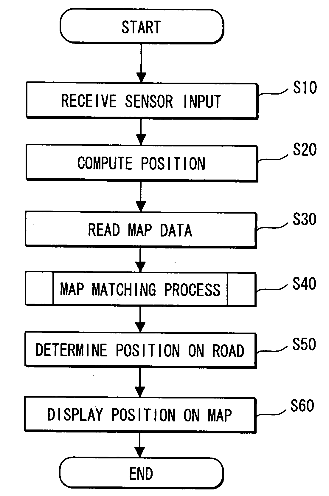
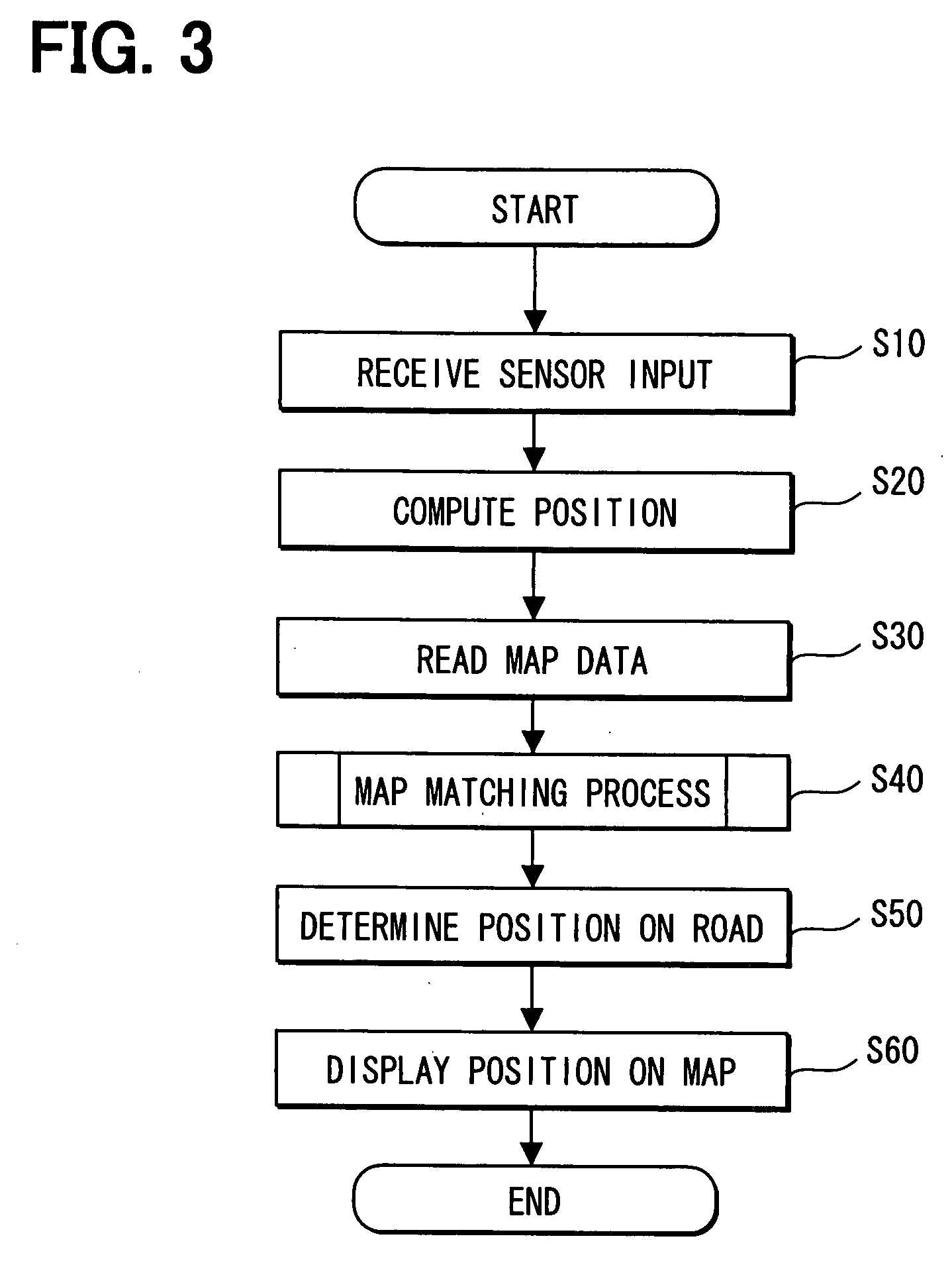
[0021]A navigation system according to an embodiment of the present invention will be explained with reference to drawings.

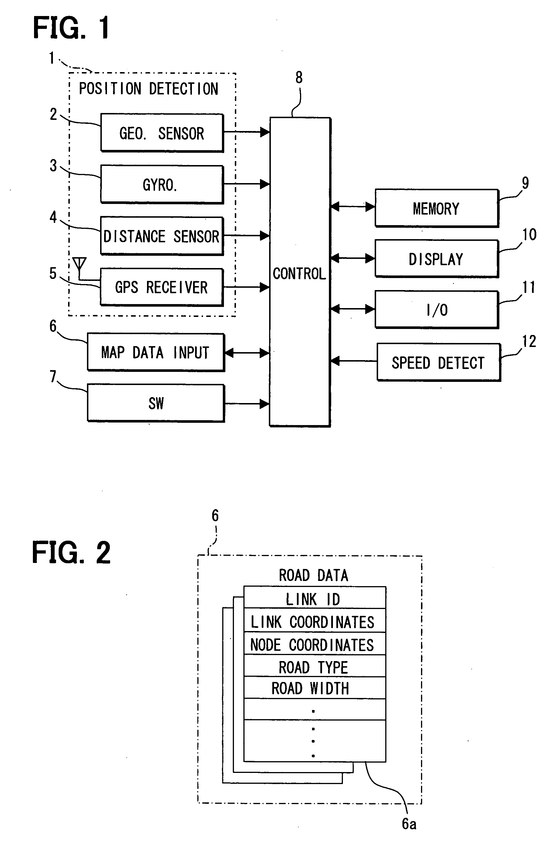
[0022]As shown in FIG. 1, a navigation system as the embodiment is provided in a subject vehicle and includes the following: a position detection unit 1, a map data input unit 6, an operation switch group 7, an external memory device 9, a display device 10, an external information input / output device 11, and a control circuit 8 connected with the foregoing components.

[0023]The control circuit 8 is a computer to have a known CPU, ROM, RAM, Input / Output (I / O), and a bus line connecting the foregoing parts with each other. The ROM stores a program executed by the control circuit 8. According to the program, the CPU or the like executes predetermined computation.

[0024]The position detection unit 1 includes known parts or sensors such as a geomagnetic sensor 2, a gyroscope 3, a distance sensor 4, and a GPS receiver 5 for GPS (Global Positioning System) to measure a p...


PUM


Abstract

A service-area road that is a road in a service area such as a rest area or parking area of an expressway is determined to be a road on which a vehicle travels on when the following three conditions are satisfied. A first condition is satisfied when the vehicle travels in an expressway. A second condition is satisfied when a main road of the expressway and the service-area road are designated as candidate roads in map matching process. A third condition is satisfied when a difference between the heading direction of the vehicle and the traffic direction of the main road is equal to or greater than a predetermined value. Thus, it can be as promptly as possible determined that the vehicle is traveling on the service-area road, allowing the vehicle mark to be accurately displayed on the service-area road on the displayed map.

Description

CROSS REFERENCE TO RELATED APPLICATION[0001]This application is based on and incorporates herein by reference Japanese Patent Application No. 2006-196129 filed on Jul. 18, 2006.FIELD OF THE INVENTION[0002]The present invention relates to a navigation system to properly display a position of a subject vehicle, which is located on a road in a service area such as a rest area or a parking area ancillary to an expressway such as a highway or a freeway.BACKGROUND OF THE INVENTION[0003]Patent document 1 discloses the following navigation system. When a subject vehicle enters a service area such as a rest area or a parking area of an expressway such as a highway or a freeway, a map matching process may produce an opposite effect to mistakenly locate the position of the vehicle. Thus, the navigation system stops the map matching process.[0004]The vehicle turns in the service area to thereby change an orientation (heading direction) of the vehicle. This sometimes causes the map matching proc...

Claims


Application Information

Patent Timeline
Patent Type & Authority Applications(United States)
IPC IPC(8): G01C21/26G06F17/30
CPCG01C21/30
Inventor KOBAYASHI, TOMOKAZU
Owner DENSO CORP
Learn More