
Method of client side map rendering with tiled vector data

a client-side map and vector data technology, applied in traffic control systems, navigation instruments, instruments, etc., can solve problems such as requiring a large storage and computational workload, requiring a large amount of server storage and computational resources, and a large amount of client-side map data loading or rendering

Active Publication Date: 2008-05-08
ENERGETIC POWER INVESTMENT
View PDF13 Cites 128 Cited by
  • Summary
  • Abstract
  • Description
  • Claims
  • Application Information

AI Technical Summary

Benefits of technology

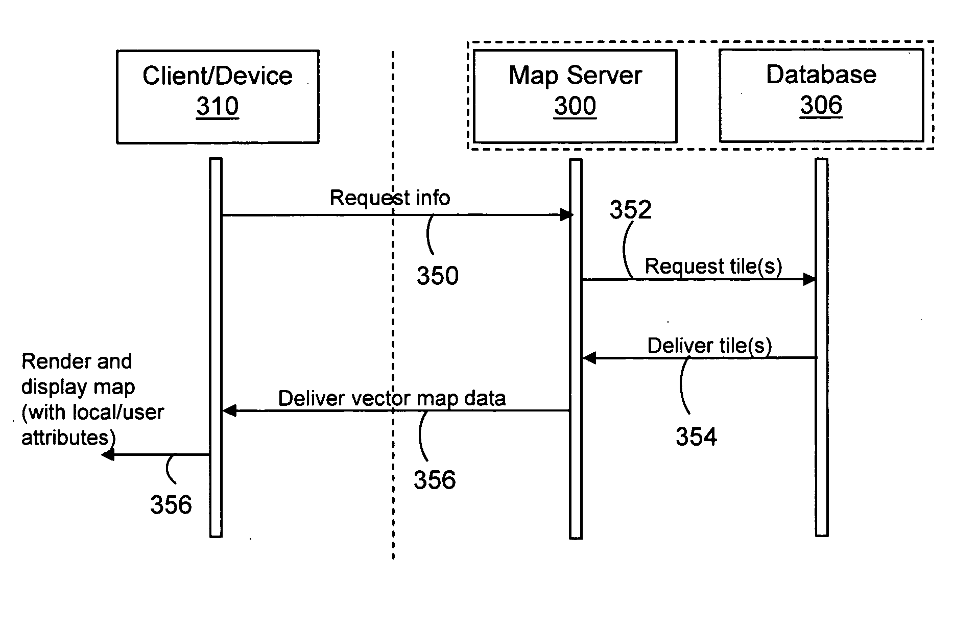
[0012]According to another aspect, a method for client-side map rendering of tiled vector data is provided. In one example the method includes transferring vector image data to a receiving device, the vector image data for displaying a map image, wherein the vector image data comprises a tile of

Problems solved by technology

The loading or rendering of map data for delivery to a client in response to a request is generally computationally burdensome on the server side, the client-side, or both.
Accordingly, current Web based map image systems, e.g., based on rastor image data, generally suffer from several drawbacks.
For example, zooming (or scaling) of the map image generally requires additional map data to be retrieved by the map server for display, and as such, generally requires greater storage and computational demands on the server to store and render each offered zoom level.
Further, rastor images are generally optimized for display on a client display device such as a computer monitor or handheld device screen (e.g., at a resolution of approximately 1280×1024 and about 80-100 pixels per inch); however, such resolution optimized for display on a monitor is generally well below a desired resolution for printing.
Increased image resolution described for printing, however, would further burden the server, client, or both during map image rendering operations.

Method used


Image

  • Method of client side map rendering with tiled vector data
  • Method of client side map rendering with tiled vector data
  • Method of client side map rendering with tiled vector data

Examples


Embodiment Construction

[0022]The following description is presented to enable a person of ordinary skill in the art to make and use the various aspects of the present invention. Descriptions of specific devices, techniques, and applications are provided only as examples. Various modifications to the examples described herein will be readily apparent to those of ordinary skill in the art, and the general principles defined herein may be applied to other examples and applications without departing from the spirit and scope of the inventions. Thus, the present invention is not intended to be limited to the examples described herein and shown, but is to be accorded the scope consistent with the claims.

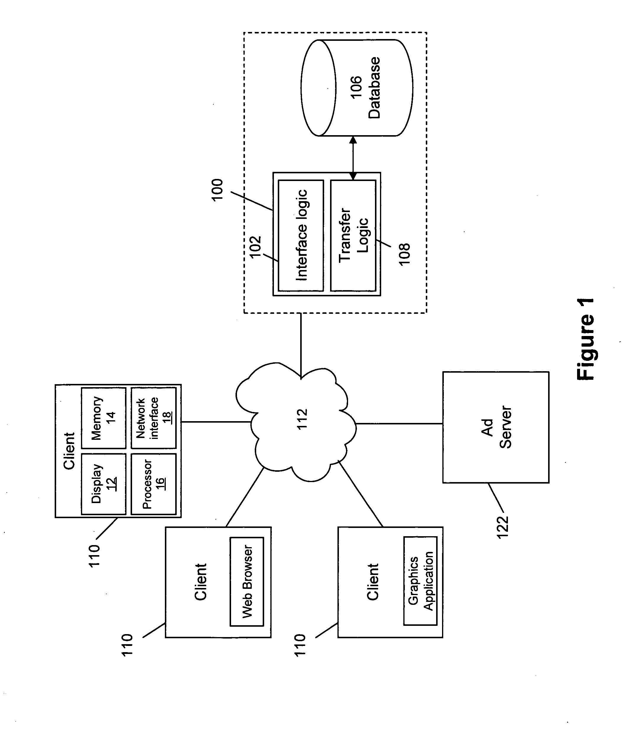
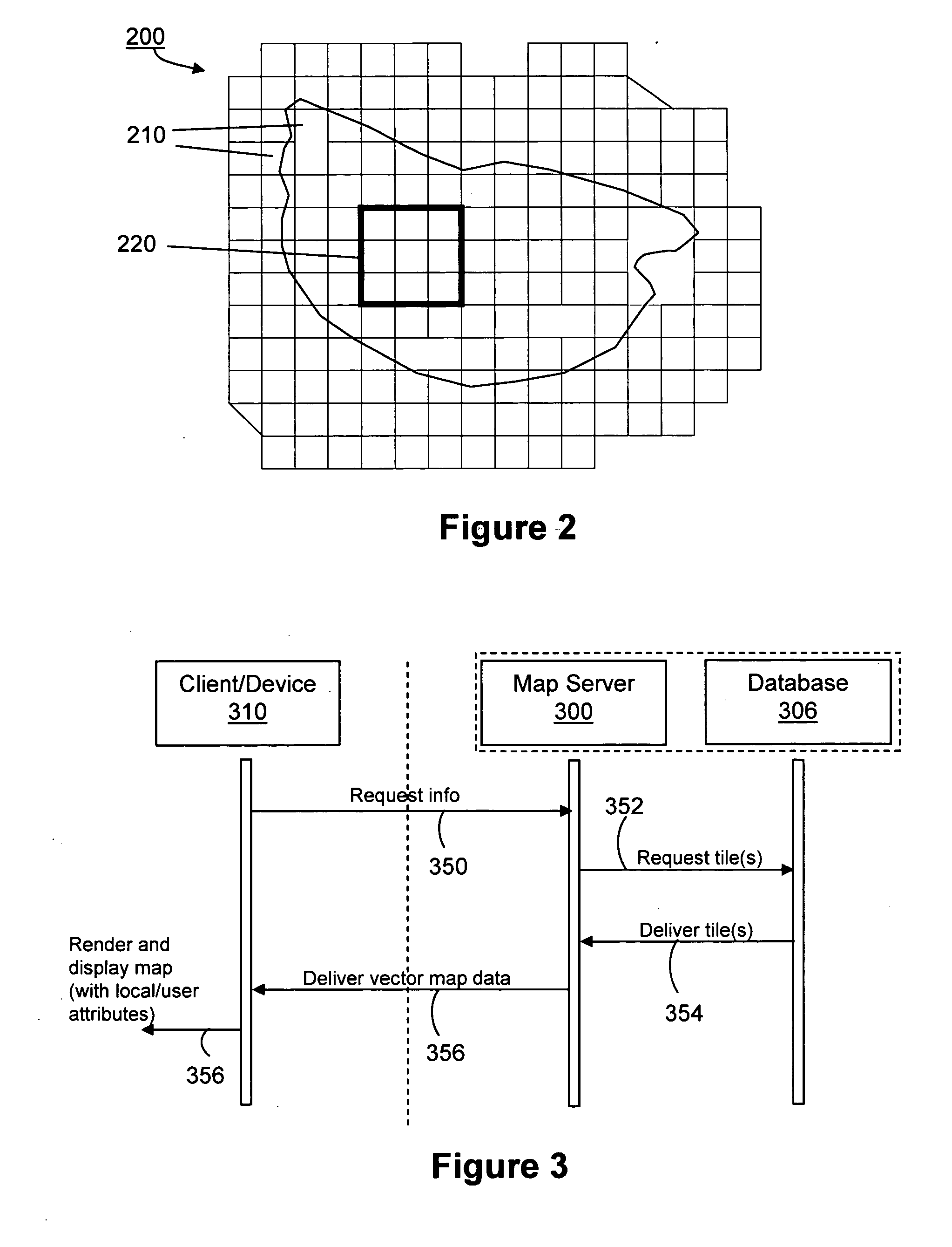
[0023]In one example of the present invention an apparatus (e.g., a map server) is described for facilitating client-side map rendering of tiled vector image data. Vector image data (or “vector data”) generally includes mathematical descriptions that determine the coordinates, length, and direction in which line...


PUM


Abstract

In one example, an apparatus and method are provided for rendering map images. In one example, an apparatus (e.g., a map server) includes logic for causing the transfer of tiled vector image data in response to a map request, wherein the vector data is associated with stored map data divided into a plurality of tiles. The tiled vector image data is transferred to a remote device (e.g., a client device) for rendering of the map image. Additionally, the vector image data may comprise one or more attributes associated therewith, the one or more attributes configurable by a receiving device. For example, the map image may be rendered (e.g., customized) based on one or more local attributes to vary the language used, colors, how items in the map are displayed, and other imaging characteristics of the map image.

Description

BACKGROUND[0001]1. Field[0002]The present invention relates generally to systems and methods for rendering large images, such as maps, in client-server systems, and in one particular example, to client-side rendering of a map image according to received tiled vector image data.[0003]2. Related Art[0004]Various map and geographic information systems are known in the art. For example, various Web-based mapping services operating to deliver map image data to clients via a Web browser are known. Generally, the map image data may span large geographic areas and may be displayed in several discrete zoom levels. The map image data may further include various additional services, such as street names, addresses, and businesses for display with or overlaying the map image.[0005]In a typical client-server environment, such as a Web based mapping service, map images are generally rendered on the server side in response to a user request for a map image and transferred to the client for display...

Claims


Application Information

Patent Timeline
IPC IPC(8): G01C21/32
CPCG01C21/32G06F17/30241G06F17/30271G06T2200/16G06F17/3087G06Q30/02G06T15/005G06F17/3028G06F16/29G06F16/51G06F16/9537G06F16/56G01C21/3881G01C21/3896
Inventor SHI, NORMAN X.WU, XIAOYI
Owner ENERGETIC POWER INVESTMENT
Learn More