Terrain modeling based on curved surface area

a surface area and terrain technology, applied in the field of digital maps, can solve the problems of limited use and/or management of digital maps, limited processing and memory resources, and large storage and processing resources for high-resolution maps

Active Publication Date: 2008-10-09
HARMAN BECKER AUTOMOTIVE SYST
View PDF6 Cites 9 Cited by
  • Summary
  • Abstract
  • Description
  • Claims
  • Application Information

AI Technical Summary

Problems solved by technology

A higher resolution map may require significant storage and processing resources.
Use and / or management of digital maps may be limited by embedded systems, such as vehicle navigation systems, that have limited processing and memory resources.
Modification made to a digital map to accommodate limited computer resources may affect the quality of the digital map.

Method used


Image

  • Terrain modeling based on curved surface area
  • Terrain modeling based on curved surface area
  • Terrain modeling based on curved surface area

Examples


Embodiment Construction

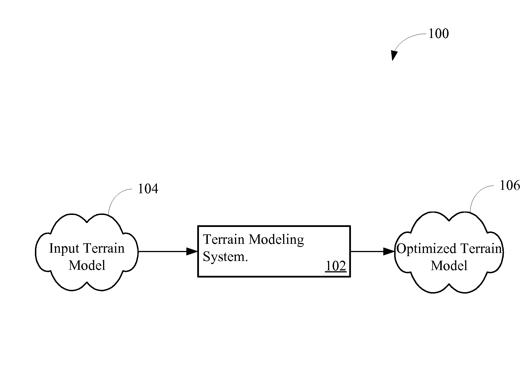
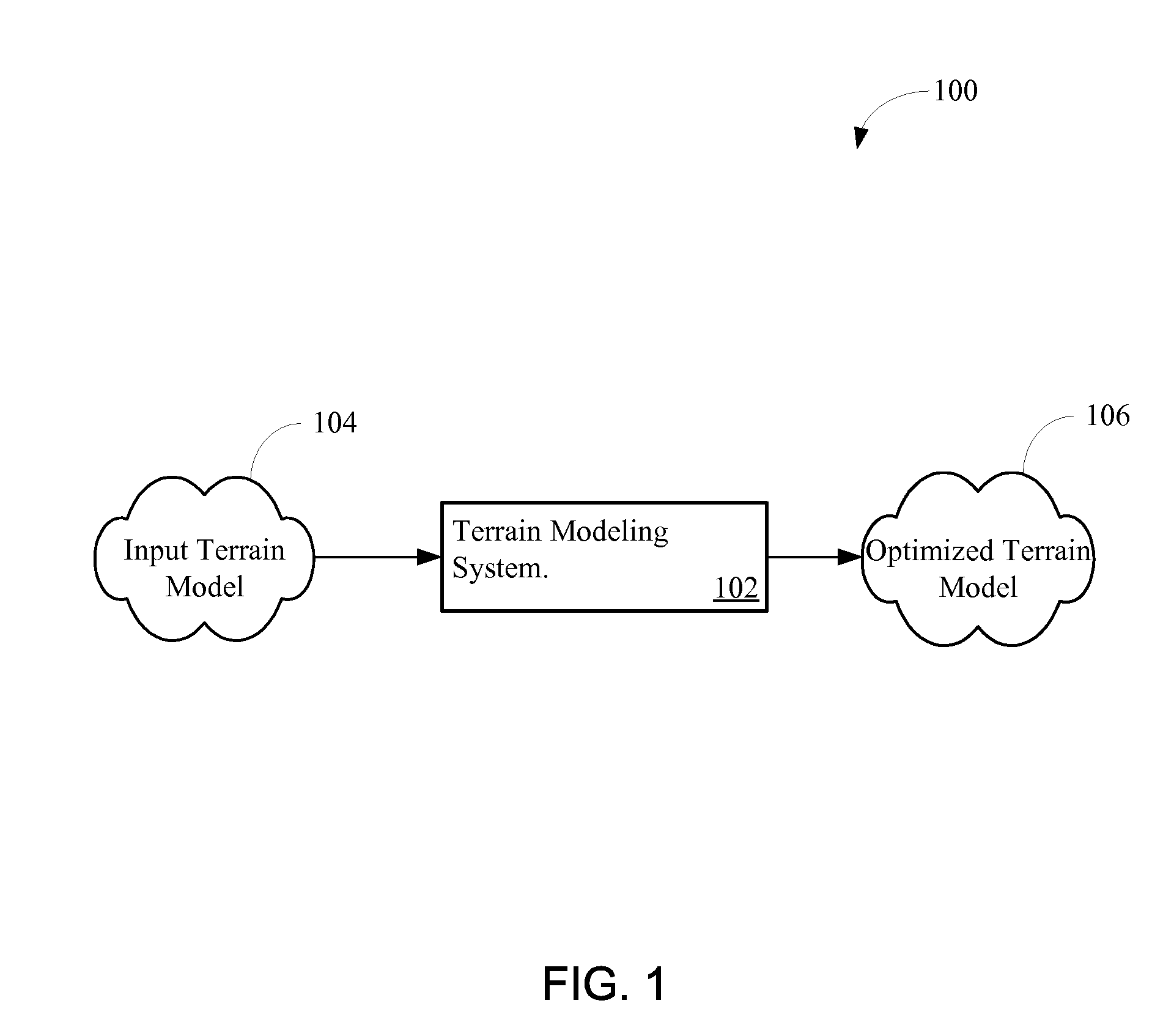
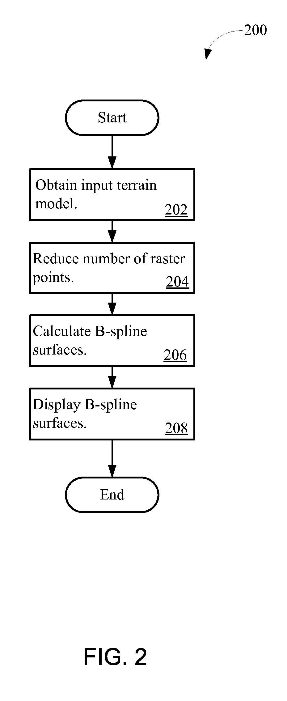
[0021]A terrain modeling system based on curved surfaces provides quality terrain models with variable resolution. A digital model of a physical terrain may be obtained. The system identifies raster points that may include a height value that differs from a height value of at least one adjacent raster point. The raster points may be interpolated to derive one or more B-spline surfaces. The system may manually or automatically adjust the resolution of the B-spline surfaces based on available storage space, processing capabilities, desired detail, and / or other considerations. The B-spline surfaces may display a representation of the terrain. The system may be implemented in, or provide the calculated B-spline surfaces to, a handheld, vehicle, or other navigation system to provide efficient and accurate rendering of maps, such as three-dimensional maps.

[0022]FIG. 1 is a flow diagram 100 of an exemplary terrain modeling process 100. A terrain modeling system 102 obtains an input terrain...


PUM


Abstract

A terrain modeling system provides a terrain model having variable resolution. The system receives an input terrain made up of raster points. The system identifies raster points that differ in height from an adjacent raster point by a threshold. The system interpolates the identified raster points to calculate one or more B-spline surfaces. The surfaces correspond to a multi-dimensional representation of a physical terrain.

Description

PRIORITY CLAIM[0001]This application claims the benefit of priority from European Patent Application No. 06024937.2, filed Dec. 1, 2006, which is incorporated by reference.BACKGROUND OF THE INVENTION[0002]1. Technical Field[0003]The inventions relate to digital maps. In particular, the inventions relate to multi-dimensional terrain modeling.[0004]2. Related Art[0005]A navigation system may use digital maps to display streets, buildings, rivers, and other features. Three-dimensional maps may provide terrain slope, directions of slope, terrain profiles between selected points, and information related to a physical terrain.[0006]The resolution of a digital map may affect the demand for electronic resources including demand for storage space and processor capabilities. A higher resolution map may require significant storage and processing resources. Use and / or management of digital maps may be limited by embedded systems, such as vehicle navigation systems, that have limited processing ...

Claims


Application Information

Patent Timeline
Patent Type & Authority Applications(United States)
IPC IPC(8): G06T15/00G06T17/05
CPCG06T17/05G06T17/20
Inventor STRASSENBURG-KLECIAK, MAREKMEYER, HENDRIK
Owner HARMAN BECKER AUTOMOTIVE SYST
Why Eureka
Try Eureka