

Positional information providing system, positional information providing apparatus and transmitter
a technology of position information and providing apparatus, which is applied in the field of providing position information, can solve the problems of unstable reception state, degraded positioning accuracy, and inability to receive signals emitted from gps satellites by the positional information providing apparatus of the user
- Summary
- Abstract
- Description
- Claims
- Application Information
AI Technical Summary
Benefits of technology
Problems solved by technology
Method used
Image

Examples
first embodiment
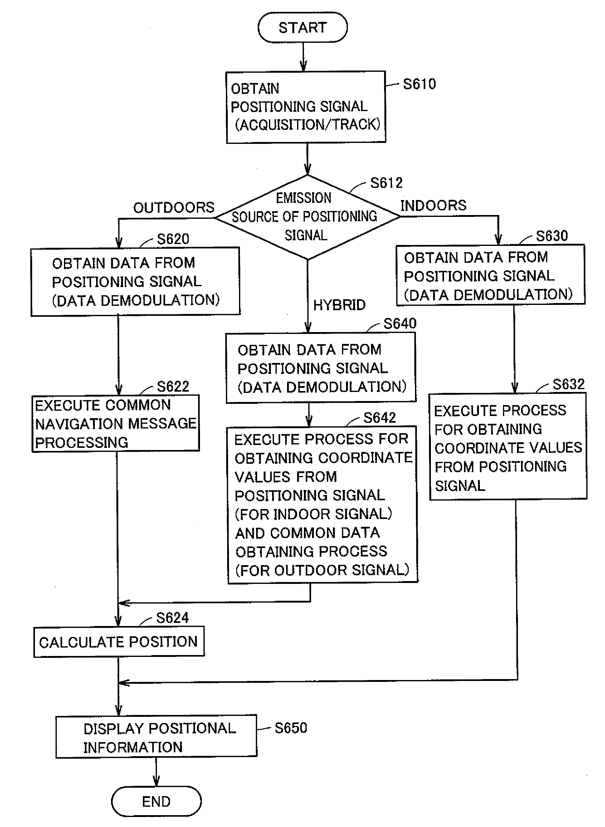
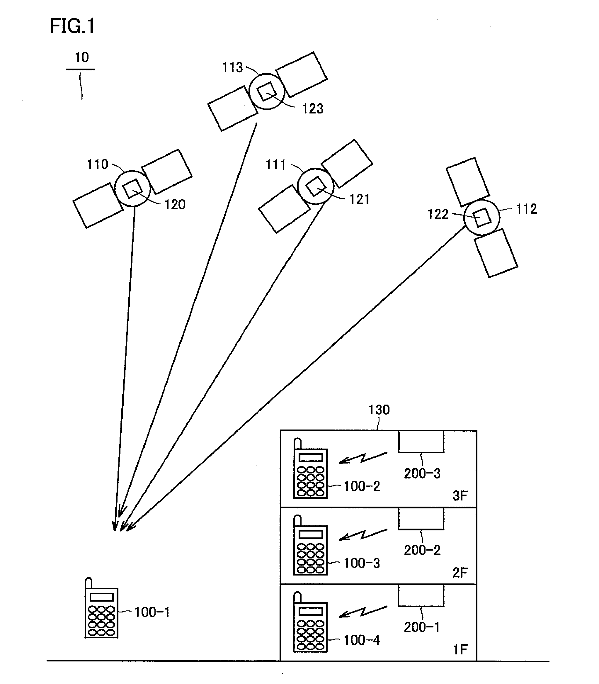
[0058]Referring to FIG. 1, a positional information providing system 10 in accordance with the first embodiment of the present invention will be described. FIG. 1 shows a configuration of positional information providing system 10. Positional information providing system 10 includes GPS (Global Positioning System) satellites 110, 111, 112 and 113 flying at an altitude of 20,000 meters above the ground, emitting signals for positioning (hereinafter referred to as positioning signals), and positional information providing apparatuses 100-1 to 100-4 functioning as apparatuses for providing positional information. Positional information providing apparatuses 100-1 to 100-4 will be generally referred to as a positional information providing apparatus 100. Positional information providing apparatus 100 is, for example, a terminal having a conventional positioning device, such as a portable telephone, a car navigation system or other mobile positioning device.
[0059]Here, the positioning si...
second embodiment
[0154]In the following, a second embodiment of the present invention will be described. The positional information providing system in accordance with the present embodiment is different from the first embodiment in that a plurality of transmitters are attached.
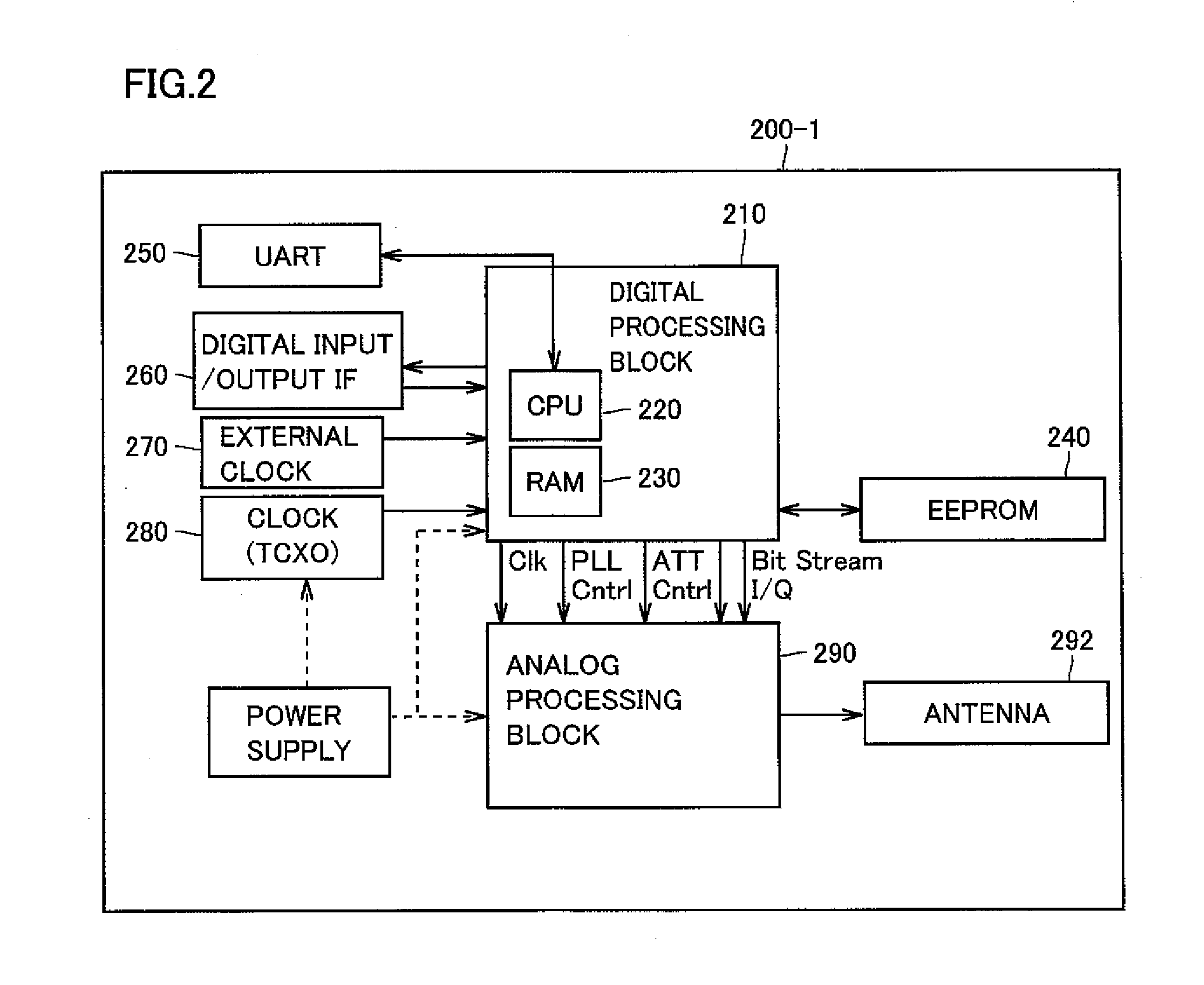
[0155]FIG. 11 shows a manner how the positional information providing apparatus in accordance with the second embodiment of the present invention is used. Referring to FIG. 11, indoor transmitters 1110, 1120 and 1130 are attached to the ceiling of one same floor, Each indoor transmitter executes the same process as executed by indoor transmitter 200-1 described above. Specifically, each indoor transmitter emits a positioning signal including data representing the location where it is installed.
[0156]Here, dependent on the position of attachment of indoor transmitters, there may be an area (or space) where signals transmitted from adjacent transmitters can both be received. By way of example, in an area 1140, signals emitted f...
third embodiment
[0160]In the following, a third embodiment of the present invention will be described. The positional information providing apparatus in accordance with the present embodiment is different from the embodiments described above in that rather than specifying the position based on the data included in the indoor transmitter, data for identifying the transmitter is transmitted to an apparatus providing information related to the transmitter, so that positional information can be obtained.
[0161]FIG. 12 shows a manner how the positional information providing apparatus in accordance with the present embodiment is used. The positional information providing apparatus is implemented, for example, as a portable telephone 1200. Portable telephone 1200 can receive a positioning signal emitted by an indoor transmitter 1210. Indoor transmitter 1210 is connected to the Internet 1220. Internet 1220 is connected to an information providing server 1230 that can provide information related to indoor tr...
PUM
 Abstract
Description
Claims
Application Information