Gps-based wireless network connection selection and network topology overlay on satellite geographic map

a wireless network and geographic map technology, applied in the direction of instruments, navigation instruments, and assessing restrictions, can solve the problems of user unsatisfactory understanding of the topology, user might not know the most suitable interface to use for changing requirements and conditions, and attendant costs

Inactive Publication Date: 2011-02-03
SONY CORP +1
View PDF29 Cites 36 Cited by
  • Summary
  • Abstract
  • Description
  • Claims
  • Application Information

AI Technical Summary

Benefits of technology

[0004]Accordingly, a mobile computing device includes a processor, a geographic position satellite (GPS) receiver communicating with the processor, and a display presented demanded images under control of the processor. At least a first wireless wide area network interface communicates with the processor for establishing wireless connectivity

Problems solved by technology

Some interfaces require communication paths that might be free but have relatively small bandwidths while other interfaces might use communication paths with robust bandwidths but with attendant costs.
As understood herein, given that a mobile computing device might have multiple interfaces with which to communicate, a user might not know the most suitable interface to use for changing requirements and conditions.
Furthermore, present principles understan

Method used


Image

  • Gps-based wireless network connection selection and network topology overlay on satellite geographic map
  • Gps-based wireless network connection selection and network topology overlay on satellite geographic map
  • Gps-based wireless network connection selection and network topology overlay on satellite geographic map

Examples


Embodiment Construction

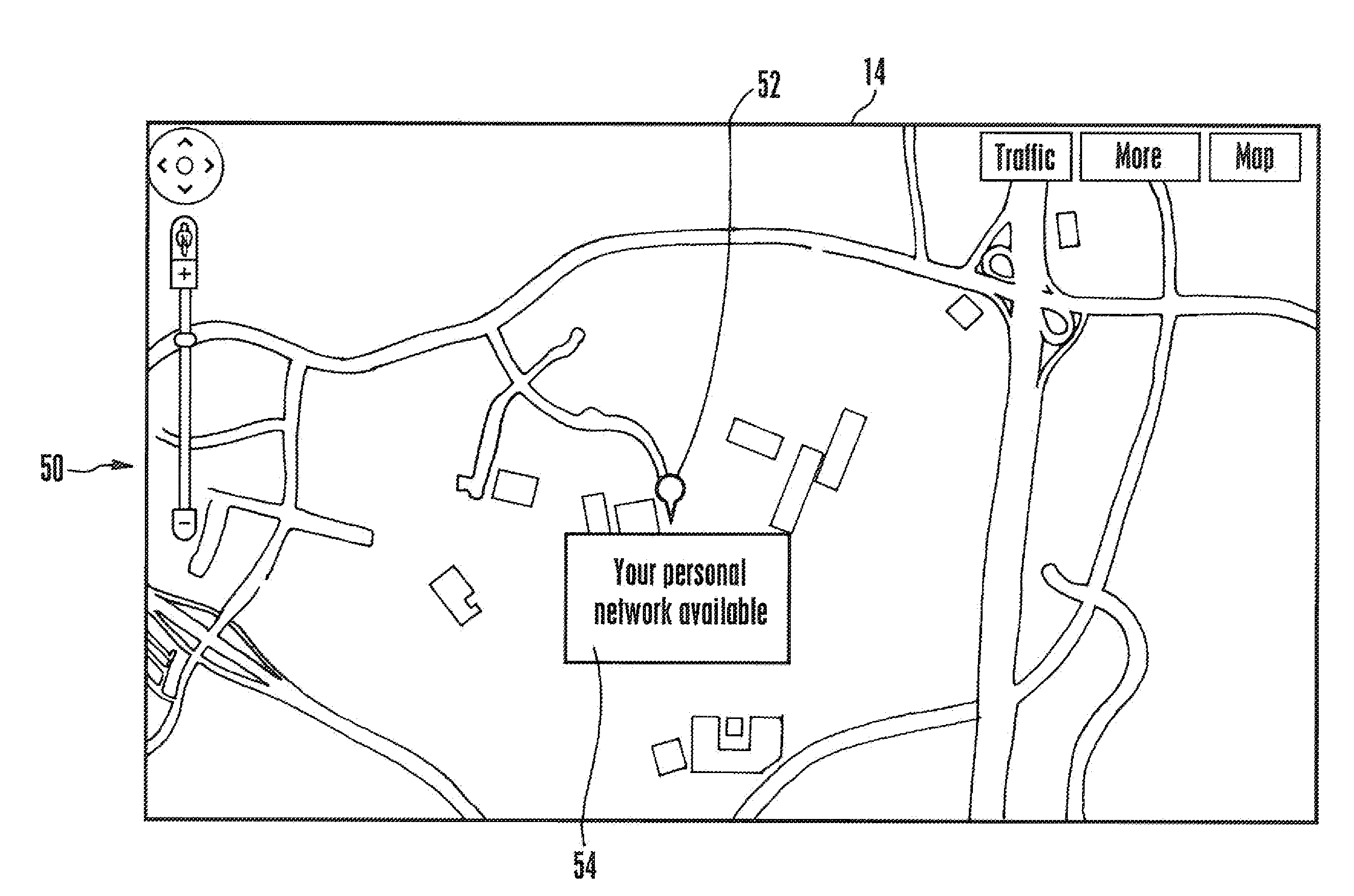
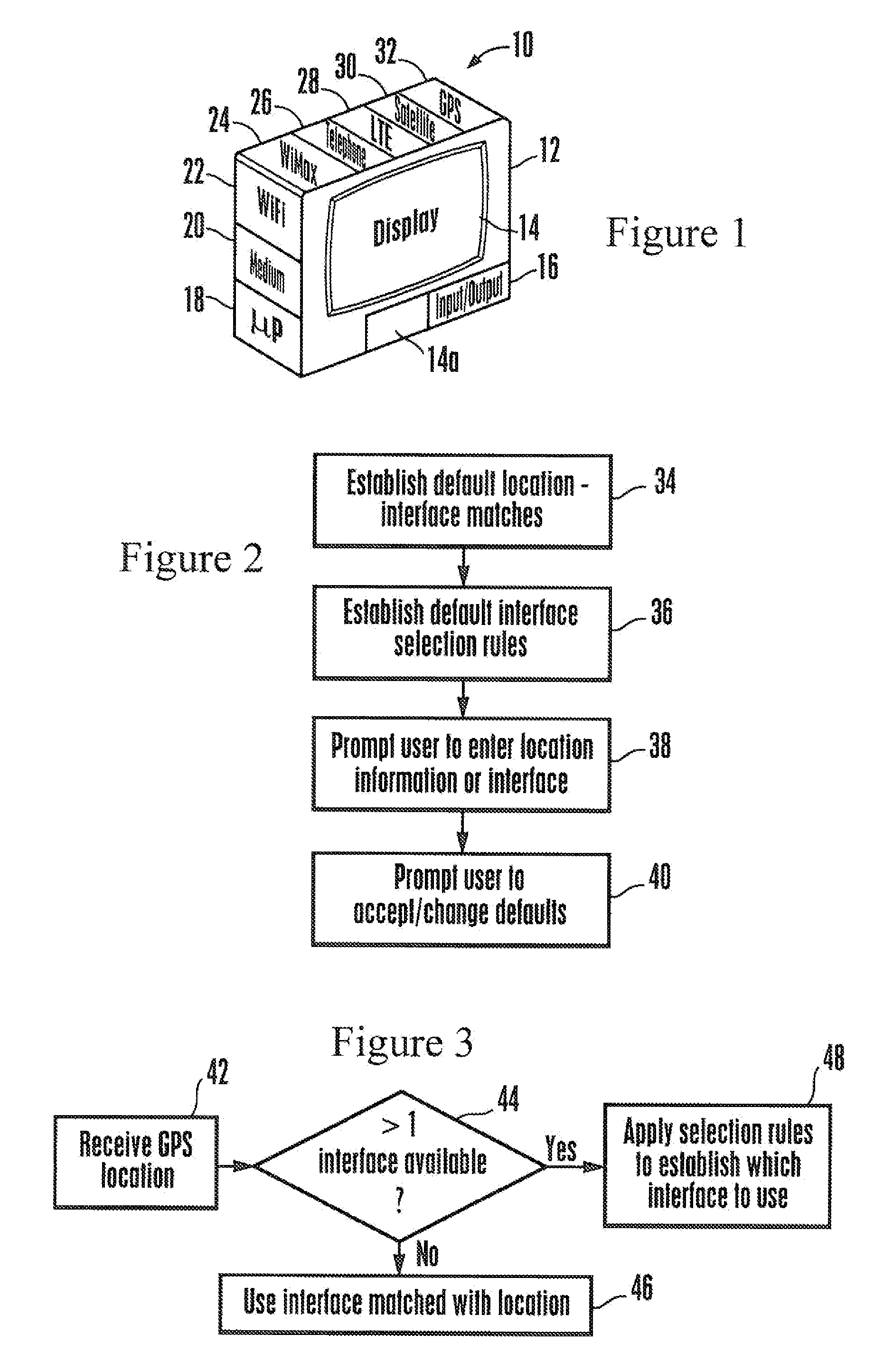
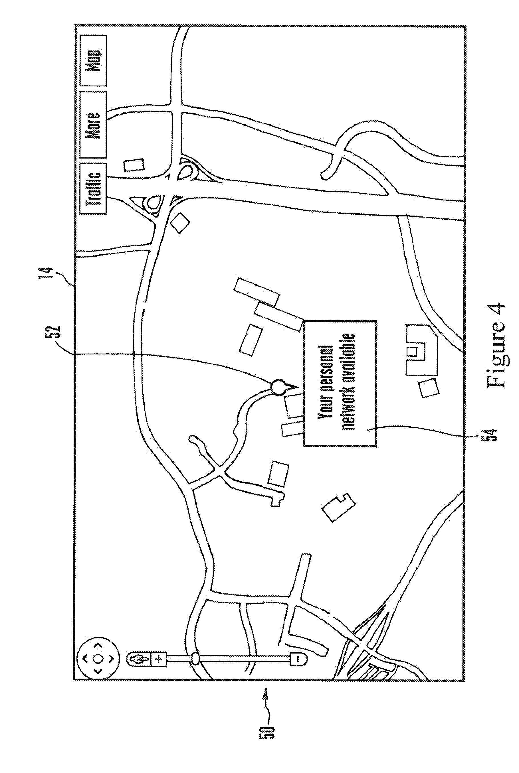
[0015]Referring initially to FIG. 1, a mobile computing device 10 includes a lightweight hollow housing 12 typically supporting a visual display 14 and one or more audio speakers 14a. The device 10 also typically includes one or more input / output (I / O devices 16 such as but not limited to keypads, point-and-click devices, voice recognition modules, etc. for inputting signals a processor 18 in the housing 12. The processor 18 controls the presentation on the display 14 and accesses a tangible computer readable storage medium 20 such as solid state storage, disk-based storage, removable storage, and any combination thereof. The medium 20 may store logic executable by the processor 18 in accordance with present principles as well as data such as but not limited to network topology data, geographic map data, etc.

[0016]The example computing device 10 may also include multiple interfaces for wirelessly communicating with a network such as the Internet. Each interface typically is associat...


PUM


Abstract

A method enables users to automatically switch available network connections for the current position as indicated by GPS while maintaining Internet connection. The selection of the network connection depends on a network connection profile which may be built up gradually and the score of each connection. Moreover the local network topology for the GPS location may be overlaid on a geographic map as might be generated by satellite imagery to give the user a better understanding of the topology.

Description

FIELD OF THE INVENTION[0001]The present application is directed generally to intelligent wireless network connection management and network topology overlays on geographic maps.BACKGROUND OF THE INVENTION[0002]Wireless devices such as wireless portable computers may have multiple interfaces to connect to the Internet. Some interfaces require communication paths that might be free but have relatively small bandwidths while other interfaces might use communication paths with robust bandwidths but with attendant costs.[0003]As understood herein, given that a mobile computing device might have multiple interfaces with which to communicate, a user might not know the most suitable interface to use for changing requirements and conditions. Furthermore, present principles understand that existing systems for enabling a user to view network topology give the user a less than complete understanding of the topology. For example, some systems permit showing topologies relative to a user-designa...

Claims


Application Information

Patent Timeline
IPC IPC(8): G01C21/00
CPCG01C21/20H04W48/18H04W4/02H04W4/024
Inventor ZHOU, YI
Owner SONY CORP
Why Eureka
Try Eureka