Shallow water highlight method and display systems

Active Publication Date: 2011-03-03
JOHNSON OUTDOORS MARINE ELECTRONICS
View PDF37 Cites 30 Cited by
  • Summary
  • Abstract
  • Description
  • Claims
  • Application Information

AI Technical Summary

Benefits of technology

[0013]Many benefits are achieved by way of the present invention over conventional techniques. In one or more embodiments, the present invention provides for improved display features coupled to a GPS Display Device. In other embodiments, the present method and system may be configured on commercial fish finders or the like. The present invention provides a user friendly method of customizing a chart display in real time to reflect current physical characteristics of the water body. Depths may be dynamically adjusted to allow for changing water lever conditions. Specific physical features of interest to the user can be highlighted in real time based on user inputs. Because the display is controlled by user in

Problems solved by technology

Although highly successful, GPS devices alone or with SONAR units still have limitations.
As an example, such devices are often cumbersome and lack easy to use functions.
Without accurate charts that provide easy access to the information they can provide, GPS devices can do little more than allow you to find a previously known point.
Moreover, the conventional G

Method used


Image

  • Shallow water highlight method and display systems
  • Shallow water highlight method and display systems
  • Shallow water highlight method and display systems

Examples


Example

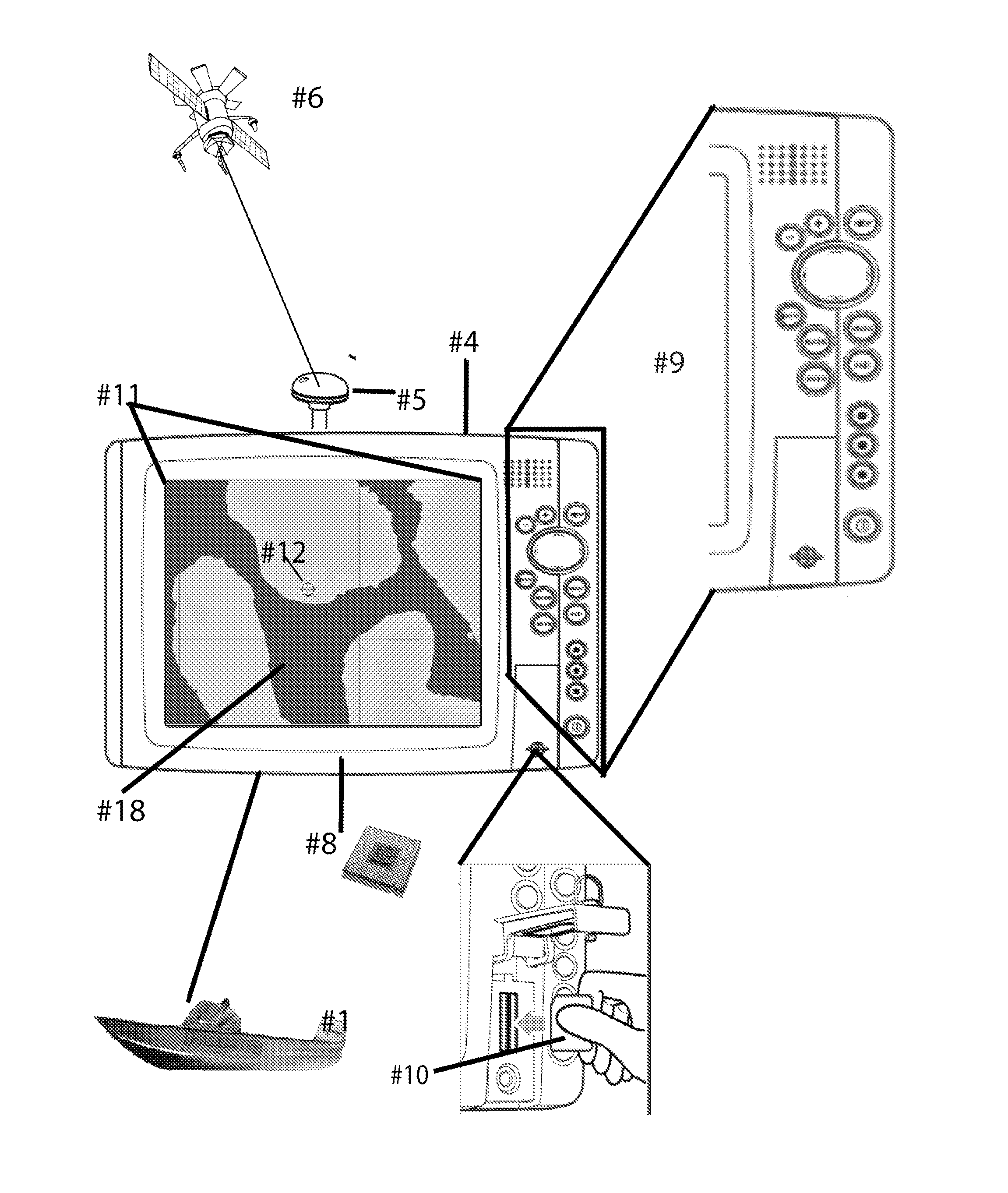
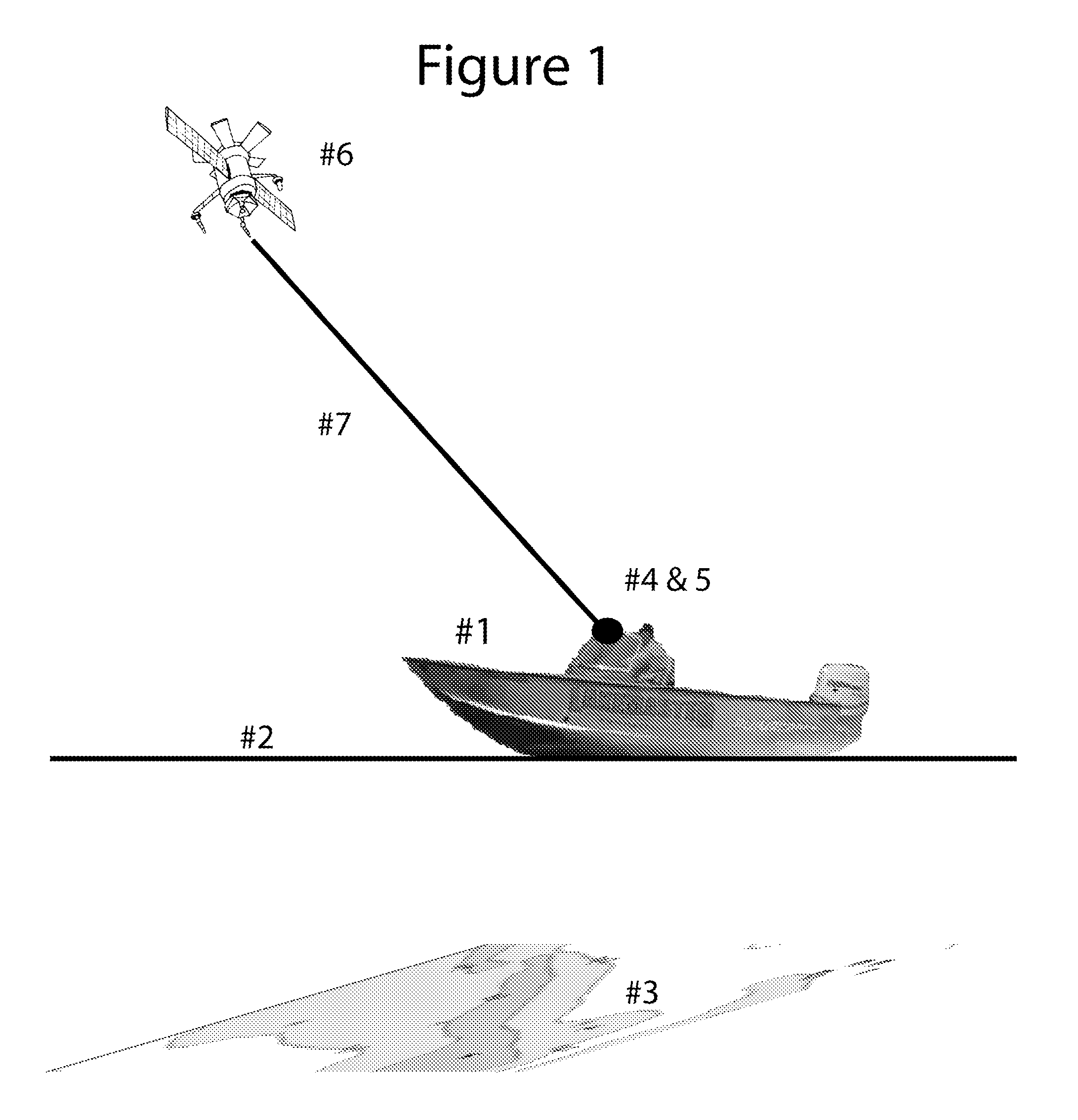
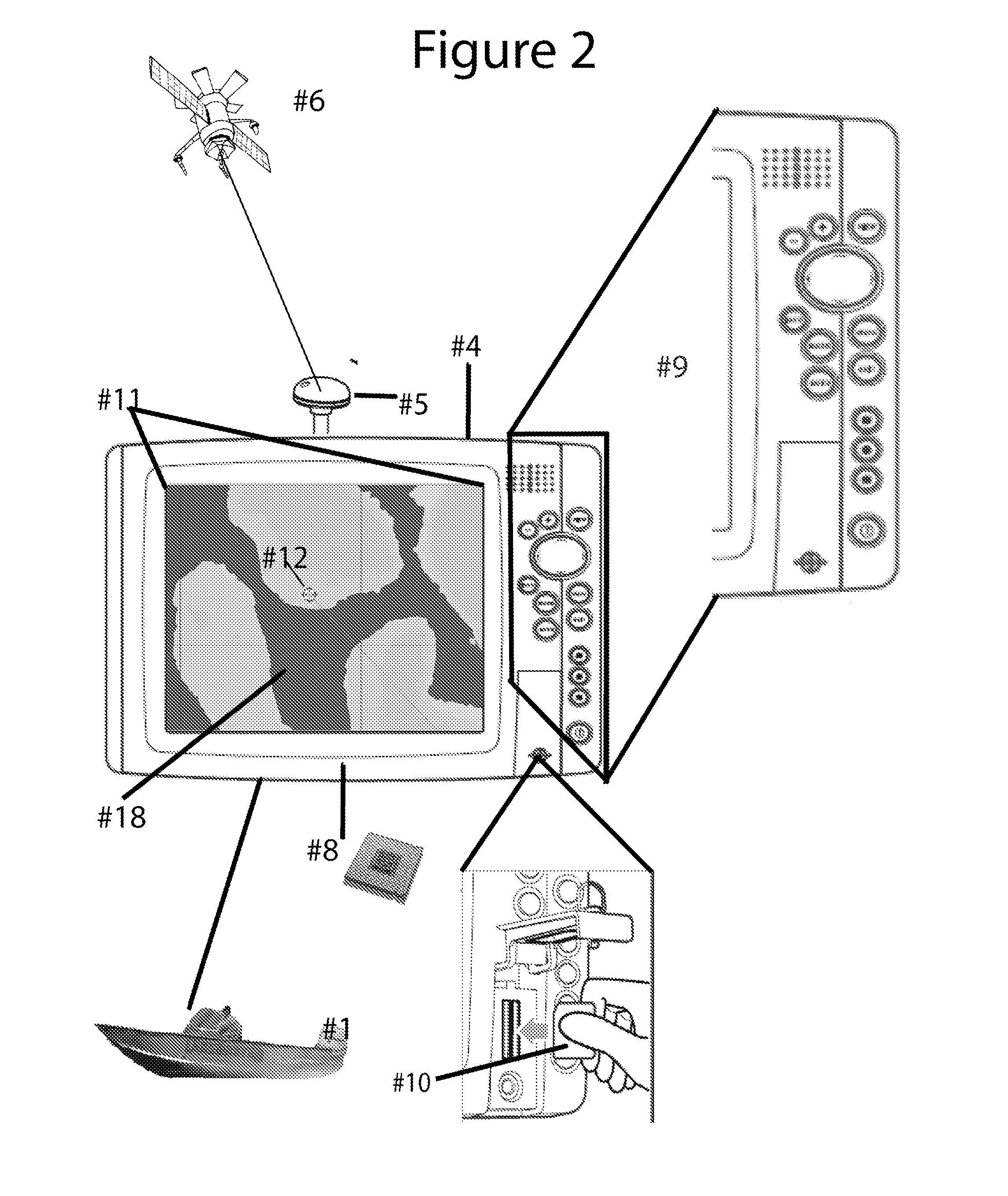
[0020]According to the present invention, techniques for digital mapping are provided. In particular, the present invention provides methods, devices, and systems for displaying charts of selected regions of a body of water and associated areas. More particularly, the present invention provides systems, methods, codes, and devices for selectively highlighting one or more depths on a chart of a body of water using a display coupled to a GPS Display Device or GPS. As an example, ProMap Technologies, Inc., dba LakeMaster Lake Maps, has developed a Chart Library and API that allows GPS manufacturers to embed the API into their OS and thus display proprietary LakeMaster® Digital Charts. These LakeMaster Digital Charts reside on a secure SD media card in a format compatible through the API with various GPS devices or GPS Display. Of course, there can be other variations, modifications, and alternatives.

[0021]As used herein, the above definitions are merely examples. There can be other var...


PUM


Abstract

A digital mapping display and related system for fishing, and other applications.

Description

CROSS-REFERENCES TO RELATED APPLICATIONS[0001]This application claims priority to U.S. Provisional Nos. 61 / 239,715 and 61 / 239,717, each of which is filed Sep. 3, 2009, commonly assigned, and hereby incorporated by reference herein.STATEMENT AS TO RIGHTS TO INVENTIONS MADE UNDER FEDERALLY SPONSORED RESEARCH AND DEVELOPMENT[0002]NOT APPLICABLEREFERENCE TO A “SEQUENCE LISTING,” A TABLE, OR A COMPUTER PROGRAM LISTING APPENDIX SUBMITTED ON A COMPACT DISK[0003]NOT APPLICABLEBACKGROUND OF THE INVENTION[0004]According to the present invention, techniques for digital mapping are provided. In particular, the present invention provides methods, devices, and systems for displaying selected regions of a body of water and associated areas. More particularly, the present invention provides systems, methods, codes, and devices for selectively highlighting one depth or one or more ranges of contiguous depths on the chart of a body of water or varying the depth values for contour lines on such chart ...

Claims


Application Information

Patent Timeline
IPC IPC(8): G06T11/20G01C21/00G01S19/42G01S15/89
CPCG01C21/00G01S19/14G09B29/006G01C21/203G06T11/203G06T11/206G01C21/3848
Inventor WOOD, MICHAEL WESLEYSMITH, JEFFREY EARL
Owner JOHNSON OUTDOORS MARINE ELECTRONICS
Why Eureka
Try Eureka