Graphics-aided remote position measurement with handheld geodesic device

a geodesic device and remote position technology, applied in direction finders using radio waves, navigation instruments, instruments, etc., can solve the problems of increasing complexity of gnss-based devices, requiring additional bulky positioning equipment, and bulky devices

Active Publication Date: 2011-03-31
JAVAD GNSS
View PDF61 Cites 36 Cited by
  • Summary
  • Abstract
  • Description
  • Claims
  • Application Information

AI Technical Summary

Problems solved by technology

Often, these points of interest are located at remote destinations which are difficult to access.
While both external hardware devices allow the user to “level” the antenna, such devices are bulky and difficult to carry.
Thus, even as positioning devices become more compact, they all suffer from the drawback of requiring additional bulky positioning equipment.
Recently, GNSS-based devices have become increasingly complex as additional measurement technologies have been incorporated.
However, even as current GNSS-based devices include such sensors, none allow a user to position the device without the use of external hardware.

Method used


Image

  • Graphics-aided remote position measurement with handheld geodesic device
  • Graphics-aided remote position measurement with handheld geodesic device
  • Graphics-aided remote position measurement with handheld geodesic device

Examples


Embodiment Construction

[0022]The following description is presented to enable a person of ordinary skill in the art to make and use the various embodiments. Descriptions of specific devices, techniques, and applications are provided only as examples. Various modifications to the examples described herein will be readily apparent to those of ordinary skill in the art, and the general principles defined herein may be applied to other examples and applications without departing from the spirit and scope of the various embodiments. Thus, the various embodiments are not intended to be limited to the examples described herein and shown, but are to be accorded the scope consistent with the claims.

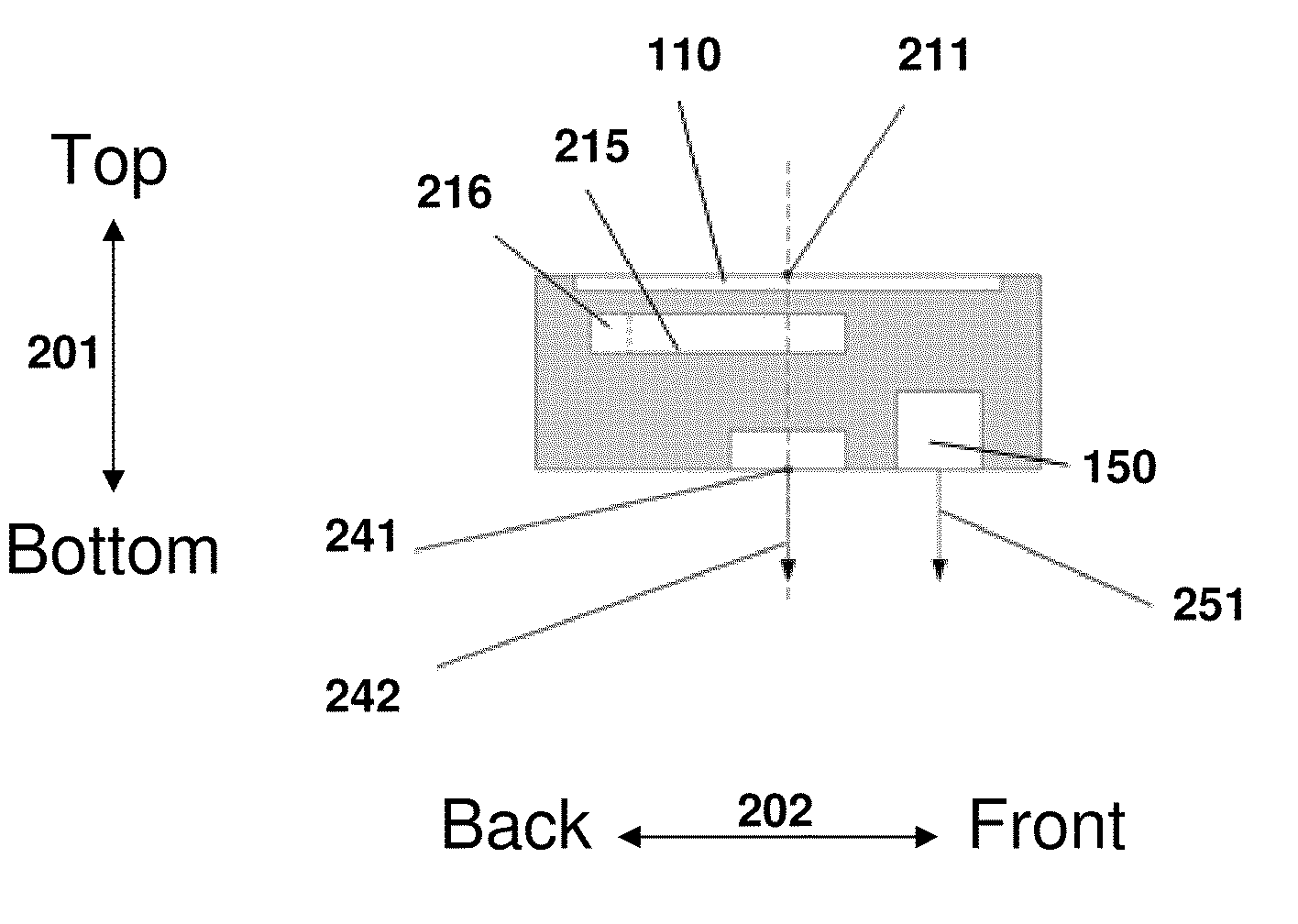
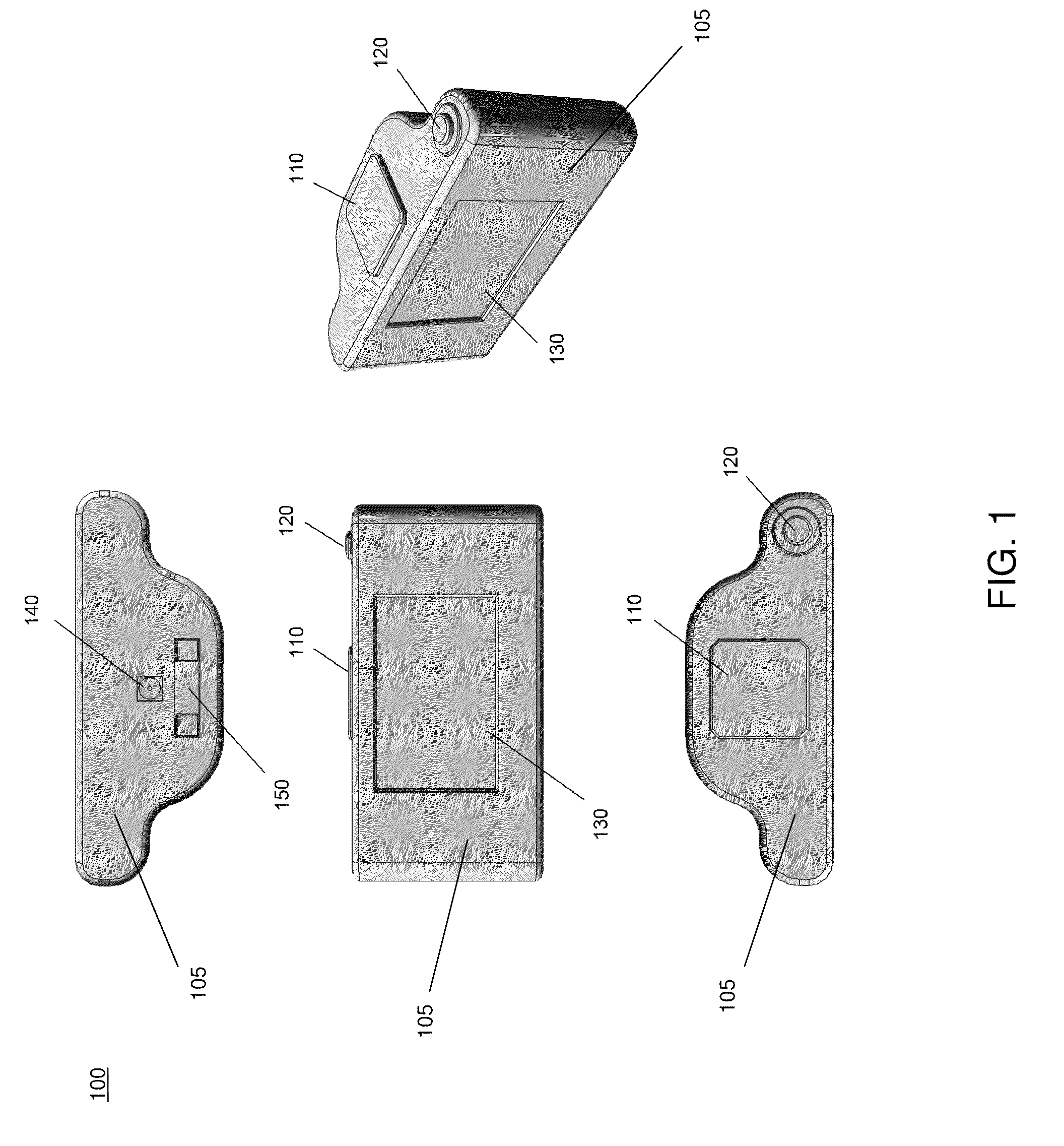
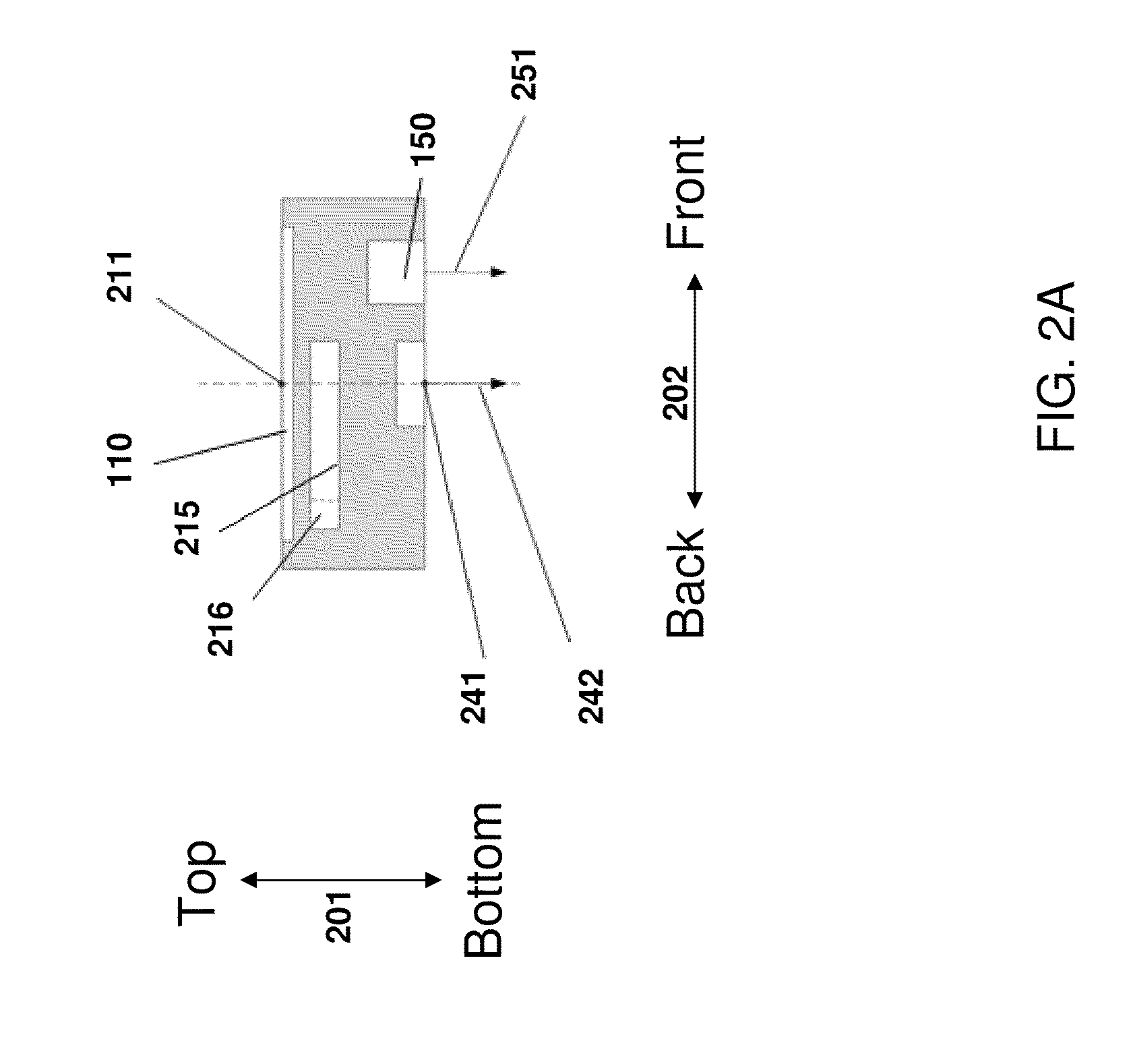
[0023]Various embodiments are described below relating to a handheld graphics-aided geodesic device. The device may include various sensors, such as a camera, distance sensor, and horizon sensors. A display element may also be included for assisting a user to position the device without the aid of external positioning e...


PUM


Abstract

A graphics-aided geodesic device is provided. The device may include a display, camera, distance meter, GNSS (Global Navigation Satellite System, including GPS, GLONASS, and Galileo) receiver and antenna, and horizon sensors. Data from the camera and horizon sensors may be displayed to assist the user in positioning the device over a point of interest. In one example, the distance meter may be used to determine the position of the point of interest. In another example, images of the point of interest taken from multiple locations may be used to determine the position of the point of interest.

Description

1. FIELD[0001]The present disclosure relates generally to geodesy and precise positioning of a handheld geodesic device.2. RELATED ART[0002]Geodesists commonly use satellite positioning devices, such as Global Navigation Satellite System (GNSS) devices, to determine the location of a point of interest anywhere on, or in the vicinity of, the Earth. Often, these points of interest are located at remote destinations which are difficult to access. Thus, compact, easy to carry positioning devices are desired.[0003]Typically, to properly measure the position of a given point using a GNSS-based device, the GNSS antenna must be positioned directly above the point of interest with the antenna ground plane parallel to the ground. To position a GNSS device in such a manner, external hardware is commonly used. For example, a tripod may be used to properly position the GNSS antenna directly over the point of interest. In another example, a pole may be used to hang a GNSS antenna above the point ...

Claims


Application Information

Patent Timeline
Patent Type & Authority Applications(United States)
IPC IPC(8): G06K9/00G01S3/02
CPCG01S19/14G01C21/005G06T7/70G06T7/97G01C11/02G01C11/30G01C15/002G01C15/02G01C15/06G01C15/08G01S19/01
Inventor ASHJAEE, JAVADGRIBKOV, MIKHAILRAPOPORT, LEV
Owner JAVAD GNSS
Why Eureka
Try Eureka