On Demand Image Overlay

a technology of image overlay and overlay layer, applied in the field of navigation related and/or mapping related features, can solve the problems of not conveying the relationship of the scene in the image bubble to the surrounding buildings or scenery, and the projection of the image bubble may not match the side of the three-dimensional rendering,

Active Publication Date: 2014-01-02
HERE GLOBAL BV
View PDF9 Cites 67 Cited by
  • Summary
  • Abstract
  • Description
  • Claims
  • Application Information

AI Technical Summary

Benefits of technology

[0003]In one embodiment, a building model is presented to a user. The building model may be a three-dimensional rendering of a geographic region. A user selects a point on the three-dimensional rendering of a geographic region. Based on the selected point one or more image bubbles are chosen. The image bubbles ...

Problems solved by technology

Zooming and panning within an image bubble provides a view from a particular viewpoint but cannot provide any perspective of the view with respect to surrounding areas.
Moreover, the relationship of the scene in the image bubble to the surrounding buildings ...

Method used


Image

  • On Demand Image Overlay
  • On Demand Image Overlay
  • On Demand Image Overlay

Examples


Embodiment Construction

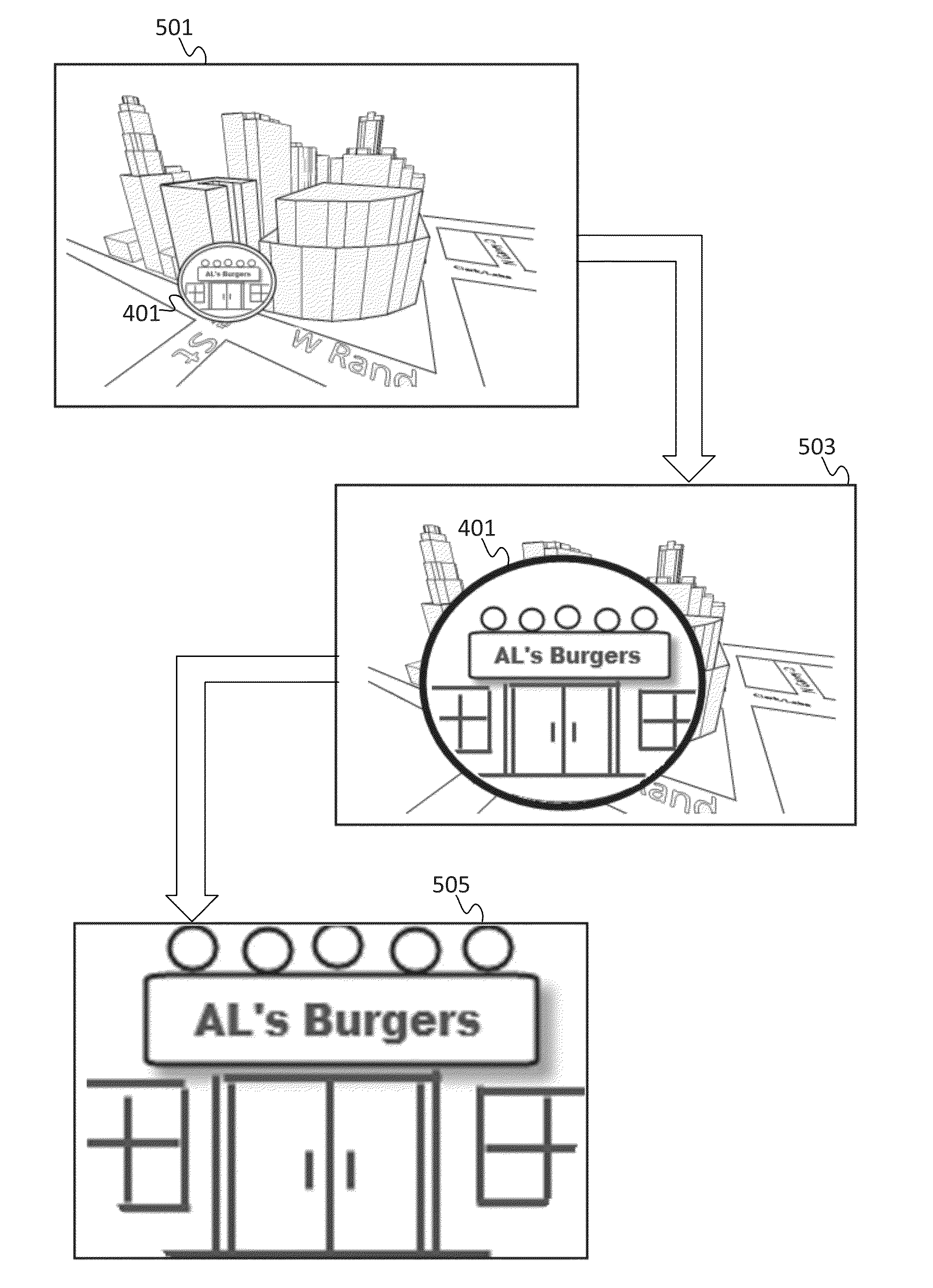
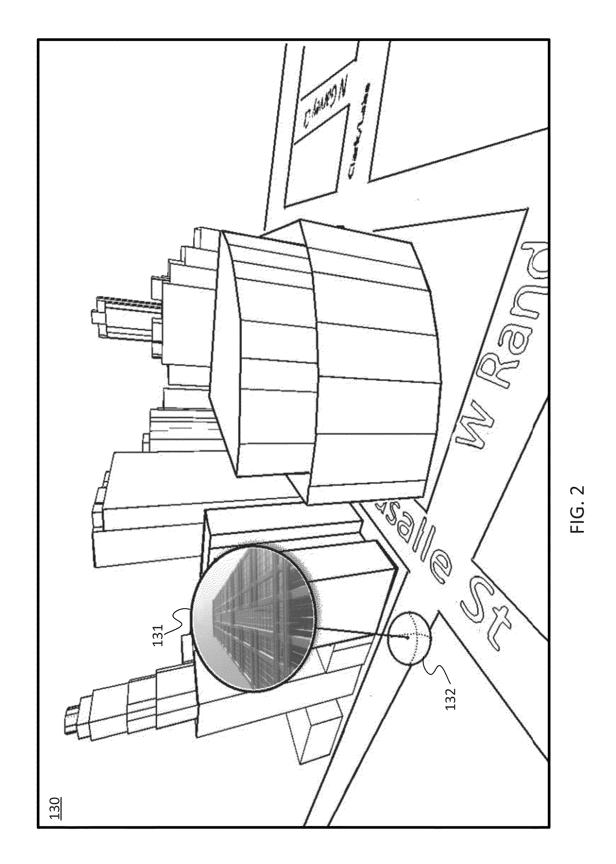
[0024]The disclosed embodiments relate to a method and system for presenting street side imagery in combination with a rendering of a geographical area. Street side imagery includes photographic images or images derived from photographic images. The street side imagery may be collected from a camera at street level. The rendering of a geographic area is a model or representation of a portion of the Earth and objects on the surface of the Earth. Examples of three-dimensional renderings of a geographic area are available as part of services such as Google Earth, Nokia 3D Maps, Bing Maps Platform (formerly, Microsoft Virtual Earth). Virtual renderings may be found in other virtual earth software models, a light detection and ranging (LiDAR) point cloud, or a building model or footprint.

[0025]A point in the rendering of the geographical area is selected, and street side imagery for that point is retrieved from a database of images. Through this approach, high resolution street side imag...


PUM


Abstract

In one embodiment, a building model is presented to a user. The building model may be a three-dimensional rendering of a geographic region. A user selects a point on the three-dimensional rendering of a geographic region. Based on the selected point one or more image bubbles are chosen. The image bubbles are photographs or similar image data. The image bubbles and the three-dimensional rendering are associated with the same geographical space. The one or more image bubbles are incorporated with the building model such that at least a portion of one of the image bubbles is displayed in a window with the building model.

Description

FIELD[0001]The following disclosure relates to a method and system for navigation-related and / or mapping-related features, or more particularly, to a method and system for presenting street side imagery within a rendering of a geographic region.BACKGROUND[0002]Conventional street view involves the manipulation of image bubbles. Image bubbles are panoramic images collected with respect to a single perspective. The image bubbles may extend nearly 360 degrees along one or more axes. Zooming and panning within an image bubble provides a view from a particular viewpoint but cannot provide any perspective of the view with respect to surrounding areas. To view another perspective, a typical street level viewing application must be switched to the next image bubble. That is, in order to view the scene along the side of the street, a user selects a direction to move to the next image bubble and waits for the next image bubble to load. A panning operation may also be required, resulting in lo...

Claims


Application Information

Patent Timeline
IPC IPC(8): G09G5/00G06T15/00
CPCG06T19/00G06T2219/004
Inventor LYNCH, JAMES D.
Owner HERE GLOBAL BV
Why Eureka
Try Eureka