Providing coordinating location information using a gridded reference graphic (GRG)

a reference graphic and location technology, applied in the field of coordination and identification of personnel, can solve the problems of affecting the operation affecting the coordination the lack of simplicity and effectiveness of the existing system and method, so as to achieve complete coverage of the designated area, improve coordination, and facilitate the effect of communication

Active Publication Date: 2017-01-26
BAE SYST INFORMATION & ELECTRONICS SYST INTERGRATION INC
View PDF6 Cites 11 Cited by
  • Summary
  • Abstract
  • Description
  • Claims
  • Application Information

AI Technical Summary

Benefits of technology

[0005]By utilizing readily available data, such as the locations of personnel and points of interest on grid-bas...

Problems solved by technology

Existing systems and methods for coordination and identification of personnel in designated areas are limited and lacking in both simplicity and effectiveness.
Personnel using such systems and methods often have d...

Method used


Image

  • Providing coordinating location information using a gridded reference graphic (GRG)
  • Providing coordinating location information using a gridded reference graphic (GRG)
  • Providing coordinating location information using a gridded reference graphic (GRG)

Examples


Embodiment Construction

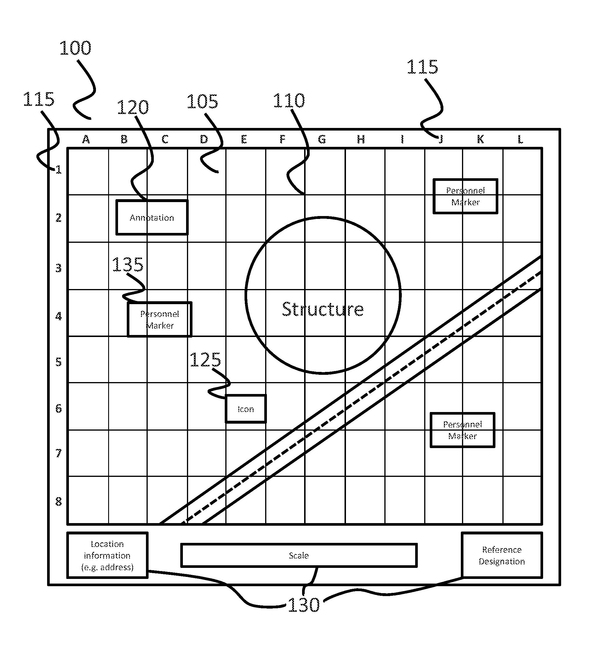
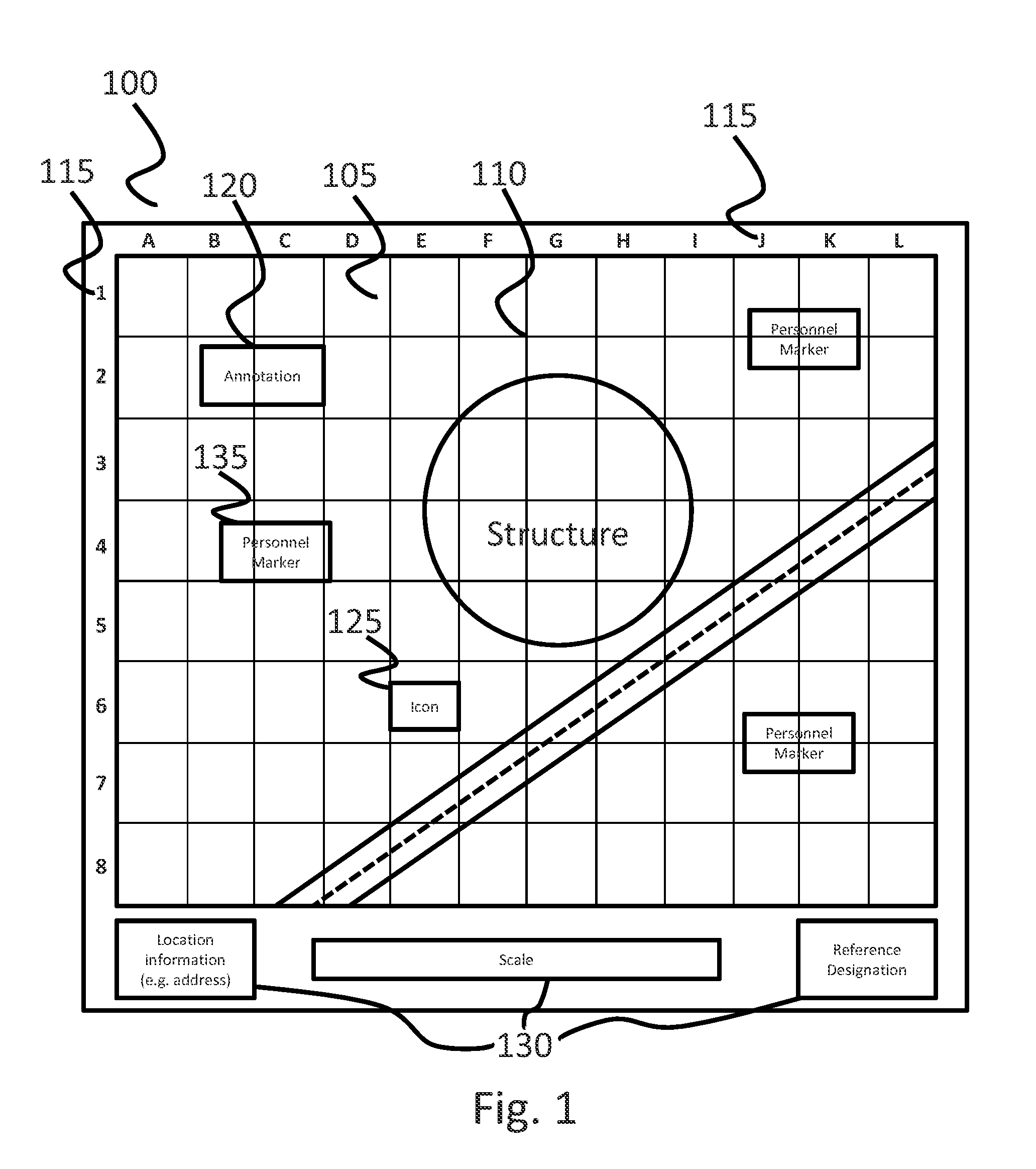
[0029]The present disclosure concerns visual, real-time and near real-time systems and methods that enable effective coordination of team members performing operations through utilization of the locations of team members and points of interest superimposed on grid-based annotated imagery 100.

[0030]A starting point for the systems and methods of the current disclosure is the creation of a Gridded Reference Graphic (GRG) 100. A GRG 100 in accordance with embodiments of the present invention comprises an image 105 of a geospatial area of interest with an overlaid grid 110 having simple alphabetical and numerical labels and / or an actual coordinate system 115 along the axes, forming a reference coordinate system 115, and including annotations 120 for points of interest.

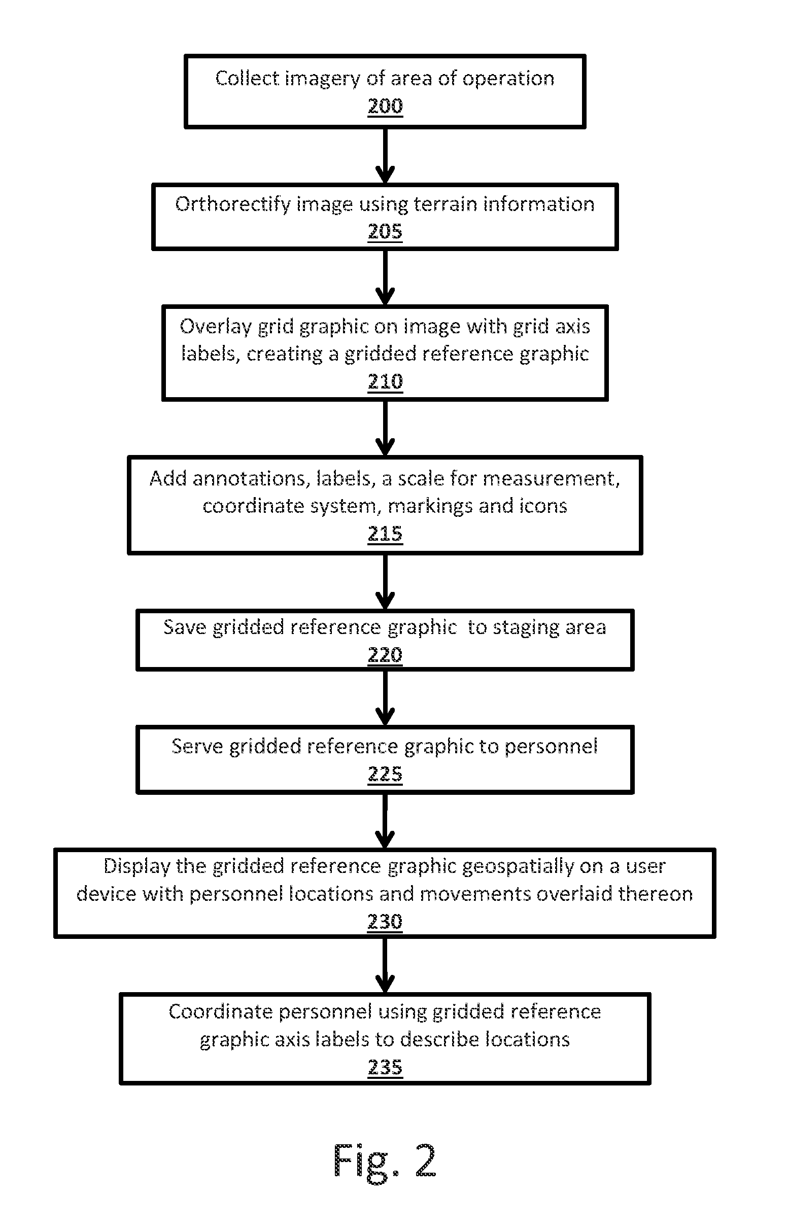
[0031]The creation of a gridded reference graphic 100 for use with embodiments of the present invention involves first obtaining imagery 105 of an intended area of operation and the surrounding area 200. The imagery 105 ob...


PUM


Abstract

A system for real-time or near real-time coordination of personnel and a method for creating a gridded reference graphic (GRG) for use in such a system is provided. A GRG is created by obtaining imagery of an area a team is to be operating in, wherein the imagery is obtained from overhead, taken from a position substantially orthogonal to the central portion of the area of operation. A grid, which may then be further modified with labels allowing identification of areas within the grid, is then overlaid thereon, creating a GRG. The GRG may then be served to personnel and displayed on a user device. The system includes a GRG comprising scale images of an intended area of operation, a labeled grid overlaid thereon and a scale for measurement of distances wherein the GRG are dispersed among and displayed to personnel.

Description

FIELD OF THE INVENTION[0001]The invention relates to the coordination and identification of personnel in a designated area, and, more particularly, to systems and methods for providing coordinating location and identification information using gridded reference graphics.BACKGROUND OF THE INVENTION[0002]Existing systems and methods for coordination and identification of personnel in designated areas are limited and lacking in both simplicity and effectiveness. Personnel using such systems and methods often have difficulty verbally, or otherwise, identifying and coordinating their locations. This is especially true in complex, unfamiliar and non-sign-marked locations, contributing to confusion that may hamper operational efforts.[0003]Improved techniques for the coordination and rapid identification of the geospatial locations of personnel would be especially useful where personnel lack intimate familiarity with the area in which they are operating. Such personnel may be first respond...

Claims


Application Information

Patent Timeline
IPC IPC(8): G06T11/60
CPCG06T11/60
Inventor DEITRICH, SCOTT
Owner BAE SYST INFORMATION & ELECTRONICS SYST INTERGRATION INC
Why Eureka
Try Eureka