

Star Tracker-Aided Airborne or Spacecraft Terrestrial Landmark Navigation System
a technology of terrestrial landmarks and satellite trackers, applied in the field of terrestrial matching navigation systems, can solve problems such as inaccurate location solutions provided by such systems
- Summary
- Abstract
- Description
- Claims
- Application Information
AI Technical Summary
Problems solved by technology
Method used
Image

Examples
Embodiment Construction
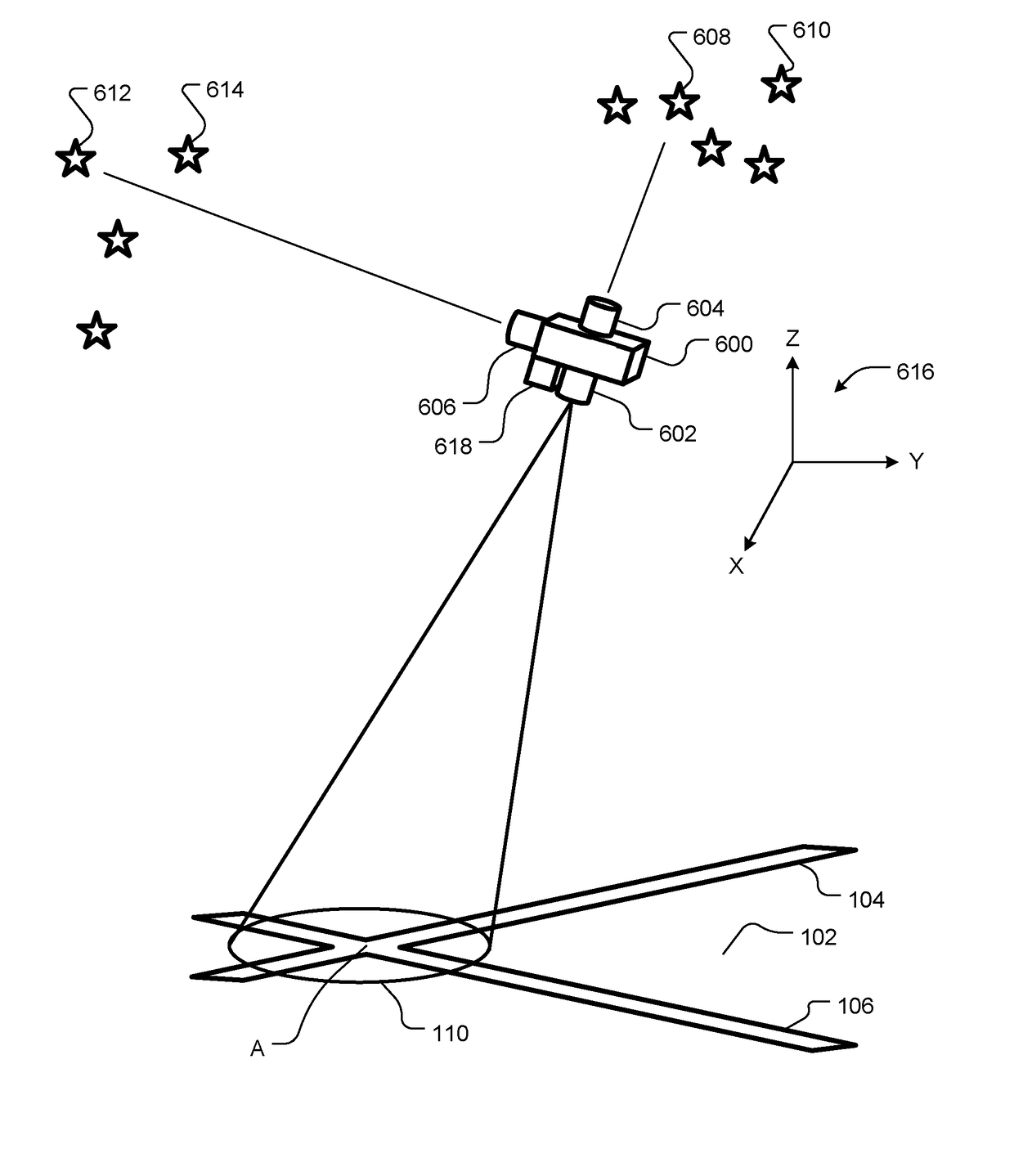
[0004]An embodiment of the present invention provides a location determining system. The location determining system includes a database, an imager, and a matching engine. The database store, or is configured to store, terrain landmark data in association with geographic location information about the terrain landmark data. The imager is configured to aim downward toward terrain below the imager and generate terrain data representing a surface aspect of the terrain. The matching engine compares, or is configured to compare, the terrain data to the terrain landmark data and determines, or is configured to determine, an estimated location of the imager, based on: (a) a match between the terrain data and the terrain landmark data and (b) the geographic location information associated with the terrain landmark data.
[0005]The location determining system also includes a star tracker configured to measure attitude of the imager and at least one additional navigation aiding sensor. The loca...
PUM
 Abstract
Description
Claims
Application Information